1900s (20th Century) Maps of Presidio County, Texas
Explore 99 historic maps of Presidio County from the 1900s (20th Century). These maps offer a rare glimpse into what life looked like during the 1900s — showing old roads, neighborhoods, homes, and landmarks that have changed or disappeared over time.
Whether you're researching your family's past, planning a metal detecting trip, or studying how Presidio County's landscape evolved across the 1900s, these high-resolution maps are a powerful tool for exploring the history of this region.
- Focus on a specific era: All maps on this page are from the 1900s, giving you a focused view of this time period.
- See what’s changed: Compare century-old streets, trails, and buildings to today's modern landscape using overlays and satellite layers.
- Research with precision: Use these maps for genealogy, historical research, land use analysis, or educational projects.
- View, download, or print: Maps are fully viewable online in high resolution, and can be downloaded or printed for your own records.
Start exploring Presidio County's history through authentic maps from the 1900s. This is your window into the past.
Presidio County, TX maps
(99)- 1903 Map of Terlingua, 1963 Print
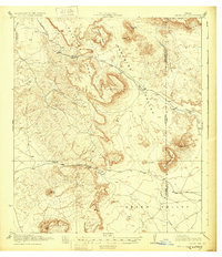
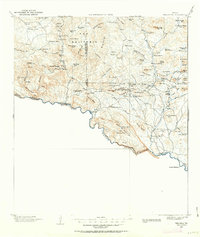 1903 Terlingua1963 Print · USGSThe Big Bend borderlands emerge at the height of the quicksilver boom, showing the isolated ranching and mining camps along the Rio Grande. Trace the roots of early mining at Study Butte and find remote family outposts like Gourleys Ranch and Lajitas.
 - 1904 Map of Terlingua
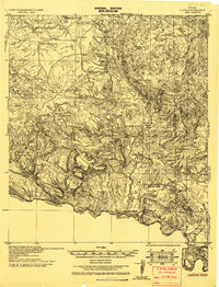
 1904 Terlingua1904 Print · USGSThe Trans-Pecos frontier is captured here at the height of the early quicksilver mining boom. Genealogists and historians can locate remote family sites like Howard's Ranch and Madril Ranch, or trace early industrial efforts at the Colquitt-Tigner Mine.5 unique versions available
 - 1917 Map of Tascotal Mesa
 1917 Tascotal Mesa1917 Print · USGSThe Trans-Pecos frontier during World War I remained a land of remote cattle outposts and historic mountain passages. Researchers can trace early regional travel routes like the Marfa and Lajitas Road and locate family landmarks such as Rooney Ranch and San Jacinto Ranch.2 unique versions available
 - 1918 Map of Jordan Gap
 1918 Jordan Gap1918 Print · USGSWest Texas ranching and frontier life are captured in the years before the Great War, showing a network of mountain passes and isolated water sources. Researchers can trace the road To Marfa, the remote outpost at Paradise, and family landmarks like Mc Cormick Mtn.
 - 1930 Map of Jordan Gap
 1930 Jordan Gap1930 Print · USGSPresidio and Brewster Counties are captured in the interwar years, showing a landscape of high mesas and desert passes. Genealogists and historians can trace old trails To Marfa and locate family-named landmarks like McKinney Mtn and McTurney Pk.3 unique versions available
 - 1931 Map of Lajitas
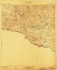
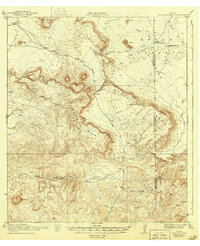
 1931 Lajitas1931 Print · USGSThe Big Bend borderlands come into focus in the early 1930s, showing the isolated ranches and rugged volcanic landscape along the Rio Grande. Genealogists and historians can trace remote outposts like Madrid Ranch, the distinctive El Solitario dome, and the old Telephone Trail.
 - 1943 Map of Valentine
 1943 Valentine1943 Print · USGSValentine and the Davis Mountains come alive in this mid-century look at the cattle and rail country of West Texas. Genealogists and historians can trace family-named holdings like Means Ranch Hdqrs., Prude's Ranch, and the isolated Foster Cabin.
 - 1944 Map of Tascotal Mesa
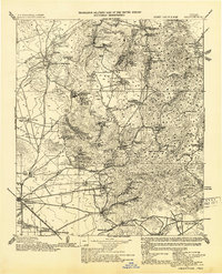
 1944 Tascotal Mesa1944 Print · USGSPresidio and Brewster counties were still a world of remote cattle outposts and primitive wagon roads in the years after the Great War. Genealogists and historians can trace family land holdings at San Jacinto Ranch or follow the historic Marfa and Lajitas Road through Wire Gap.2 unique versions available
 - 1954 Map of Fort Stockton, 1965 Print
 1954 Fort Stockton1965 Print · USGSWest Texas ranching and the early energy industry converge in this mid-century survey of the Trans-Pecos. Genealogists and historians can locate specific family lands like Graef Brothers Ranch and trace the paths of the Old Spanish Trail and the Southern Pacific railroad.3 unique versions available
 - 1958 Map of Fort Stockton
 1958 Fort Stockton1958 Print · USGSThe Trans-Pecos region of West Texas in the late fifties is a landscape of vast mesas and isolated ranching hubs. Genealogists and historians can trace the paths of the Texas and New Orleans RR through Alpine or locate early settlements like Bakersfield and Sanderson.
 - 1959 Map of Emory Peak, 1967 Print
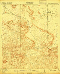
 1959 Emory Peak1967 Print · USGSThe Big Bend country of West Texas is documented here just as the national park was becoming a major destination. Researchers can trace remote desert outposts like Lajitas, Castolon, and the Terlingua Post Office along the winding Rio Grande.3 unique versions available
 - 1959 Map of Presidio, 1969 Print
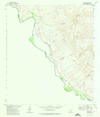
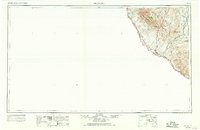 1959 Presidio1969 Print · USGSThe Texas-Mexico borderlands come into focus in the late fifties, showing a landscape defined by the Rio Grande and remote mining outposts. Researchers can trace the Atchison Topeka and Santa Fe rail line or locate historic sites like Old Fort Leaton (ruins) and the Shafter Mine.2 unique versions available
 - 1959 Map of Marfa, 1976 Print
 1959 Marfa1976 Print · USGSThe Trans-Pecos frontier is captured here in the mid-twentieth century as cattle ranching and high-altitude science shaped the landscape. Researchers can trace the Southern Pacific rail line through Valentine or locate remote border outposts like Ruidosa and Indian Hot Springs Resort.2 unique versions available
 - 1965 Map of Presidio
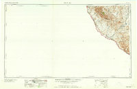 1965 Presidio1965 Print · USGSThe Big Bend borderlands appear in the mid-sixties as a rugged landscape of high-altitude ranching and retired mines. Trace the river road to the Old Fort Leaton ruins or locate family landmarks like Alamo Ranch and the Shafter Mine.
 - 1965 Map of Marfa
 1965 Marfa1965 Print · USGSBig Bend ranching and high-desert rail travel come together in the 1960s along the Rio Grande and the southern reaches of the Davis Mountains. Researchers can trace the lineage of cattle outfits like Brite Ranch and historic stops like Valentine and Candelaria.
 - 1965 Map of Emory Peak
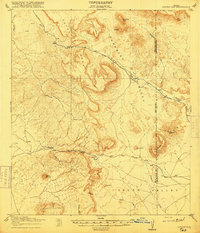
 1965 Emory Peak1965 Print · USGSThe Big Bend backcountry in the mid-1960s reveals a desert landscape of remote ranches and mercury mining. Trace the historic boundary along the Rio Grande and locate landmarks like the Fresno Mine and Panther Spring.
 - 1966 Map of Adobes, 1969 Print
 1966 Adobes1969 Print · USGSThe Texas-Mexico borderlands come into sharp focus in the 1970s as the Rio Grande Bravo winds past remote outposts. Researchers can trace family history at the Adobe Cemetery or locate vanished infrastructure like the desert landing strip.
 - 1971 Map of Redford SE
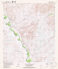
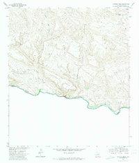
 1971 Redford SE1971 Print · USGSThe Texas-Mexico borderlands come into sharp focus in the early 1970s along the winding Rio Grande. Researchers can trace the isolated Cem near the riverbank or navigate the deep drainage of Colorado Canyon and Closed Canyon.2 unique versions available
 - 1971 Map of The Solitario, 1974 Print
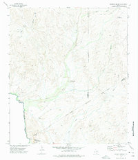
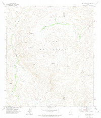 1971 The Solitario1974 Print · USGSThe Trans-Pecos high desert unfolds in the early seventies, centered on the massive geologic formation of The Solitario. Researchers can trace isolated ranching outposts like Burnt Camp and navigation points through the Righthand Shutup and Lower Shutup.
 - 1971 Map of Agua Adentro Mountain, 1974 Print
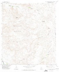 1971 Agua Adentro Mountain1974 Print · USGSThe high desert of Presidio County is shown in the early 1970s, a land of deep canyons and essential water holes. Researchers can trace remote ranching infrastructure like Alamito Dam and Corral, or locate springs such as Rancherias Spring and Oso Spring.2 unique versions available
 - 1971 Map of Sauceda Ranch, 1974 Print
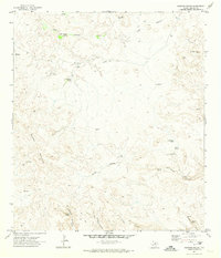 1971 Sauceda Ranch1974 Print · USGSPresidio County in the early seventies is a landscape of remote cattle outposts and vital desert water sources. Researchers can trace the layout of Sauceda Ranch and locate isolated landmarks like Madrid Falls or the Landing Strip.2 unique versions available
 - 1971 Map of Lajitas, 1974 Print
 1971 Lajitas1974 Print · USGSThe Chihuahuan Desert borderlands come to life in this early 1970s survey of the river country near the Brewster and Presidio county line. Researchers can trace remote mining operations at Whitroy Mine, old cattle landmarks like Madrid Ranch, and river crossings near Lajitas.3 unique versions available
 - 1971 Map of Redford, 1974 Print
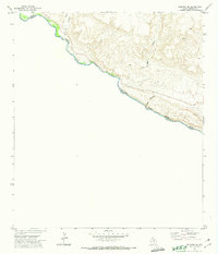
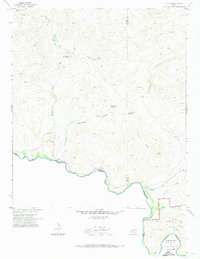
 1971 Redford1974 Print · USGSThe Texas-Mexico border comes into focus in the early seventies, showing the riverside settlement of Redford and the shifting channel of the Rio Grande. Genealogists and historians can trace local landmarks like Redford Cem, the PO, and the remote Jeep Trail through the Bofecillos highlands.2 unique versions available
 - 1971 Map of Santana Mesa, 1974 Print
 1971 Santana Mesa1974 Print · USGSPresidio County, Texas, meets the Mexican border in the early seventies along a jagged stretch of river and high desert. Researchers can trace remote ranching outposts at Madril, locate isolated water sources like Seep Spring, and follow the deep cuts of Madera Canyon.2 unique versions available
 - 1972 Map of Mesquite Spring, 1975 Print
 1972 Mesquite Spring1975 Print · USGSThe High Desert borderlands along the Rio Grande appear in detail in the early 1970s. Researchers can trace remote water sources like Mesquite Spring, isolated outposts at Sixty Six, and the winding path of the Green River.
Showing maps 1-25 of 99
Top cities of Presidio County
- Presidio historical maps
- Marfa historical maps
- Redford historical maps
- Candelaria historical maps
- Ruidosa historical maps
- Plata historical maps
See more
Frequently asked questions
- What are the different types of historical maps available for Presidio County?
- What is the oldest map of Presidio County?
- Where can I purchase historical maps of Presidio County for my home or office?
- Where can I download high-res historical maps of Presidio County?
- Are there historical topographic maps available for Presidio County?
- Is there historical aerial imagery available for Presidio County?
- Where are historical maps of Presidio County sourced from?