Old Maps of Tyler, Texas for Academic Research
Study the evolution of Tyler with 52 high-resolution historic maps. Whether you're teaching, researching, or modeling changes in land use, these maps provide essential visual documentation of urban, environmental, and geographic change.
- Analyze long-term change: Track patterns in development, transportation, and natural features.
- Ideal for environmental or urban studies: Support academic projects with primary historical map data.
- Use in the classroom or lab: Educators and researchers rely on these maps to bring historical context to life.
These maps are a powerful tool for teaching, research, and visualizing how Tyler has changed over the decades.
Tyler, TX maps
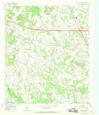
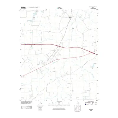
(52)- 1938 Map of Winona
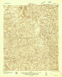 1938 Winona1938 Print · USGSSmith County during the late thirties was a landscape of close-knit rural communities and a burgeoning highway system. Family historians can trace numerous rural schoolhouses and churches like the Maggie Murphy Sch and White Chapel, alongside the St Louis Southwestern Line railroad.
 - 1943 Map of Winona
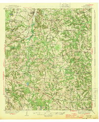 1943 Winona1943 Print · USGSThe rural landscape of Smith County is captured here just before the mid-century, showing a vibrant network of community schools and churches. Genealogists can trace family footprints through sites like Seastrunk Cem, Maggie Murphy Sch, and the St Louis Southwestern rail line.2 unique versions available
 - 1946 Map of Bullard, 1960 Print
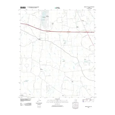
 1946 Bullard1960 Print · USGSEast Texas rail and river life converge in the 1940s as the St Louis Southwestern tracks link rural farming hubs. Trace local family history through numerous landmarks like Larissa Cem, the Kickapoo Monument, and Mount Selman.2 unique versions available
 - 1948 Map of Bullard
 1948 Bullard1948 Print · USGSNortheastern Cherokee and southern Smith counties are captured here in the late forties, showcasing a network of rural schools and rail-fed towns. Genealogists can trace family sites at Larissa Cem, Mount Comfort Ch, and the high ground of Kickapoo Mtn.
 - 1948 Map of Tyler, 1964 Print
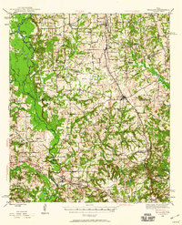
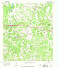
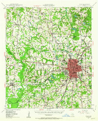 1948 Tyler1964 Print · USGSSmith County and the growing city of Tyler are captured here in the late 1940s, showing a landscape of rail-driven commerce and established rural communities. Local historians can trace family roots through numerous landmarks like Camp Ford, Pounds Field, and Texas College.2 unique versions available
 - 1949 Map of Tyler
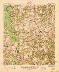
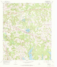
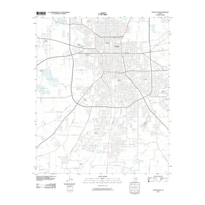
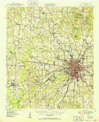 1949 Tyler1949 Print · USGSMid-century Smith County is captured here at a peak of rail and aviation development, centered on the growing hub of Tyler. Genealogists and historians can trace numerous country churches and schools like Lanes Chapel and Young Hill Sch, alongside the sprawling grounds of Camp Ford.
 - 1956 Map of Tyler
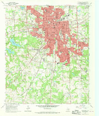
 1956 Tyler1956 Print · USGSEast Texas was a powerhouse of oil production and rail transport during the mid-fifties, centered on the sprawling East Texas Oil Field. Researchers can trace the heritage of industrial hubs like Kilgore, military sites such as the Longhorn Ordnance Works, and many rural landmarks like Mount Enterprise.5 unique versions available
 - 1966 Map of Chandler, 1967 Print
 1966 Chandler1967 Print · USGSChandler and the surrounding East Texas countryside are shown in the mid-sixties during the development of Lake Palestine. Researchers can trace old family roots at Macedonia Cem and Sevenleague Cem or locate former community centers like Dixie Sch.3 unique versions available
 - 1966 Map of Tyler North, 1969 Print
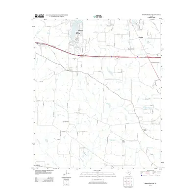
 1966 Tyler North1969 Print · USGSThe northern environs of Tyler during the mid-1960s show a mix of rural oil production and suburban expansion. Genealogists can locate family landmarks like Shamburger Cem or Old Butler Cem and trace the paths of the Missouri Pacific and St Louis Southwestern railroads.2 unique versions available
 - 1966 Map of Mount Sylvan, 1969 Print
 1966 Mount Sylvan1969 Print · USGSThe rural communities of Smith County are frozen in the mid-sixties, showing a landscape of oil wells, creek-fed farms, and country churches. Genealogists can trace family landmarks like Sitton Cem, Dixie Sch, and the settlements of Mount Sylvan and New Harmony.2 unique versions available
 - 1966 Map of Bascom, 1969 Print
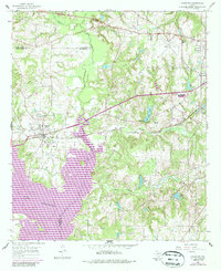
 1966 Bascom1969 Print · USGSSmith County is shown here in the late sixties as the region's water and oil infrastructure matured southeast of Tyler. Family historians can trace rural roots through Emmanuel Cem, Bascom Ch, and the grounds of the Texas State Quail Farm.3 unique versions available
 - 1966 Map of Winona, 1969 Print
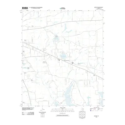
 1966 Winona1969 Print · USGSMid-century Smith County is captured during a period of institutional growth along the St Louis Southwestern rail line. Genealogists can trace family names at McDougle Cem, Ingram Cem, and the East Texas Tuberculosis Hospital.2 unique versions available
 - 1966 Map of Tyler South, 1970 Print
 1966 Tyler South1970 Print · USGSTyler was experiencing a surge of post-war growth in the sixties, visible here through its expanding neighborhoods and civic institutions. Genealogists and local historians can trace family plots across a high concentration of cemeteries including Oakwood Cem and St Louis Cem, or locate landmarks like Caldwell Zoo and Tyler Jr College.3 unique versions available
 - 1973 Map of Bullard, 1977 Print
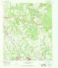
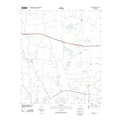
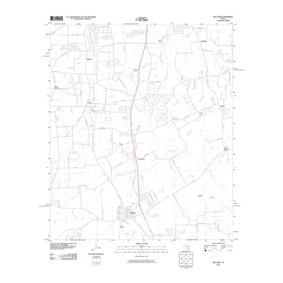
 1973 Bullard1977 Print · USGSThe ST LOUIS SOUTHWESTERN rail line cuts through the heart of East Texas in the early seventies, connecting rural communities across Smith and Cherokee counties. Genealogists can trace family landmarks like Barron Cem, Rather Cem, and the community of Flint.
 - 1984 Map of Tyler
 1984 Tyler1984 Print · USGSEast Texas at the peak of its reservoir-building era shows a landscape defined by new lakes and established rail corridors. Trace the path of the St Louis Southwestern RR or locate industrial sites like the Longhorn Ordnance Works.3 unique versions available
 - 1985 Map of Tyler
 1985 Tyler1985 Print · USGSEast Texas in the mid-eighties centers on the growth of Tyler and the expansive waters of Lake Palestine. Genealogists and researchers can trace family landmarks like Henry's Chapel and Browning Cem alongside the routes of the Southern Pacific RR.
 - 1991 Map of Tyler
 1991 Tyler1991 Print · USGSEast Texas in the early nineties centered on the expansion of Tyler and the recreational draw of Lake Palestine. Researchers can trace the layout of smaller communities like Ben Wheeler, Frankston, and Troup as they existed before modern suburban growth.
 - 2010 Map of Winona, 2010 Print
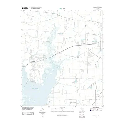
 2010 Winona2010 Print · USGSCovers Tyler, including Winona, Owentown, and other nearby areas
 - 2010 Map of Tyler North, 2010 Print
 2010 Tyler North2010 Print · USGSCovers Tyler, including Swan, Pine Springs, and other nearby areas
 - 2010 Map of Mount Sylvan, 2010 Print
 2010 Mount Sylvan2010 Print · USGSCovers Tyler, including Lindale, Hideaway, and other nearby areas
 - 2010 Map of Chandler, 2010 Print
 2010 Chandler2010 Print · USGSCovers Tyler, including Chandler, Noonday, and other nearby areas
 - 2010 Map of Bascom, 2010 Print
 2010 Bascom2010 Print · USGSCovers Tyler, including Whitehouse, New Chapel Hill, and other nearby areas
 - 2010 Map of Tyler South, 2010 Print
 2010 Tyler South2010 Print · USGSCovers Tyler, including Smith County, United States, and other nearby areas
 - 2010 Map of Bullard, 2010 Print
 2010 Bullard2010 Print · USGSCovers Tyler, including Whitehouse, Bullard, and other nearby areas
 - 2012 Map of Mount Sylvan, 2012 Print
 2012 Mount Sylvan2012 Print · USGSCovers Tyler, including Lindale, Hideaway, and other nearby areas
Showing maps 1-25 of 52
Top cities near Tyler
- Whitehouse historical maps
- Lindale historical maps
- Chandler historical maps
- Hideaway historical maps
- Bullard historical maps
- Troup historical maps
See more
Top neighborhoods of Tyler
Frequently asked questions
- What are the different types of historical maps available for Tyler?
- What is the oldest map of Tyler?
- Where can I purchase historical maps of Tyler for my home or office?
- Where can I download high-res historical maps of Tyler?
- Are there historical topographic maps available for Tyler?
- Is there historical aerial imagery available for Tyler?
- Where are historical maps of Tyler sourced from?