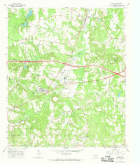
1966 Map of Winona
USGS Topo · Published 1969About this map
St Louis Southwestern railroad tracks anchor the landscape of northern Smith County in the mid-1960s, connecting the community of Winona to the broader regional economy. The map reveals a transition from traditional rural life to institutional and industrial development, most notably marked by the expansive East Texas Tuberculosis Hospital complex and its nearby Sewage Disposal plant. While the hospital and a local Dragstrip represent modern additions to the era, the map remains a vital resource for genealogists seeking family-named landmarks like McDougle Cem and Harris Creek Ch. The terrain is defined by a dense network of small waterways, including Wiggins Creek and Harris Creek, which likely dictated the placement of early settlements and local schools such as St Viola Ch.
Find a feature on this map
46 named features on this map. Tap any name to fly to it.
Don’t see what you’re looking for? This feature index may not catch every label — zoom into the map to look around manually.
Map Details
Editions of this 1966 Winona Map
2 editions found
Other maps of this area

1938 · Winona
USGS Topo · 1:48,000

1943 · Winona
USGS Topo · 1:62,500

1948 · Tyler
USGS Topo · 1:62,500

1949 · Tyler
USGS Topo · 1:62,500

1956 · Tyler
USGS Topo · 1:250,000

1960 · Hawkins
USGS Topo · 1:24,000

1960 · Big Sandy
USGS Topo · 1:24,000

1960 · Crow
USGS Topo · 1:24,000

1966 · Hope Pond
USGS Topo · 1:24,000
1966 · Starrville
USGS Topo · 1:24,000