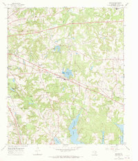
1966 Map of Bascom
USGS Topo · Published 1969About this map
The Missouri Pacific railroad cuts through this East Texas landscape southeast of Tyler, where rural communities like Bascom and Chapel Hill anchor a region defined by small churches and family burial grounds. Surveyed in the mid-1960s, the terrain reveals a transition toward organized water management and recreation with the presence of Lake Tyler and Lake Tyler East, as well as numerous smaller impoundments such as Pleasant Acres Lake and Dogwood Hollow Lake. Local institutions such as Jackson Sch and the Texas State Quail Farm reflect the agricultural and civic life of Smith County during this era. Genealogists will find significant detail in the mapped locations of Universe Cem, Belcher Cem, and Meador Cem, while the scatter of Oil Wells across the eastern quadrants indicates the persistent influence of the petroleum industry on the local economy.
Find a feature on this map
45 named features on this map. Tap any name to fly to it.
Don’t see what you’re looking for? This feature index may not catch every label — zoom into the map to look around manually.
Map Details
Editions of this 1966 Bascom Map
3 editions found
Other maps of this area

1937 · Troupe
USGS Topo · 1:48,000

1938 · Winona
USGS Topo · 1:48,000

1943 · Troup
USGS Topo · 1:62,500

1943 · Winona
USGS Topo · 1:62,500

1946 · Bullard
USGS Topo · 1:62,500

1948 · Bullard
USGS Topo · 1:62,500

1948 · Tyler
USGS Topo · 1:62,500

1949 · Tyler
USGS Topo · 1:62,500

1956 · Tyler
USGS Topo · 1:250,000

1966 · Hope Pond
USGS Topo · 1:24,000