
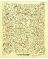
1943 Map of Winona
USGS Topo · Published 1943About this map
The St Louis Southwestern railroad corridor anchors this East Texas landscape, passing through the settlement of Winona and near the winding Sabine River in the northeast. This 1930s-era survey reveals a densely populated rural network characterized by numerous family-named landmarks and local institutions. The distribution of schools like Maggie Murphy Sch and Jamestown Sch, alongside burial grounds such as Seastrunk Cem and St Viola Cem, suggests a well-established community structure prior to mid-century consolidation.
Find a feature on this map
62 named features on this map. Tap any name to fly to it.
Don’t see what you’re looking for? This feature index may not catch every label — zoom into the map to look around manually.
Map Details
Editions of this 1943 Winona Map
2 editions found
Other maps of this area

1935 · Henderson
USGS Topo · 1:48,000

1936 · Kilgore
USGS Topo · 1:48,000

1937 · Troupe
USGS Topo · 1:48,000

1938 · Winona
USGS Topo · 1:48,000

1939 · Henderson
USGS Topo · 1:62,500

1940 · Kilgore
USGS Topo · 1:62,500

1943 · Troup
USGS Topo · 1:62,500

1946 · Bullard
USGS Topo · 1:62,500

1948 · Bullard
USGS Topo · 1:62,500

1948 · Tyler
USGS Topo · 1:62,500