2020s Maps of Taylor County, Texas
Explore 25 historic maps of Taylor County from the 2020s. These maps offer a rare glimpse into what life looked like during the 2020s — showing old roads, neighborhoods, homes, and landmarks that have changed or disappeared over time.
Whether you're researching your family's past, planning a metal detecting trip, or studying how Taylor County's landscape evolved across the 2020s, these high-resolution maps are a powerful tool for exploring the history of this region.
- Focus on a specific era: All maps on this page are from the 2020s, giving you a focused view of this time period.
- See what’s changed: Compare century-old streets, trails, and buildings to today's modern landscape using overlays and satellite layers.
- Research with precision: Use these maps for genealogy, historical research, land use analysis, or educational projects.
- View, download, or print: Maps are fully viewable online in high resolution, and can be downloaded or printed for your own records.
Start exploring Taylor County's history through authentic maps from the 2020s. This is your window into the past.
Taylor County, TX maps
(25)- 2022 Map of Stith, 2022 Print
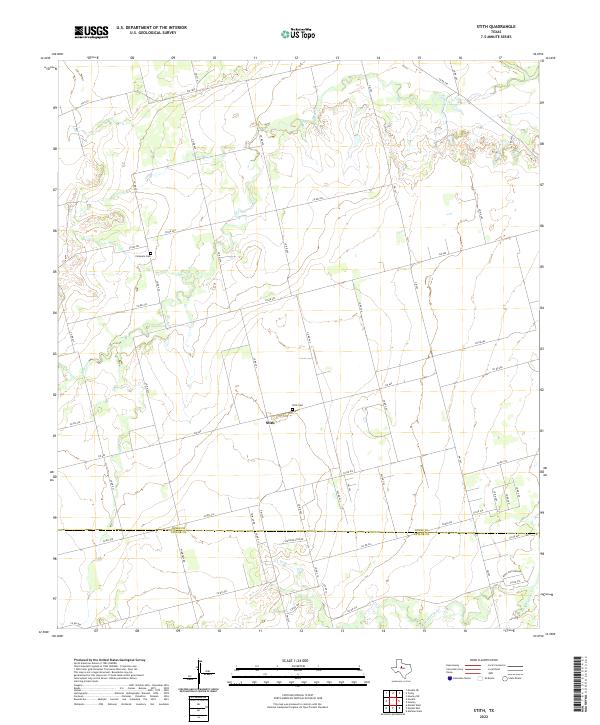 2022 Stith2022 Print · USGSStith and the surrounding ranchlands near the Jones and Taylor County line are shown here in modern detail. Researchers can locate family sites and landmarks like Stith Cem, Compere Cem, and the winding course of Bitter Cr.
 - 2022 Map of Bald Knob, 2022 Print
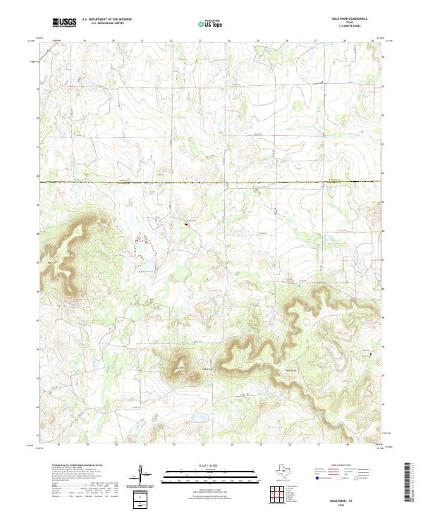 2022 Bald Knob2022 Print · USGSThe Taylor and Runnels County line in the modern era maintains its rural character among prominent topographical features. Researchers can trace the location of family burial grounds such as Dewey Cem and Cooper Cem near the slopes of Table Mtn.
 - 2022 Map of Merkel East, 2022 Print
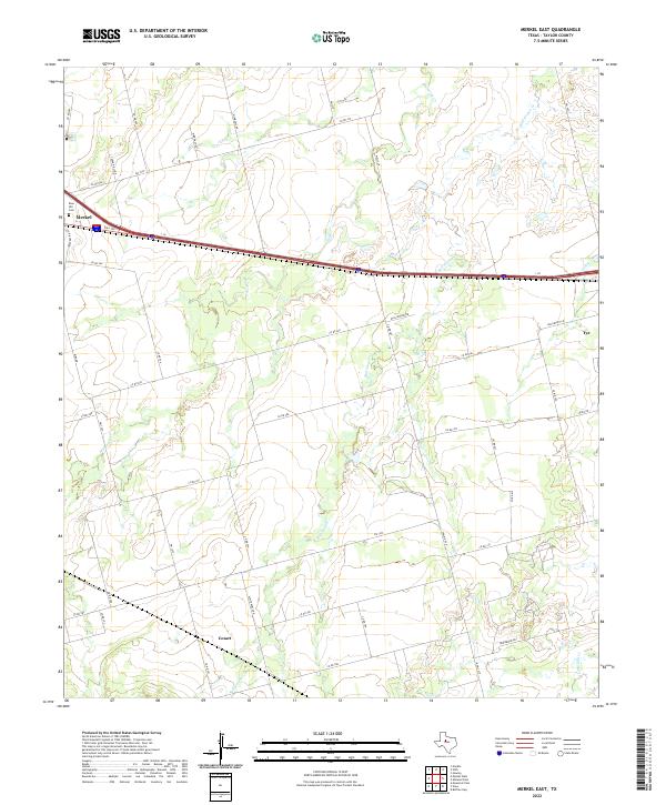 2022 Merkel East2022 Print · USGSTaylor County settlement patterns are visible in the modern era as the communities of Merkel and Tye expand along the interstate corridor. Researchers can trace rural landmarks like Rose Hill Cem, the Cozart area, and family-named roads such as Wimberly Rd.
 - 2022 Map of View, 2022 Print
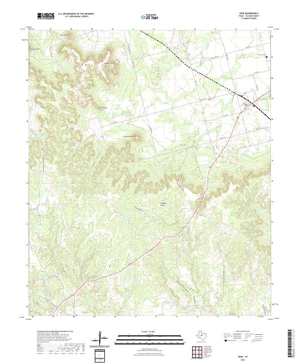 2022 View2022 Print · USGSTaylor County ranchlands and the high ridges of the Callahan Divide define this landscape during the early 2020s. Genealogists and local historians can locate the Drummond Cem and trace the terrain around View and Buzzard Mtn.
 - 2022 Map of Buffalo Gap, 2022 Print
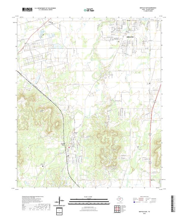 2022 Buffalo Gap2022 Print · USGSTexas settlement and the geography of the Callahan Divide come into focus in this late twenty-first-century survey. Trace local lineage and historic sites from Buffalo Gap to Caps, including the Iberis Cemetery and Cedar Gap Cemetery.
 - 2022 Map of Goldsboro, 2022 Print
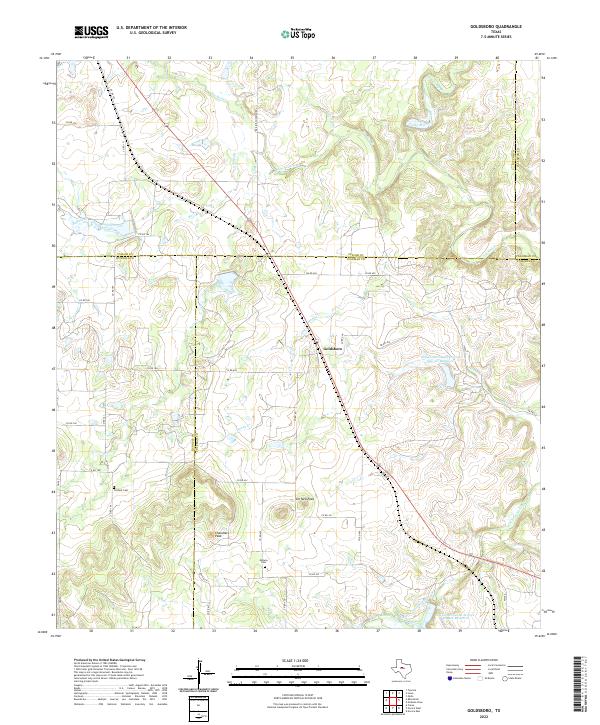 2022 Goldsboro2022 Print · USGSGoldsboro sits at the intersection of five county borders in central Texas during the 2020s, showing a landscape defined by ranch roads and creek drainage. Researchers can locate family landmarks like Content Cem and Midway Cem near the prominent Jim Ned Peak.
 - 2022 Map of Bradshaw, 2022 Print
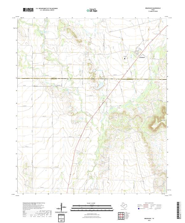 2022 Bradshaw2022 Print · USGSThe West Texas ranchlands of Taylor and Runnels counties are captured here in the early twenty-first century. Genealogists and local historians can trace family land via the network of county roads connecting Bradshaw, Drasco, and the Bradshaw Cem.
 - 2022 Map of Tuscola, 2022 Print
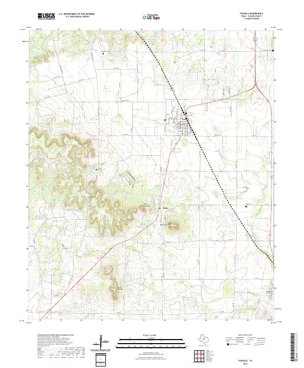 2022 Tuscola2022 Print · USGSTaylor County ranch lands and small towns are captured here in the early twenty-first century. Genealogists can trace family heritage at Lemons Gap Cem and McBee Cem or locate the historic post office at Tuscola.
 - 2022 Map of Merkel West, 2022 Print
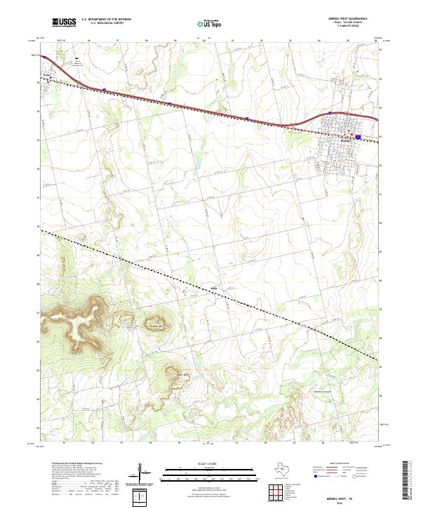 2022 Merkel West2022 Print · USGSThe Taylor County high plains and breaks come into focus in 2022, centered on the Interstate 20 corridor. Trace local landmarks like the White Church, Trent Garden of Memories Cem, and the prominent slopes of Blowout Mtn.
 - 2022 Map of Mountain Pass, 2022 Print
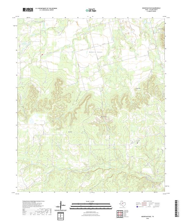 2022 Mountain Pass2022 Print · USGSThis Taylor County landscape reveals the topographic character of the Texas frontier in the early twenty-first century. Family historians can trace routes near Dudley Cem or locate family-named landmarks like Pat Powers Cove and Butman Falls.
 - 2022 Map of Potosi, 2022 Print
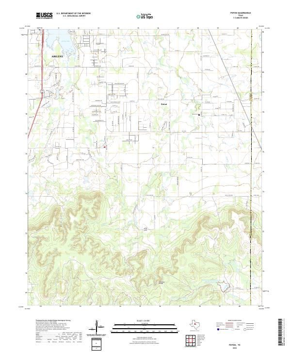 2022 Potosi2022 Print · USGSThe Abilene suburbs meet the southern hills in the early 2020s, revealing a landscape of growing communities and strategic water management. Genealogists and local researchers can locate the Potosi Cem, trace the waters of Kirby Lake, and explore the winding roads of the Callahan Divide.
 - 2022 Map of Lawn, 2022 Print
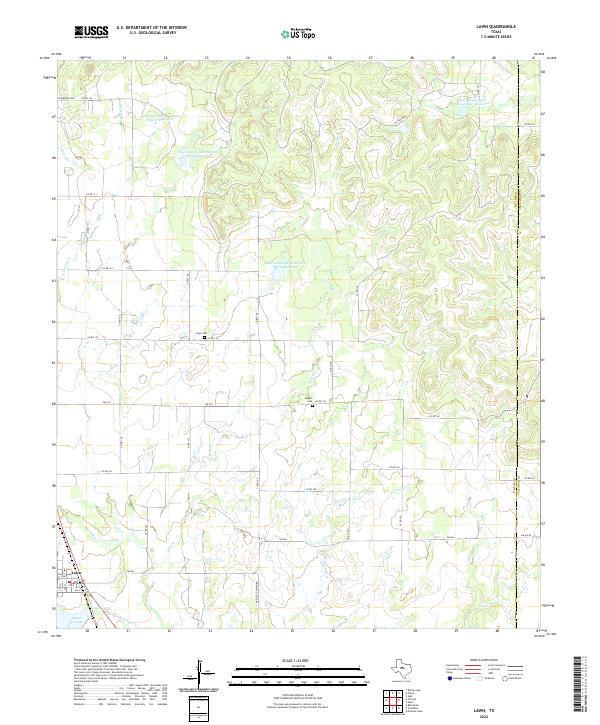 2022 Lawn2022 Print · USGSThe ranching and oil lands of Taylor County are captured in this recent survey of the area around Lawn. Local historians can trace family plots at Snodgrass Cem or Cope Cem and examine modern water management at Lake Lawn.
 - 2022 Map of Abilene West, 2022 Print
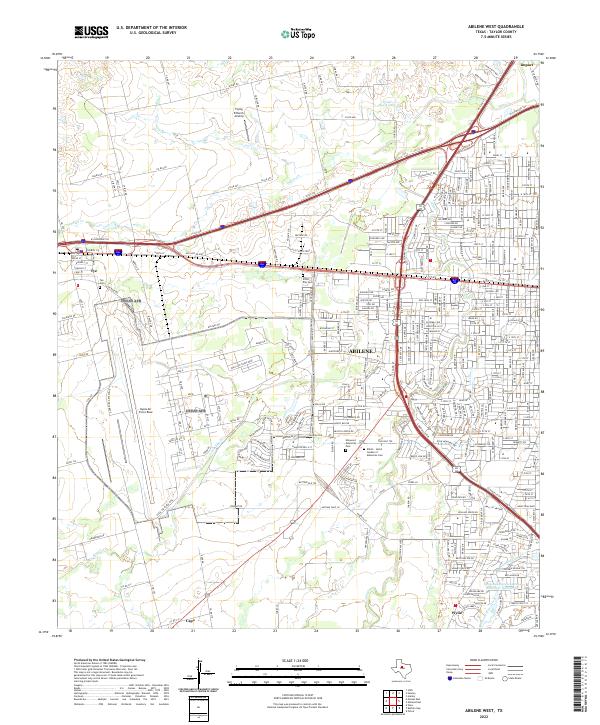 2022 Abilene West2022 Print · USGSAbilene and the surrounding Taylor County plains appear in the early 2020s as a hub of military aviation and modern commerce. Trace the layout of Dyess Air Force Base, find family roots at Little Elm Cem, or explore the environs of Impact.
 - 2022 Map of Hamby, 2022 Print
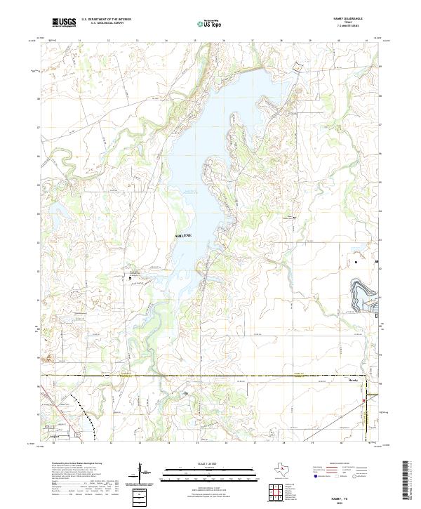 2022 Hamby2022 Print · USGSNorthern Jones County and the Abilene fringe are shown here in the 2020s, centered on the waters of Lake Fort Phantom Hill. Researchers can locate Round Mound Cem, the Texas State Veteran's Cem at Abilene, and the small community of Hamby.
 - 2022 Map of Hawley, 2022 Print
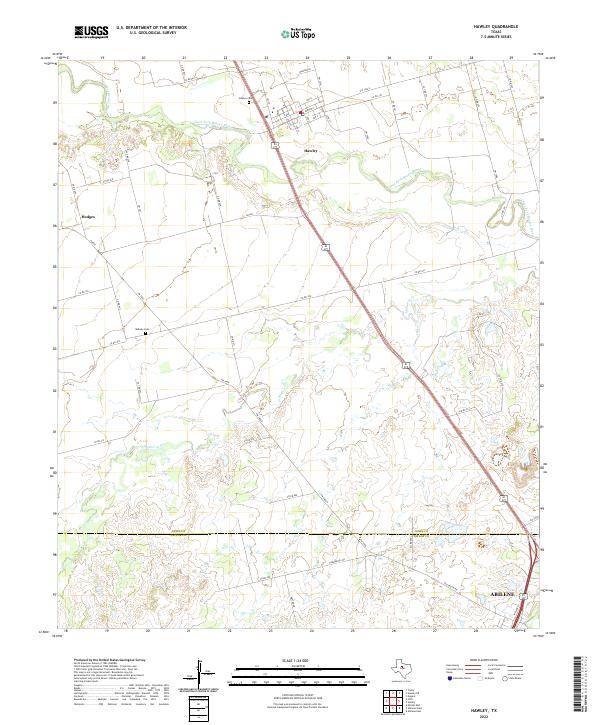 2022 Hawley2022 Print · USGSJones and Taylor counties are captured in the early 2020s, showing the rural transitions between Hawley and the outskirts of Abilene. Genealogists can trace local burials at Hawley Cem and Midway Cem along the Clear Fork Brazos River.
 - 2022 Map of Lake Abilene, 2022 Print
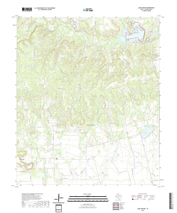 2022 Lake Abilene2022 Print · USGSTexas ranchlands and rugged breaks south of Abilene appear here in the early twenty-first century. Local researchers can trace old roads and water sources like Puckett Springs, Graham Lake, and the landmark summit of Steamboat Mtn.
 - 2022 Map of Abilene East, 2022 Print
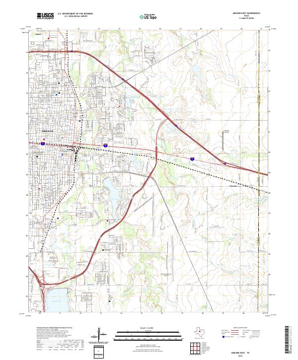 2022 Abilene East2022 Print · USGSAbilene and its eastern suburbs are shown in great detail in this 2020s study of the Texas Big Country. Genealogists can trace family landmarks like the Old Colony Cem while researchers locate the campuses of Hardin-Simmons University and McMurry University.
 - 2022 Map of Wingate, 2022 Print
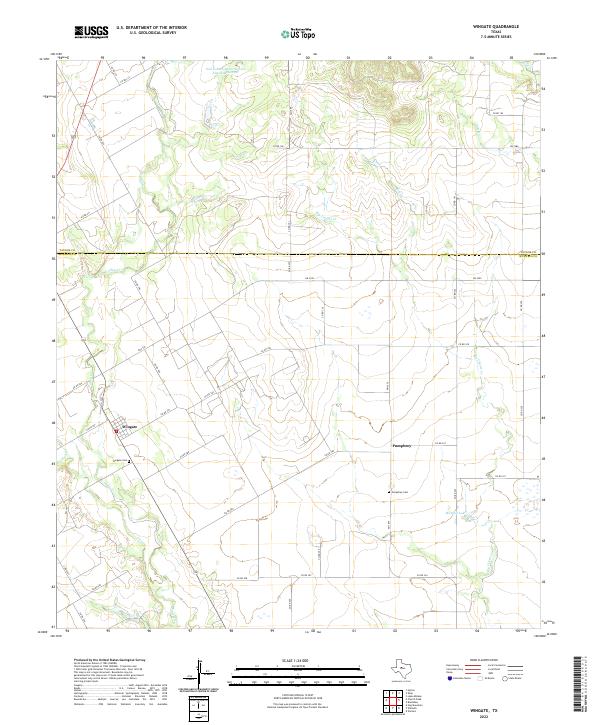 2022 Wingate2022 Print · USGSThe ranchlands of the Taylor and Runnels county line are captured here in the early twenty-first century. Genealogists and local historians can trace the foundations of the area at Wingate and Pumphrey, including the Wingate Cem and Pumphrey Cem.
 - 2022 Map of Church Peak, 2022 Print
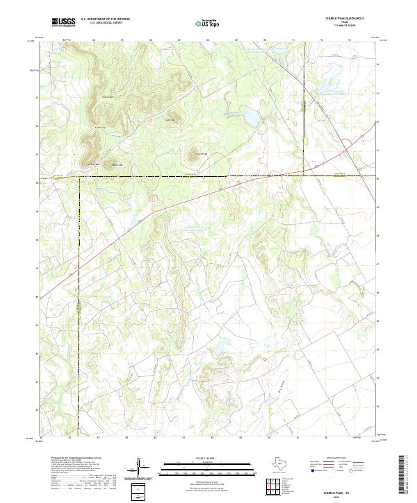 2022 Church Peak2022 Print · USGSThe high mesas of the Callahan Divide meet where four counties intersect in this contemporary West Texas survey. Researchers can trace land boundaries near Church Peak or locate water features like Odom Currie Wylie Estate Lake Number 1 and Dry Hollow.
 - 2022 Map of Nolan, 2022 Print
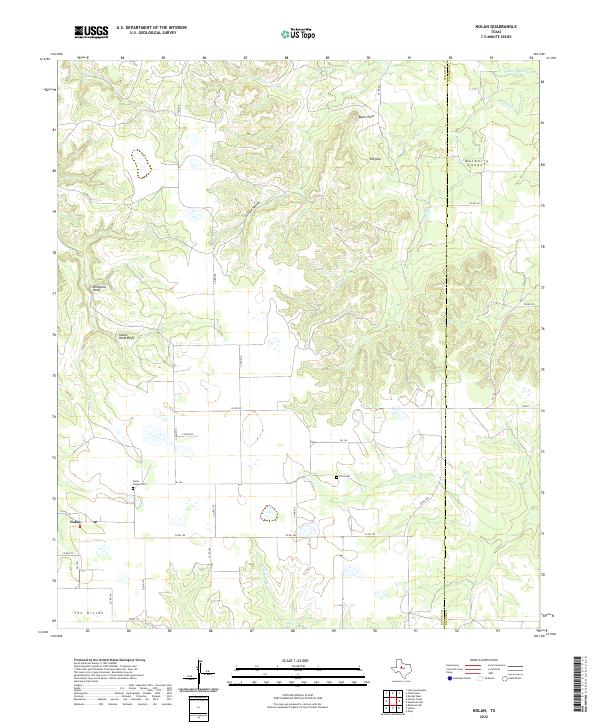 2022 Nolan2022 Print · USGSNear the Nolan and Taylor County line, this recent study captures the high-ground ranching country of the Texas Rolling Plains. Genealogists can locate Slater Chapel Cem and Dora Cem or trace the geography of Mulberry Canyon.
 - 2022 Map of Hylton, 2022 Print
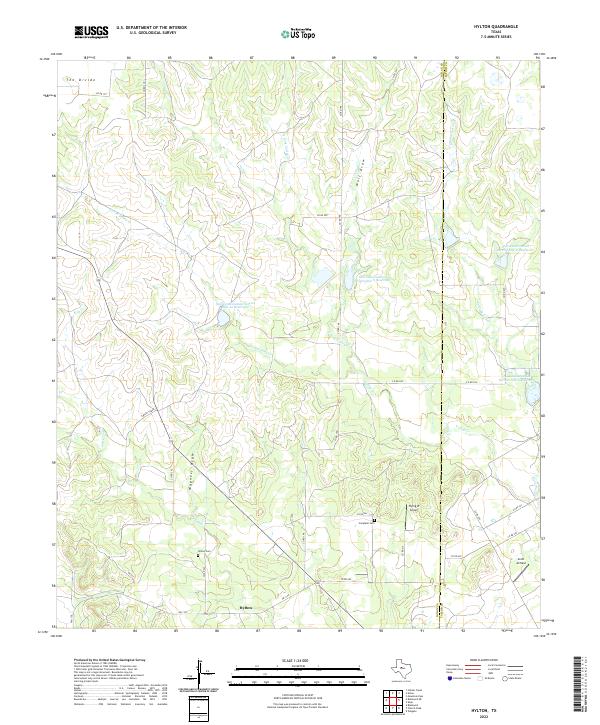 2022 Hylton2022 Print · USGSNolan County ranch lands at the Taylor County line are captured here in the early 2020s, showing the enduring layout of rural West Texas. Researchers can locate the Hylton Cemetery, Campbell Cemetery, and aviation landmarks like Flying W Airport.
 - 2022 Map of Shep, 2022 Print
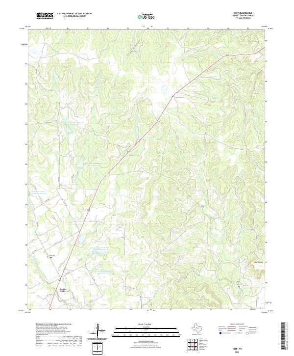 2022 Shep2022 Print · USGSTaylor County ranching country comes into focus in this early 2020s study of the area near the Nolan county line. Researchers can locate Happy Valley and trace family history at the Shep Cem and Bluff Creek Cem.
 - 2022 Map of Chalk Peak, 2022 Print
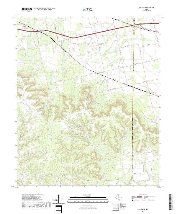 2022 Chalk Peak2022 Print · USGSThe high breaks of the Texas ranch lands are captured here along the Nolan and Taylor county line. Genealogists and local researchers can trace the rural landscape from the White Church Cem to the early settlements of Grimes and Tesco.
 - 2022 Map of Noodle, 2022 Print
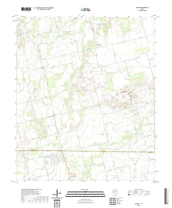 2022 Noodle2022 Print · USGSThe ranching and farming country near the border of Jones and Taylor Counties comes into focus in this recent survey. Researchers can trace rural landmarks and family burial sites like the Noodle Cem and follow the paths of Noodle Cr and Bitter Cr.
 - 2022 Map of Raven Creek South, 2022 Print
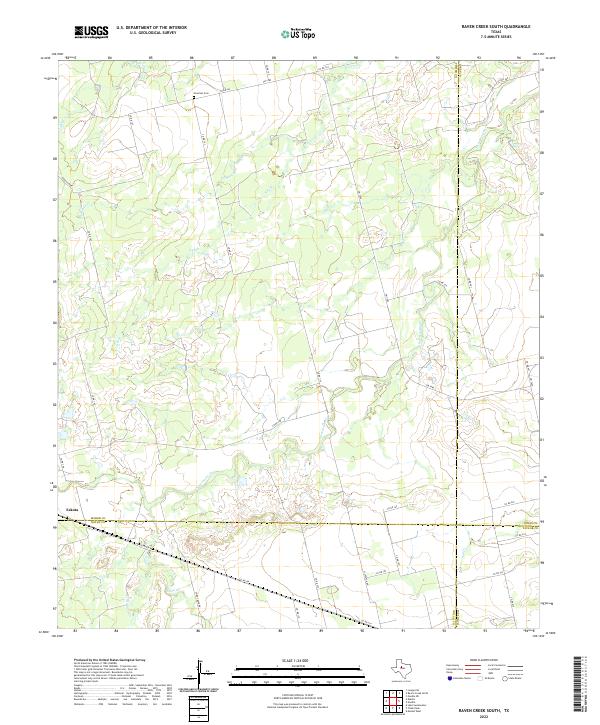 2022 Raven Creek South2022 Print · USGSFisher County and its neighbors are captured here in the early 2020s, showing the intersection of four Texas counties. Trace local family history at Newman Cem or explore the rural surroundings of Eskota and the banks of Sweetwater Cr.
End of results
Showing maps 1-25 of 25
Top cities of Taylor County
- Abilene historical maps
- Merkel historical maps
- Tye historical maps
- Tuscola historical maps
- Buffalo Gap historical maps
- Lawn historical maps
See more
Frequently asked questions
- What are the different types of historical maps available for Taylor County?
- What is the oldest map of Taylor County?
- Where can I purchase historical maps of Taylor County for my home or office?
- Where can I download high-res historical maps of Taylor County?
- Are there historical topographic maps available for Taylor County?
- Is there historical aerial imagery available for Taylor County?
- Where are historical maps of Taylor County sourced from?