1960s Maps of Uvalde County, Texas
Explore 14 historic maps of Uvalde County from the 1960s. These maps offer a rare glimpse into what life looked like during the 1960s — showing old roads, neighborhoods, homes, and landmarks that have changed or disappeared over time.
Whether you're researching your family's past, planning a metal detecting trip, or studying how Uvalde County's landscape evolved across the 1960s, these high-resolution maps are a powerful tool for exploring the history of this region.
- Focus on a specific era: All maps on this page are from the 1960s, giving you a focused view of this time period.
- See what’s changed: Compare century-old streets, trails, and buildings to today's modern landscape using overlays and satellite layers.
- Research with precision: Use these maps for genealogy, historical research, land use analysis, or educational projects.
- View, download, or print: Maps are fully viewable online in high resolution, and can be downloaded or printed for your own records.
Start exploring Uvalde County's history through authentic maps from the 1960s. This is your window into the past.
Uvalde County, TX maps
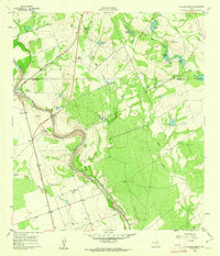
(14)- 1960 Map of Concan, 1962 Print
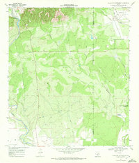
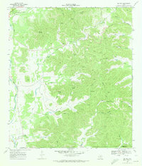
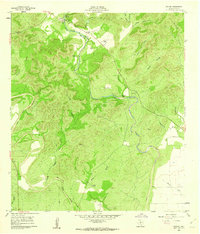 1960 Concan1962 Print · USGSUvalde County ranch lands are documented here in the early sixties as they transition into a recreation and livestock corridor along the Frio River. Researchers can trace old family holdings at Stoner Ranch and Fitzgerald Ranch or locate the Concan Cem.2 unique versions available
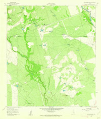
 - 1960 Map of Hacienda, 1962 Print
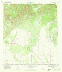
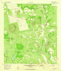 1960 Hacienda1962 Print · USGSUvalde County ranchlands and the winding river valley are captured here in the early sixties. Genealogists and local historians can locate several family holdings including Rosenow Ranch and Mirasol Ranch near the Nueces River.2 unique versions available
 - 1960 Map of Chalk Bluff, 1962 Print
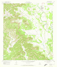
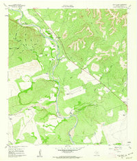 1960 Chalk Bluff1962 Print · USGSUvalde County ranchlands are documented here in the early sixties as the cattle industry and river geography shaped the local economy. Genealogists and historians can trace family properties like Gray Ranch and Lewis Ranch or locate the historic Haby Crossing on the Nueces River.2 unique versions available
 - 1960 Map of Magers Crossing, 1962 Print
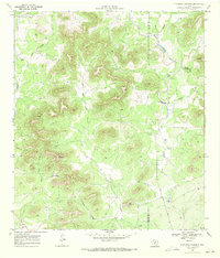
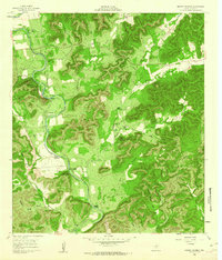 1960 Magers Crossing1962 Print · USGSThe Frio River canyon in the early sixties is a landscape of private ranches and burgeoning recreation. Researchers can trace the boundaries of Garner State Park or locate family-named sites like Kelly Ranch and Magers Crossing.
 - 1960 Map of Pulliam Ranch, 1962 Print
 1960 Pulliam Ranch1962 Print · USGSRanching operations in South Texas define this landscape at the dawn of the sixties, where family estates dominate the riverbanks. Genealogists and historians can trace the specific boundaries of the Pulliam Ranch, Palmer Ranch, and the rail siding at A B Junction.
 - 1960 Map of Sand Mountain, 1962 Print
 1960 Sand Mountain1962 Print · USGSZavala and Uvalde Counties in the early sixties reveal a landscape of remote ranching outposts and vital water infrastructure along the Nueces River. Genealogists and historians can trace family holdings like Anthon Ranch or Lyles Ranch and locate the historic Smyth Station along the Missouri Pacific tracks.
 - 1964 Map of Del Rio
 1964 Del Rio1964 Print · USGSAlong the Mexican border during the mid-sixties, this area centered on the confluence of the Rio Grande and Devils River. Researchers can trace the Southern Pacific line through isolated stops like Pumpville or locate military and industrial sites such as Laughlin Air Force Base and the mines at Blewett.
 - 1964 Map of Seco Pass, 1968 Print
 1964 Seco Pass1968 Print · USGSThe Bandera County highlands of the mid-sixties are captured here at the intersection with Uvalde and Medina Counties. Researchers can trace rural landmarks like Haby Cem, identify remote sites like Sutherland, and locate Sentry Mountain.
 - 1969 Map of Vanderpool, 1972 Print
 1969 Vanderpool1972 Print · USGSThe Sabinal River valley in the late sixties reveals a landscape of isolated ranching and deep limestone canyons. Trace local family history and rural industry at the Jones Cem, the Vanderpool settlement, and several named peaks like Taylor Mountain.2 unique versions available
 - 1969 Map of Comanche Waterhole, 1972 Print
 1969 Comanche Waterhole1972 Print · USGSThe Uvalde and Medina County line area was a landscape of ranching and specialized industry in the late sixties. Researchers can trace land use through the K Bar Ranch and Valdina Farms, or locate the Automotive Test Facility and Comanche Waterhole.
 - 1969 Map of Trio, 1972 Print
 1969 Trio1972 Print · USGSThis Uvalde County landscape captures the Hill Country edge in the late sixties, where ranching life met the winding Sabinal River. Researchers can locate the small settlement of Trio, trace the drainage of Little Blanco Creek, and find landmarks like the Landing Strip.
 - 1969 Map of Utopia, 1972 Print
 1969 Utopia1972 Print · USGSThe Sabinal River valley in the late sixties shows a landscape of small settlements and Hill Country ranching. Genealogy researchers can locate the Waresville Cem and High Sch, or trace family landmarks like Blanco Ranch and Bald Mountain.
 - 1969 Map of Flatrock Crossing, 1972 Print
 1969 Flatrock Crossing1972 Print · USGSThe Edwards Plateau breaks into the Hill Country of Uvalde and Medina counties during the late sixties, where ranching life follows the limestone creek beds. Researchers can locate remote family landmarks like Miller Cem, the Flatrock Crossing ford, and high points like Holy Mountain.2 unique versions available
 - 1969 Map of Rio Frio, 1973 Print
 1969 Rio Frio1973 Print · USGSThe Rio Frio area of the Hill Country is documented here in the late sixties, showing the complex river networks of the Edwards Plateau. Genealogists and hikers can locate family-named landmarks like Bailey Hollow and Panther Springs or the local Cem near the river.2 unique versions available
End of results
Showing maps 1-14 of 14
Top cities of Uvalde County
- Uvalde historical maps
- Uvalde Estates historical maps
- Sabinal historical maps
- Knippa historical maps
- Utopia historical maps
Frequently asked questions
- What are the different types of historical maps available for Uvalde County?
- What is the oldest map of Uvalde County?
- Where can I purchase historical maps of Uvalde County for my home or office?
- Where can I download high-res historical maps of Uvalde County?
- Are there historical topographic maps available for Uvalde County?
- Is there historical aerial imagery available for Uvalde County?
- Where are historical maps of Uvalde County sourced from?