Old Maps of Uvalde County, Texas for Metal Detecting
Plan your next treasure hunt with 229 historic maps of Uvalde County. Find old homesites, ghost towns, trails, and gathering spots that may be lost to time — perfect for identifying promising metal detecting locations.
- Locate forgotten sites: Uncover places like long-lost settlements, abandoned rail lines, or gathering spots.
- Plan better hunts: Use map overlays combined with LiDAR or satellite views to narrow in on historically rich areas.
- Made for detectorists: Thousands of hobbyists use these maps to discover relics, coins, and hidden history.
Use these historic maps to boost your research and find new opportunities beneath the surface of Uvalde County.
Uvalde County, TX maps
(229)- 1893 Map of Nueces
 1893 Nueces1893 Print · USGSTexas ranching culture and the canyons of the Nueces River are captured here during the 1890s frontier era. Genealogists and local historians can trace early family landholdings like the Ford and Holliday Ranch and remote settlements such as Camp Wood or Barksdale.
 - 1896 Map of Nueces
 1896 Nueces1896 Print · USGSThe upper Nueces River valley in the 1890s is captured here as a network of isolated family ranches and riverfront settlements. Genealogists and historians can trace early landholders at the Ford and Holliday Ranch, Johnson Ranch, and Hillcoat Ranch.4 unique versions available
 - 1896 Map of Brackett
 1896 Brackett1896 Print · USGSSouthwest Texas ranching and military life come into focus in the 1890s, centered on the strategic presence of the frontier army. Genealogists can trace family holdings like Weymiller Ranch or find early communities such as the Seminole Settlement and Spofford.
 - 1897 Map of Brackett
 1897 Brackett1897 Print · USGSThe frontier of Kinney and Uvalde counties is captured here in the late nineteenth century, centered on the military and ranching hub of Brackett. Researchers can trace the Southern Pacific R. R. through Cline or locate the historic Seminole Settlement and Fort Clark.3 unique versions available
 - 1898 Map of Uvalde
 1898 Uvalde1898 Print · USGSTexas ranching culture and early rail expansion meet in the late 1890s across this detailed landscape. Genealogists and researchers can trace family-named estates like Molesworth Ranch, locate the Sansom P.O., and find industrial relics like the Silver Mine.3 unique versions available
 - 1899 Map of Uvalde, 1931 Print
 1899 Uvalde1931 Print · USGSThe South Texas ranching frontier comes into focus during the late nineteenth century as railroads began to transform the cattle economy. Researchers can trace family ranch lands such as McDaniels Ranch, locate the Sansom P.O. at Uvalde, and find local landmarks like Myricks Upper Apiary.
 - 1928 Map of Frio Town, 1956 Print
 1928 Frio Town1956 Print · USGSThe ranchlands of South Texas are documented here in the late 1920s, showing a landscape shaped by water rights and family holdings. Genealogists and local historians can trace the bounds of the Schuddemagen Ranch and Woodward Ranch or locate the old Post Office at Frio Town.
 - 1938 Map of Turkey Mountain
 1938 Turkey Mountain1938 Print · USGSKinney and Uvalde counties are shown here in the late 1930s, a period when isolated ranching estates and river crossings defined the local economy. Researchers can trace historic family lands like Harrison Ranch Headquarters and the Moss Ranch, or locate the rural Liveoak Sch.4 unique versions available
 - 1943 Map of Turkey Mountain
 1943 Turkey Mountain1943 Print · USGSKinney and Uvalde counties in the late 1930s reveal a landscape of remote ranching outposts and vital waterholes. Genealogists and historians can trace family-named lands like the Harrison Ranch Headquarters and Dave Rose Ranch or locate the rural Live Oak Sch.2 unique versions available
 - 1944 Map of Barksdale
 1944 Barksdale1944 Print · USGSThe Edwards County ranching country of the mid-1940s is detailed here during the expansion of rural utility lines and cattle operations. Genealogists can locate family-named landmarks like Double Wells Ranch, Old Chapman Place, and the riverfront grounds of Camp Wood.
 - 1949 Map of Cline
 1949 Cline1949 Print · USGSSouthwest Texas ranching and asphalt mining are captured here in the late 1930s and 40s. Genealogists and historians can locate family landmarks like Finley Ranch and trace the specialized Asphalt Belt Line railroad serving Blewett.2 unique versions available
 - 1954 Map of San Antonio, 1964 Print
 1954 San Antonio1964 Print · USGSSan Antonio and the Texas Hill Country are captured here in the mid-fifties, showing a landscape defined by massive military air bases and the rising Canyon Reservoir. Trace family ties through historic rail towns like D'Hanis and Castroville or explore the Cold War footprint of Lackland AFB and Randolph AFB.3 unique versions available
 - 1956 Map of Sabinal
 1956 Sabinal1956 Print · USGSRanching and rail transit define this South Texas landscape in the mid-1950s. Genealogists and historians can trace family holdings like the A Rothe Ranch, locate the industry of the Brick Yard, and follow the old Fort Clark-San Antonio Road past Sabinal.
 - 1956 Map of Tarpley
 1956 Tarpley1956 Print · USGSThe Texas Hill Country around Tarpley comes into focus in this mid-century survey, showing the transition from family ranches to early industrial infrastructure. Trace old property lines and landmarks like Old Montell Camp, the German Settlement, and the Humble Pipeline.
 - 1956 Map of Utopia
 1956 Utopia1956 Print · USGSThe Sabinal and Frio River valleys are mapped here during the mid-twentieth century, showcasing a transition from pioneer homesteads to established ranching. Genealogists and historians can trace family locations like Paterson Ranch or find vanished landmarks like Thompsons Mill and Taylor School.
 - 1957 Map of San Antonio
 1957 San Antonio1957 Print · USGSSan Antonio and the Texas Hill Country are shown here during the mid-fifties, capturing the region's expanding post-war military and transportation footprint. Genealogists and local historians can trace the early residential boundaries of Alamo Heights or locate rural landmarks like St Hedwig and Medina Lake.
 - 1957 Map of York Hollow
 1957 York Hollow1957 Print · USGSThe ranchlands of the Frio River canyons are shown during a period of transition in the mid-1950s. Genealogists and local historians can trace family landmarks and rural education sites like Reagan Wells, Exile School, and the Wheeler Ranch.
 - 1958 Map of Del Rio, 1970 Print
 1958 Del Rio1970 Print · USGSThe Texas-Mexico borderlands come alive in the late fifties, showing the confluence of the Rio Grande and the emerging Amistad Reservoir. Trace the lineage of the Southern Pacific rail line through stops at Pumpville, Shumla, and the mining vicinity of Blewett.2 unique versions available
 - 1960 Map of Concan, 1962 Print
 1960 Concan1962 Print · USGSUvalde County ranch lands are documented here in the early sixties as they transition into a recreation and livestock corridor along the Frio River. Researchers can trace old family holdings at Stoner Ranch and Fitzgerald Ranch or locate the Concan Cem.2 unique versions available
 - 1960 Map of Hacienda, 1962 Print
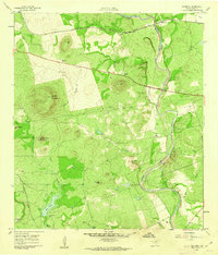 1960 Hacienda1962 Print · USGSUvalde County ranchlands and the winding river valley are captured here in the early sixties. Genealogists and local historians can locate several family holdings including Rosenow Ranch and Mirasol Ranch near the Nueces River.2 unique versions available
 - 1960 Map of Chalk Bluff, 1962 Print
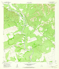 1960 Chalk Bluff1962 Print · USGSUvalde County ranchlands are documented here in the early sixties as the cattle industry and river geography shaped the local economy. Genealogists and historians can trace family properties like Gray Ranch and Lewis Ranch or locate the historic Haby Crossing on the Nueces River.2 unique versions available
 - 1960 Map of Magers Crossing, 1962 Print
 1960 Magers Crossing1962 Print · USGSThe Frio River canyon in the early sixties is a landscape of private ranches and burgeoning recreation. Researchers can trace the boundaries of Garner State Park or locate family-named sites like Kelly Ranch and Magers Crossing.
 - 1960 Map of Pulliam Ranch, 1962 Print
 1960 Pulliam Ranch1962 Print · USGSRanching operations in South Texas define this landscape at the dawn of the sixties, where family estates dominate the riverbanks. Genealogists and historians can trace the specific boundaries of the Pulliam Ranch, Palmer Ranch, and the rail siding at A B Junction.
 - 1960 Map of Sand Mountain, 1962 Print
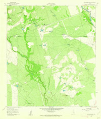 1960 Sand Mountain1962 Print · USGSZavala and Uvalde Counties in the early sixties reveal a landscape of remote ranching outposts and vital water infrastructure along the Nueces River. Genealogists and historians can trace family holdings like Anthon Ranch or Lyles Ranch and locate the historic Smyth Station along the Missouri Pacific tracks.
 - 1964 Map of Del Rio
 1964 Del Rio1964 Print · USGSAlong the Mexican border during the mid-sixties, this area centered on the confluence of the Rio Grande and Devils River. Researchers can trace the Southern Pacific line through isolated stops like Pumpville or locate military and industrial sites such as Laughlin Air Force Base and the mines at Blewett.
Showing maps 1-25 of 229
Top cities of Uvalde County
- Uvalde historical maps
- Uvalde Estates historical maps
- Sabinal historical maps
- Knippa historical maps
- Utopia historical maps
Frequently asked questions
- What are the different types of historical maps available for Uvalde County?
- What is the oldest map of Uvalde County?
- Where can I purchase historical maps of Uvalde County for my home or office?
- Where can I download high-res historical maps of Uvalde County?
- Are there historical topographic maps available for Uvalde County?
- Is there historical aerial imagery available for Uvalde County?
- Where are historical maps of Uvalde County sourced from?