1970s Maps of Uvalde County, Texas
Explore 22 historic maps of Uvalde County from the 1970s. These maps offer a rare glimpse into what life looked like during the 1970s — showing old roads, neighborhoods, homes, and landmarks that have changed or disappeared over time.
Whether you're researching your family's past, planning a metal detecting trip, or studying how Uvalde County's landscape evolved across the 1970s, these high-resolution maps are a powerful tool for exploring the history of this region.
- Focus on a specific era: All maps on this page are from the 1970s, giving you a focused view of this time period.
- See what’s changed: Compare century-old streets, trails, and buildings to today's modern landscape using overlays and satellite layers.
- Research with precision: Use these maps for genealogy, historical research, land use analysis, or educational projects.
- View, download, or print: Maps are fully viewable online in high resolution, and can be downloaded or printed for your own records.
Start exploring Uvalde County's history through authentic maps from the 1970s. This is your window into the past.
Uvalde County, TX maps
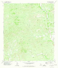
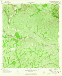
(22)- 1970 Map of Irishman Hill, 1973 Print
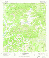
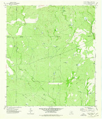
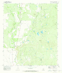 1970 Irishman Hill1973 Print · USGSSettled along the border of Uvalde and Medina counties in the early 1970s, this landscape shows the rural intersection of the Sabinal River and its many tributaries. Genealogists and local historians can locate the Brown Cem and landmarks like Irishman Hill and Pilot Knob.
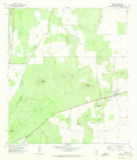
 - 1970 Map of Sabinal, 1973 Print
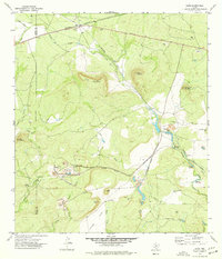
 1970 Sabinal1973 Print · USGSThe community of Sabinal thrives at the intersection of rail and river during the early 1970s. Genealogists can locate family landmarks such as St Patrick Cem and Davenport Cem, or trace the Southern Pacific line past the local Rodeo Ground.
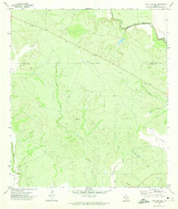
 - 1971 Map of Sevenmile Hill, 1973 Print
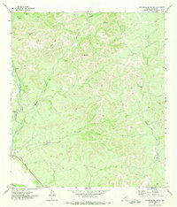
 1971 Sevenmile Hill1973 Print · USGSUvalde County in the early 1970s was a landscape defined by ranching and the slow transition of its transport networks. Researchers can trace the Old Railroad Grade and identify water sources like Eightmile Waterhole and the prominent Taylor Mountain.
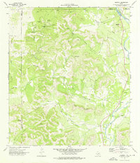
 - 1971 Map of Garner Field NE, 1973 Print
 1971 Garner Field NE1973 Print · USGSThe rural brush country of Uvalde County is captured here in the early seventies, centered on the winding Frio River. Local researchers can trace the seasonal flows of Blanco Creek and Dinner Creek past isolated landmarks like the Long Hollow and scattered wells.
 - 1971 Map of Sycamore Mountain, 1973 Print
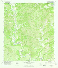
 1971 Sycamore Mountain1973 Print · USGSThe western edge of Uvalde County is captured in the early 1970s, defined by the winding Nueces River and the high limestone ridges of the Hill Country. Local historians can trace the path of the Old Railroad Grade and locate geological landmarks like Indian Creek Cave and Sycamore Mountain.
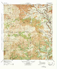
 - 1971 Map of Garner Field, 1974 Print
 1971 Garner Field1974 Print · USGSUvalde County in the early 1970s reveals a landscape defined by the convergence of the Frio River and the growing campus of Southwest Texas Jr College. Researchers can trace the rural property boundaries of the day, identifying local landmarks like Garner Field, Toadstool Waterhole, and the Rodeo Ground.
 - 1971 Map of Leakey, 1974 Print
 1971 Leakey1974 Print · USGSThe town of Leakey and its surroundings in the early 1970s reveal a community defined by the Frio River and its rugged draws. Genealogists and researchers can locate family landmarks like Exile Cem, Clark Cem, and the springs at Leakey Springs.
 - 1971 Map of Uvalde, 1974 Print
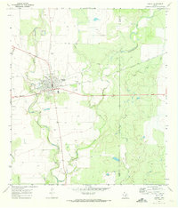
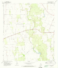
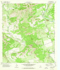
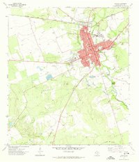 1971 Uvalde1974 Print · USGSUvalde and its southern ranchlands are documented here in the early seventies, showing a growing community centered on the railroad. Researchers can locate civic landmarks like the Fort Inge (Historical Site), the Honey Bowl Stadium, and the Uvalde National Fish Hatchery.2 unique versions available
 - 1971 Map of Lake Creek, 1974 Print
 1971 Lake Creek1974 Print · USGSThe Uvalde County backcountry in the early 1970s is a landscape of high ridges and spring-fed canyons. Researchers can trace the Old Railroad Grade along the Nueces River or locate rural sites like Blucher and Walnut Springs.
 - 1971 Map of Blanco Lake, 1974 Print
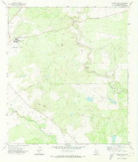
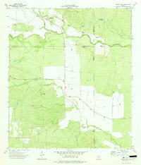
 1971 Blanco Lake1974 Print · USGSUvalde County in the early 1970s is a landscape of rural industry and seasonal waterways defined by the Southern Pacific rail line. Researchers can trace family history at Wish Cem or locate old ranching infrastructure like the Landing Strip and Storage Bins.
 - 1971 Map of Batesville Hill, 1974 Print
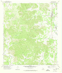
 1971 Batesville Hill1974 Print · USGSThe South Texas brush country along the Uvalde and Zavala county line is documented here in the early seventies. Researchers can locate a solitary Grave near the Leona River or trace the drainage of Camp Lake Slough and Gallina Creek.
 - 1971 Map of Reagan Wells, 1974 Print
 1971 Reagan Wells1974 Print · USGSReagan Wells and the rugged Frio River canyons are captured here in the early 1970s. Local researchers can trace family landmarks like Cummins Heard Cemetery, the Heard Community Center, and remote hill country features like Devils Backbone Mountain.
 - 1971 Map of Deep Creek, 1974 Print
 1971 Deep Creek1974 Print · USGSUvalde County at the start of the 1970s shows a landscape defined by ranching life and river drainages. Genealogists and local historians can trace family landmarks like Davenport Cem and Davenport Hill near the Dry Frio River.
 - 1971 Map of Knippa, 1974 Print
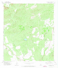
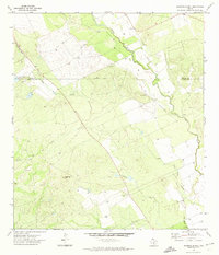
 1971 Knippa1974 Print · USGSKnippa and the surrounding Uvalde County ranchlands are documented here in the early seventies as the railroad economy shaped the landscape. Trace the Southern Pacific line past local landmarks like Traprock Hill and the distinctive Blue Mountain.
 - 1971 Map of Lone Tree Hill, 1974 Print
 1971 Lone Tree Hill1974 Print · USGSZavala and Uvalde counties are shown here in the early seventies, a landscape defined by the winding paths of the Frio River and Leona River. Researchers can trace the rural development of the era through landmarks like Lone Tree Hill, isolated Well sites, and a local Landing Strip.
 - 1973 Map of Montell, 1976 Print
 1973 Montell1976 Print · USGSThe Nueces River valley in the early seventies shows a landscape of remote ranching outposts and vital desert springs. Genealogists and researchers can trace local landmarks like Montell, Shoe Peg Mountain, and the family-named Hayes Mountain.
 - 1974 Map of Olmos Creek, 1977 Print
 1974 Olmos Creek1977 Print · USGSThe brush country of South Texas in the mid-1970s is shown at the meeting point of four counties. Researchers can trace the essential water-security network of the era, from ranching landmarks like Government Tank and Muela Well to Kennedy Flats.
 - 1974 Map of Cline, 1977 Print
 1974 Cline1977 Print · USGSSouthwest Texas in the mid-1970s shows a landscape of industrial extraction and rail transit. Trace the operations at Whites Mine, locate the Sparks Cem near Cline, and follow the Old Railroad Grade across Kennedy Flats.
 - 1974 Map of Laguna, 1977 Print
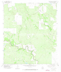
 1974 Laguna1977 Print · USGSThe Nueces River valley in Uvalde County was captured in the mid-1970s, showcasing a landscape of high bluffs and scattered ranching landmarks. Researchers can locate the Live Oak School, trace family roots at Yancy Cem, or identify historic landmarks like Housetop Mountain.
 - 1974 Map of Gross Tank, 1977 Print
 1974 Gross Tank1977 Print · USGSThe ranchlands of Zavala and Uvalde counties are captured here in the mid-1970s at a time of increasing energy exploration. Researchers can trace the water-dependent settlement patterns along the Frio River, identified by numerous Gas Wells and remote landmarks like Gross Tank.
 - 1974 Map of Mustang Waterhole, 1977 Print
 1974 Mustang Waterhole1977 Print · USGSThe West Nueces River country in the 1970s is shown here at the intersection of Kinney and Uvalde counties. You can trace early ranching and transport points like Mustang Waterhole and the Southern Pacific railroad line.
 - 1975 Map of Barksdale
 1975 Barksdale1975 Print · USGSThe Nueces River valley in the early 1940s is a landscape of established family ranches and limestone peaks. Genealogists can trace property lines and legacy sites like the Rhodes Ranch, the settlement of Barksdale, and the grounds of Camp Fawcett.
End of results
Showing maps 1-22 of 22
Top cities of Uvalde County
- Uvalde historical maps
- Uvalde Estates historical maps
- Sabinal historical maps
- Knippa historical maps
- Utopia historical maps
Frequently asked questions
- What are the different types of historical maps available for Uvalde County?
- What is the oldest map of Uvalde County?
- Where can I purchase historical maps of Uvalde County for my home or office?
- Where can I download high-res historical maps of Uvalde County?
- Are there historical topographic maps available for Uvalde County?
- Is there historical aerial imagery available for Uvalde County?
- Where are historical maps of Uvalde County sourced from?