1900s (20th Century) Maps of Willacy County, Texas
Explore 43 historic maps of Willacy County from the 1900s (20th Century). These maps offer a rare glimpse into what life looked like during the 1900s — showing old roads, neighborhoods, homes, and landmarks that have changed or disappeared over time.
Whether you're researching your family's past, planning a metal detecting trip, or studying how Willacy County's landscape evolved across the 1900s, these high-resolution maps are a powerful tool for exploring the history of this region.
- Focus on a specific era: All maps on this page are from the 1900s, giving you a focused view of this time period.
- See what’s changed: Compare century-old streets, trails, and buildings to today's modern landscape using overlays and satellite layers.
- Research with precision: Use these maps for genealogy, historical research, land use analysis, or educational projects.
- View, download, or print: Maps are fully viewable online in high resolution, and can be downloaded or printed for your own records.
Start exploring Willacy County's history through authentic maps from the 1900s. This is your window into the past.
Willacy County, TX maps
(43)- 1921 Map of Tarida Ranch
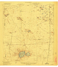
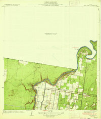
 1921 Tarida Ranch1921 Print · USGSSouth Texas ranching culture is captured here in the early twentieth century, showing a landscape of sprawling family estates and isolated outposts. Researchers can trace the heritage of historic properties like Tarida Ranch, Punta del Monte Ranch, and the remote Santa Margarita School.2 unique versions available
 - 1922 Map of La Sal Vieja
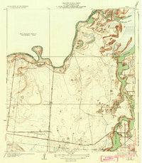
 1922 La Sal Vieja1922 Print · USGSCoastal South Texas ranchlands appear here in the early twenties, centered on the salt lakes and the railroad. Genealogists can trace family outposts like San Juan Ranch and Andres Ranch or follow the St Louis Brownsville and Mexico rail line.3 unique versions available
 - 1929 Map of Santa Rosa
 1929 Santa Rosa1929 Print · USGSCoastal South Texas is captured here in the late twenties as the rail-driven agricultural boom reshaped the Rio Grande Valley. Researchers can trace family estates like Santa Rita Ranch or locate the Asadon Cem near the Southern Pacific RR tracks.
 - 1930 Map of La Leona
 1930 La Leona1930 Print · USGSCoastal Texas ranching and tidal waterways are frozen in time during this pre-war survey of the Rio Grande Valley. Genealogists and historians can trace the footprint of early holdings like La Leona Ranch and Los Coyotes Ranch along the Arroyo Colorado.
 - 1932 Map of Combes
 1932 Combes1932 Print · USGSThe lower Rio Grande Valley comes into focus in the early 1930s, showing a landscape of family ranches and new flood control infrastructure. Genealogists and historians can trace the Missouri Pacific No 96 rail line through Combes and find rural landmarks like Briggs Coleman Sch and La India Ranch.2 unique versions available
 - 1933 Map of Santa Rosa
 1933 Santa Rosa1933 Print · USGSThe Rio Grande Valley landscape comes into focus in the early thirties as irrigation and flood control reshape the coastal plain. Researchers can trace the footprints of family estates like Santa Rita Ranch and the vital paths of the Missouri Pacific railroad.3 unique versions available
 - 1933 Map of Paso Real
 1933 Paso Real1933 Print · USGSDeep in the Rio Grande Valley in the early 1930s, this area shows a landscape shaped by the Arroyo Colorado. Genealogists and historians can trace the Ferry at Paso Real, the Missouri Pacific railroad line, and old settlements like Fernando.2 unique versions available
 - 1936 Map of La Leona
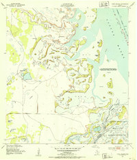
 1936 La Leona1936 Print · USGSCoastal Cameron County was a land of sprawling ranch outposts and tidal waterways in the mid-1930s. Genealogists and historians can trace family landholdings at Boca Chica Ranch or La Leona and follow the old Missouri Pacific rail corridor.3 unique versions available
 - 1949 Map of Mc Allen, 1954 Print
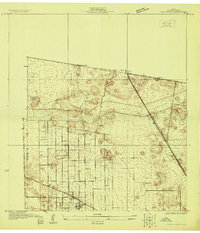
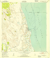
 1949 Mc Allen1954 Print · USGSThe Rio Grande Valley at mid-century reveals a bustling international corridor of citrus groves, rail lines, and growing border towns. Genealogists and historians can trace the Missouri Pacific RR through McAllen or locate rural landmarks like the Santa Fe School and Arkansas City.
 - 1952 Map of Green Island, 1953 Print
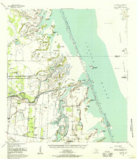
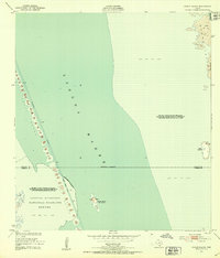 1952 Green Island1953 Print · USGSThe South Texas coast comes alive in the early 1950s, showing the intersection of wildlife conservation and maritime commerce. Trace the dredging of the Intracoastal Waterway past the Green Island (Bird Sanctuary) and the wild Shifting Sand Dunes of Padre Island.2 unique versions available
 - 1952 Map of North Of Port Isabel NW, 1953 Print
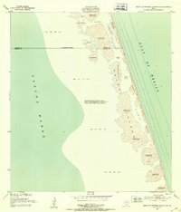
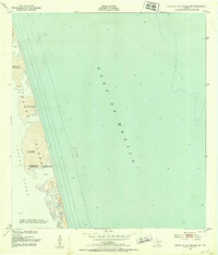 1952 North Of Port Isabel NW1953 Print · USGSCoastal Texas was still a wild frontier of drifting dunes and shallow lagoons in the early fifties. Genealogists and historians can trace the small settlement of Camwill and landmarks like the Negro station among the Shifting sand dunes of Padre Island.2 unique versions available
 - 1952 Map of South of Potrero Lopeno SE, 1953 Print
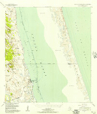
 1952 South of Potrero Lopeno SE1953 Print · USGSPadre Island remained a wild, shifting landscape of dunes and tides during the early fifties. Genealogists and coastal historians can trace the exact 1950 shoreline and survey markers like Harena among the Shifting Sand Dunes and Laguna Madre.3 unique versions available
 - 1952 Map of Hawk Island, 1953 Print
 1952 Hawk Island1953 Print · USGSThe South Texas coast comes alive in the early 1950s where the brushland meets the Laguna Madre. Local history researchers can trace the ranching life through named sites like Loma Alta Well and the waters of the Arroyo Colorado.3 unique versions available
 - 1952 Map of Port Mansfield, 1953 Print
 1952 Port Mansfield1953 Print · USGSThe Texas coast near Port Mansfield is captured here in the early fifties, showing a landscape of maritime industry and ranching water sources. Researchers can locate named landmarks like the Landing Field, the Julian Well, and the Agua Gorda Well.2 unique versions available
 - 1952 Map of South of Potrero Lopeno, 1957 Print
 1952 South of Potrero Lopeno1957 Print · USGSThe South Texas coast during the early fifties reveals a landscape of isolated artesian wells and developing maritime access. Genealogists and local historians can trace the foundations of Port Mansfield or locate historic water sites like Mujeres Wells and Sausel Well.2 unique versions available
 - 1953 Map of Brownsville
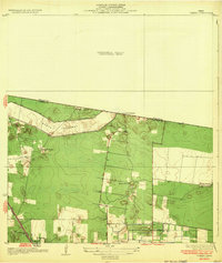
 1953 Brownsville1953 Print · USGSSouth Texas ranchlands and the Lower Rio Grande Valley are captured here in the early fifties as the region's irrigation and shipping networks expanded. Genealogists and historians can trace family landholdings like Tecolote Ranch or follow the route of the St Louis Brownsville and Mexico rail line through Sebastian and Yturria.
 - 1954 Map of McAllen
 1954 McAllen1954 Print · USGSCovers Willacy County, including Reynosa, McAllen, and other nearby areas
 - 1955 Map of La Leona, 1957 Print
 1955 La Leona1957 Print · USGSCoastal Texas ranching comes to life in the mid-fifties along the Laguna Madre. Researchers can trace the layout of traditional family lands including Los Coyotes Ranch and Rancho Nuevo as they appeared before modern coastal changes.2 unique versions available
 - 1955 Map of North Of Port Isabel, 1957 Print
 1955 North Of Port Isabel1957 Print · USGSThe South Texas coast in the mid-1950s remained a landscape of moving earth and isolated outposts. Trace the early shoreline of Padre Island and locate remote named points like Los Tanques and Los Bancos de en Medio.
 - 1955 Map of La Leona, 1957 Print
 1955 La Leona1957 Print · USGSIn the mid-1950s, the South Texas coastline was a patchwork of cattle operations and tidal wetlands. Trace family roots at La Leona Cem or locate historical holdings like Miradores Ranch and Totman Ranch along the Arroyo Colorado.4 unique versions available
 - 1956 Map of San Perlita South, 1958 Print
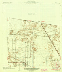
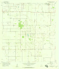 1956 San Perlita South1958 Print · USGSWillacy County in the mid-fifties is captured here as a landscape of coastal prairie and organized drainage projects. Genealogists and local historians can trace family locations near San Perlita and Porfirio, or locate the small Cem and private flight paths like the Cole Landing Strip (Private).3 unique versions available
 - 1956 Map of La Sal Vieja, 1958 Print
 1956 La Sal Vieja1958 Print · USGSThe South Texas brush country at the edge of the Rio Grande Valley was a landscape of remote cattle ranches and emerging energy fields in the mid-fifties. Researchers can trace the heritage of local ranching through named sites like La Sal Vieja Ranch and a network of water sources including San Leonardo Windmill and the Stillman Windmill.2 unique versions available
 - 1956 Map of San Perlita North, 1958 Print
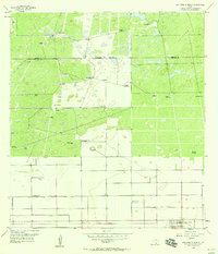 1956 San Perlita North1958 Print · USGSCoastal Texas ranching and early oil exploration meet at the Kenedy-Willacy line in the mid-1950s. Genealogists and historians can trace family-named sites like Punta del Monte Ranch and the Old Railroad Grade near the San Perlita border.2 unique versions available
 - 1956 Map of Santa Rosa, 1958 Print
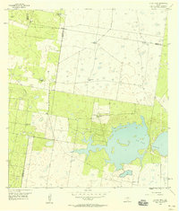
 1956 Santa Rosa1958 Print · USGSThe Rio Grande Valley's irrigation and rail network are captured here in the mid-1950s as agriculture reshaped the Cameron County landscape. Researchers can trace historic cemeteries like San Rafael Cem and follow the path of the North Floodway.3 unique versions available
 - 1956 Map of Willamar SW, 1958 Print
 1956 Willamar SW1958 Print · USGSMid-century Cameron County was a landscape defined by industrial irrigation and agricultural labor just as the region’s modern infrastructure took shape. Trace local family history at the Noyola Cem and Bracero Camp or follow the path of the Missouri Pacific rail line.3 unique versions available
Showing maps 1-25 of 43
Top cities of Willacy County
- Raymondville historical maps
- Lyford historical maps
- Sebastian historical maps
- Lasara historical maps
- San Perlita historical maps
- Port Mansfield historical maps
Frequently asked questions
- What are the different types of historical maps available for Willacy County?
- What is the oldest map of Willacy County?
- Where can I purchase historical maps of Willacy County for my home or office?
- Where can I download high-res historical maps of Willacy County?
- Are there historical topographic maps available for Willacy County?
- Is there historical aerial imagery available for Willacy County?
- Where are historical maps of Willacy County sourced from?