
1956 Map of San Perlita South
USGS Topo · Published 1958About this map
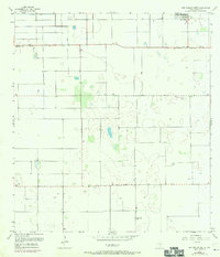
San Perlita sits at the northern edge of this coastal prairie landscape, where the flat terrain of Willacy County is defined by an intricate network of ditches and elevated roads. In the mid-1950s, the economy here was largely shaped by agriculture and coastal access, as evidenced by the straight-line orientation of Red Fish Bay Road and Parker Road cutting across the survey. A small Cem and the settlement of Porfirio provide specific points of interest for genealogists tracing local families in this part of South Texas. The transition from terrestrial to coastal features is marked by scattered landing strips, including the Cole Landing Strip (Private), reflecting the reliance on private aviation for managing large agricultural holdings and navigating the remote stretches of the Gulf Coast hinterland.
Find a feature on this map
8 named features on this map. Tap any name to fly to it.
Don’t see what you’re looking for? This feature index may not catch every label — zoom into the map to look around manually.
Map Details
Editions of this 1956 San Perlita South Map
3 editions found
Other maps of this area

1921 · Tarida Ranch
USGS Topo · 1:62,500

1922 · La Sal Vieja
USGS Topo · 1:62,500

1929 · Santa Rosa
USGS Topo · 1:24,000

1932 · Combes
USGS Topo · 1:31,680

1933 · Santa Rosa
USGS Topo · 1:31,680

1933 · Paso Real
USGS Topo · 1:31,680

1953 · Brownsville
USGS Topo · 1:250,000

1956 · San Perlita North
USGS Topo · 1:24,000

1956 · Santa Rosa
USGS Topo · 1:24,000
1956 · Willamar SW
USGS Topo · 1:24,000