1960s Maps of Garfield County, Utah
Explore 50 historic maps of Garfield County from the 1960s. These maps offer a rare glimpse into what life looked like during the 1960s — showing old roads, neighborhoods, homes, and landmarks that have changed or disappeared over time.
Whether you're researching your family's past, planning a metal detecting trip, or studying how Garfield County's landscape evolved across the 1960s, these high-resolution maps are a powerful tool for exploring the history of this region.
- Focus on a specific era: All maps on this page are from the 1960s, giving you a focused view of this time period.
- See what’s changed: Compare century-old streets, trails, and buildings to today's modern landscape using overlays and satellite layers.
- Research with precision: Use these maps for genealogy, historical research, land use analysis, or educational projects.
- View, download, or print: Maps are fully viewable online in high resolution, and can be downloaded or printed for your own records.
Start exploring Garfield County's history through authentic maps from the 1960s. This is your window into the past.
Garfield County, UT maps
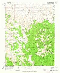
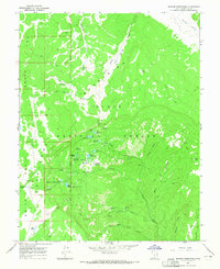
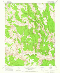
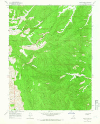
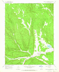
(50)- 1960 Map of Escalante
 1960 Escalante1960 Print · USGSSouthern Utah and northern Arizona appear at a historic turning point in the late fifties as Lake Powell begins to reshape the canyons. Researchers can trace remote sites like Goulding Trading Post, a lonely Uranium Mine, and Coyote Ranches before the reservoir's rise.
 - 1960 Map of Salina
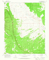
 1960 Salina1960 Print · USGSThe high plateaus and canyonlands of south-central Utah appear in the early sixties as a region of remote ranching towns and developing parklands. Researchers can trace historic settlements like Fruita and Loa or locate the uranium mines and the tracks of the Denver and Rio Grande Western RR.2 unique versions available
 - 1960 Map of Moab
 1960 Moab1960 Print · USGSThe canyonlands and high plateaus of the Utah-Colorado border are shown here during the mid-century uranium boom. Researchers can trace the river-and-rail corridors of the Colorado River and the Denver and Rio Grande Western near Moab and Uravan.3 unique versions available
 - 1962 Map of Moab
 1962 Moab1962 Print · USGSThe canyon country of southeastern Utah and western Colorado is captured here in the early sixties, showing the reach of the Denver and Rio Grande Western through the desert. Researchers can trace the layout of mining settlements like Uravan and old railroad stops at Cisco and Sagers Station.
 - 1962 Map of Salina
 1962 Salina1962 Print · USGSSevier County and the surrounding desert wilderness appear here in the early sixties as a network of isolated river valley towns and high-altitude forests. Researchers can locate remote landmarks like Fruita, trace the Denver & Rio Grande Western RR, and find backcountry sites like the Aquarius Ranger Station.
 - 1962 Map of Cedar City
 1962 Cedar City1962 Print · USGSSouthern Utah in the early sixties showcases a landscape of dramatic plateaus and historic mining outposts. Trace the early settlement patterns at the Silver Reef (ruins), locate the Iron Mine near the Hurricane Cliffs, or find the Fort Harmony Monument.
 - 1962 Map of Mt. Ellen, 1964 Print
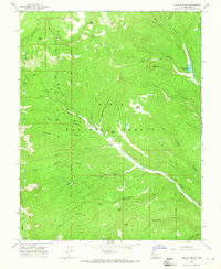
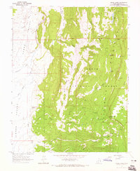
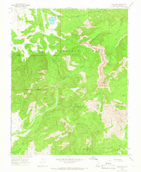
 1962 Mt. Ellen1964 Print · USGSGarfield County rangeland and the high Henry Mountains are captured here in the early sixties, showing a landscape of mining and ranching. Trace old mining operations at Bromide Mine or locate historic seasonal outposts like King Ranch and Rock Corral.2 unique versions available
 - 1964 Map of Moab
 1964 Moab1964 Print · USGSThe canyonlands of eastern Utah and western Colorado are captured here in the mid-1960s, a time when uranium mining shaped the local economy. Researchers can trace the river-and-rail network through Sinbad Valley and locate mining outposts like Uravan and Vancorum.
 - 1964 Map of Griffin Point, 1965 Print
 1964 Griffin Point1965 Print · USGSThe Escalante Mountains of southern Utah are shown in the mid-1960s, documenting a landscape of high plateaus and isolated mines. Trace the history of high-country extraction at Corn Creek Mine or navigate old routes like the Pack Trail and Jeep Trail.2 unique versions available
 - 1964 Map of Sunset Flat, 1965 Print
 1964 Sunset Flat1965 Print · USGSGarfield County's high desert plateaus are captured here in the mid-sixties, showing a landscape of remote livestock ranges and primitive trails. Researchers can trace the era's pastoral movement through sites like Twentymile Mile Corral, Harris, and Early Weed Bench.2 unique versions available
 - 1964 Map of Tenmile Flat, 1965 Print
 1964 Tenmile Flat1965 Print · USGSGarfield County’s high plateaus were still a landscape of remote trails and livestock grazing in the mid-1960s. Researchers can trace the path of the Sheffield Road past Tenmile Spring and locate isolated landmarks like Deadman Ridge.3 unique versions available
 - 1964 Map of Barker Reservoir, 1965 Print
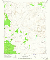
 1964 Barker Reservoir1965 Print · USGSGarfield County rangelands and high-mountain reservoirs are captured here in the mid-sixties during a period of active forest management. Genealogists and historians can trace seasonal livestock hubs like White Ranch and backcountry water sources including Joe Lay Reservoir and Barker Reservoir.
 - 1964 Map of Grass Lakes, 1965 Print
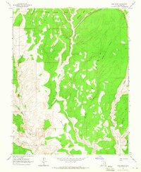
 1964 Grass Lakes1965 Print · USGSGarfield County’s high-country ranching and forest lands are captured in the mid-1960s, showing the transition from the Johns Valley floor to the national forest. Researchers can trace historic access routes like the Pack Trail past Otter Lake and the Ranch near Birch Creek.
 - 1964 Map of King Bench, 1965 Print
 1964 King Bench1965 Print · USGSGarfield County's high desert landscape is detailed in the mid-1960s, showing the intersection of the Escalante River and its rugged tributaries. Researchers can locate the historic Cliff Dwelling and trace old routes across King Bench and Brigham Tea Bench.3 unique versions available
 - 1964 Map of Dave Canyon, 1966 Print
 1964 Dave Canyon1966 Print · USGSGarfield County's high plateau country is captured here in the mid-sixties, dominated by the massive verticality of the Straight Cliffs. Researchers can trace remote water sources like Oak Spring and the rugged path of a lone Jeep Trail winding through Alvey Wash.
 - 1964 Map of Calf Creek, 1966 Print
 1964 Calf Creek1966 Print · USGSCentral Utah in the mid-1960s reveals a wild landscape of arches and deep canyons. Trace geological wonders and early trails like Escalante Natural Bridge, Phipps Arch, and the remote McGath Trail.5 unique versions available
 - 1964 Map of Canaan Creek, 1966 Print
 1964 Canaan Creek1966 Print · USGSGarfield County's high-plateau country comes into focus in the 1960s, showing a landscape defined by deep canyons and early resource extraction. Researchers can locate an early Oil Well, multiple mining Prospects, and topographic features like Cherry Flat and Upper Valley.2 unique versions available
 - 1964 Map of Canaan Peak, 1966 Print
 1964 Canaan Peak1966 Print · USGSSouthern Utah's high desert and the Dixie National Forest are shown here in the mid-1960s as a landscape of remote trails and seasonal washes. Researchers can trace early routes like the Pack Trails through Headquarters Valley and locate landmarks like Canaan Peak and Horse Spring.
 - 1964 Map of Seep Flat, 1966 Print
 1964 Seep Flat1966 Print · USGSGarfield and Kane counties in the mid-1960s were characterized by high desert plateaus and deeply carved canyons. Trace the remote network of water sources and landmarks like Barney Reservoir, the Devils Garden, and Twentymile Corral.2 unique versions available
 - 1964 Map of Death Ridge, 1966 Print
 1964 Death Ridge1966 Print · USGSThe high plateau of southern Utah is captured in the mid-sixties, showing the remote canyonlands along the Garfield and Kane county line. Researchers can trace livestock and travel routes between essential water sources like Horse Spring, Star Seep, and the Death Ridge Reservoir.2 unique versions available
 - 1964 Map of Henrieville, 1966 Print
 1964 Henrieville1966 Print · USGSHenrieville was a remote ranching hub in southern Utah during the mid-sixties, serving as the gateway to a vast system of plateaus and valleys. Genealogists and historians can trace the early infrastructure of the area through sites like Henrieville Spring, Chimney Rock, and the expansive Big Dry Valley.
 - 1964 Map of Carcass Canyon, 1966 Print
 1964 Carcass Canyon1966 Print · USGSThe Straight Cliffs of Southern Utah stand out in this mid-1960s survey, mapping the high plateau terrain where Garfield and Kane counties meet. Modern researchers can trace remote water sources like Hardhead Water Spring and landmarks such as Camp Flat and Sarah Ann Canyon.
 - 1964 Map of Sweetwater Creek, 1966 Print
 1964 Sweetwater Creek1966 Print · USGSGarfield County is captured in the mid-sixties as a high-altitude landscape of plateaus and steep canyons within the Dixie National Forest. Researchers can trace the layout of Widtsoe or locate the small Cem and family-named features like Manning Hollow.
 - 1964 Map of Wide Hollow Reservoir, 1966 Print
 1964 Wide Hollow Reservoir1966 Print · USGSThe Escalante River valley in the mid-1960s showcases a high-desert landscape shaped by ranching and water management. Researchers can locate established homesteads like Riddle Ranch and Griffin Ranch or trace the historic Pack Trail through the Black Hills.
 - 1964 Map of Pine Lake, 1966 Print
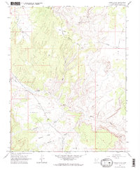
 1964 Pine Lake1966 Print · USGSThe high country of the Dixie National Forest is mapped here during the mid-1960s, showing a rugged network of pack trails and jeep tracks. Trace the paths to the Shakespeare Mine, the waters of Pine Lake, and the landmark Powell Point.2 unique versions available
Showing maps 1-25 of 50
Top cities of Garfield County
- Panguitch historical maps
- Escalante historical maps
- Tropic historical maps
- Bryce Canyon City historical maps
- Henrieville historical maps
- Cannonville historical maps
See more
Frequently asked questions
- What are the different types of historical maps available for Garfield County?
- What is the oldest map of Garfield County?
- Where can I purchase historical maps of Garfield County for my home or office?
- Where can I download high-res historical maps of Garfield County?
- Are there historical topographic maps available for Garfield County?
- Is there historical aerial imagery available for Garfield County?
- Where are historical maps of Garfield County sourced from?