1990s Maps of Garfield County, Utah
Explore 11 historic maps of Garfield County from the 1990s. These maps offer a rare glimpse into what life looked like during the 1990s — showing old roads, neighborhoods, homes, and landmarks that have changed or disappeared over time.
Whether you're researching your family's past, planning a metal detecting trip, or studying how Garfield County's landscape evolved across the 1990s, these high-resolution maps are a powerful tool for exploring the history of this region.
- Focus on a specific era: All maps on this page are from the 1990s, giving you a focused view of this time period.
- See what’s changed: Compare century-old streets, trails, and buildings to today's modern landscape using overlays and satellite layers.
- Research with precision: Use these maps for genealogy, historical research, land use analysis, or educational projects.
- View, download, or print: Maps are fully viewable online in high resolution, and can be downloaded or printed for your own records.
Start exploring Garfield County's history through authentic maps from the 1990s. This is your window into the past.
Garfield County, UT maps
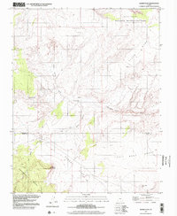
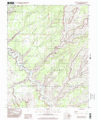
(11)- 1996 Map of Elaterite Basin, 2002 Print
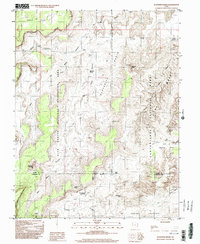 1996 Elaterite Basin2002 Print · USGSThe high desert canyons of Wayne and Garfield Counties are captured in the mid-1990s, revealing a primitive landscape of deep basins and sandstone spires. Researchers can trace remote routes through The Maze to landmarks like The Golden Stairs and Big Water Spring.
 - 1996 Map of Spanish Bottom, 2002 Print
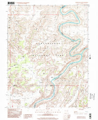 1996 Spanish Bottom2002 Print · USGSThe confluence of the Green and Colorado Rivers is captured here in the mid-1990s within Canyonlands National Park. You can trace remote trails to geological landmarks like The Doll House and the monoliths of The Maze.
 - 1996 Map of Bowdie Canyon East, 2002 Print
 1996 Bowdie Canyon East2002 Print · USGSThe high desert of San Juan County is captured here in the mid-nineties, showing where the river meets the vast plateau. Researchers can trace remote canyon systems like Gypsum Canyon and identify isolated infrastructure like the Landing Strip near Horse Pasture.
 - 1997 Map of Egypt, 2002 Print
 1997 Egypt2002 Print · USGSGarfield and Kane counties meet in this late-twentieth-century study of the high desert canyonlands. Local historians and explorers can trace the complex drainages of Twentyfive Mile Wash and the Escalante River near landmarks like Egypt.
 - 1997 Map of Sunset Flat, 2002 Print
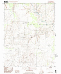
 1997 Sunset Flat2002 Print · USGSHigh desert benches and seasonal washes define this Garfield County landscape in the late 1990s. Local researchers can trace old livestock routes and water sources including Twentyfive-Mile Corral, Little Red Rock Spring, and White Point.
 - 1997 Map of King Bench, 2002 Print
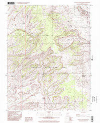
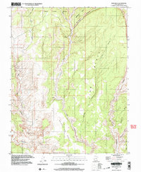 1997 King Bench2002 Print · USGSHigh plateaus and deep sandstone canyons define this Garfield County landscape at the turn of the millennium. Researchers can trace historic ranching names and ancient sites like Cliff Dwelling, King Bench, and the winding Escalante River.
 - 1997 Map of Red Breaks, 2002 Print
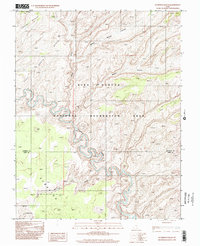
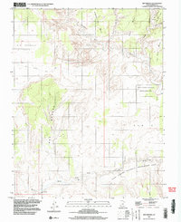 1997 Red Breaks2002 Print · USGSGarfield County's remote canyonlands are captured here in the late 1990s, showing a landscape of high benches and deep washes. Trace the path of the Escalante River past landmarks like Natural Arch and the historic Old Sheffield Road.
 - 1997 Map of Cross Canyon, 2002 Print
 1997 Cross Canyon2002 Print · USGSSan Juan County at the end of the twentieth century reveals a landscape defined by the deep incisions of the Colorado River. Researchers can trace the unique geology of The Grabens or locate remote landmarks like Bobbys Hole and Horsehoof Arch.
 - 1997 Map of Silver Falls Bench, 2002 Print
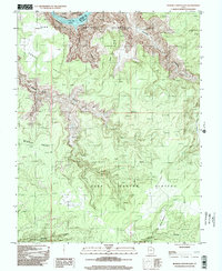
 1997 Silver Falls Bench2002 Print · USGSThe Escalante River corridor and the canyons of Garfield County appear here in the late twentieth century as they were transitioning into a major recreational landscape. Researchers can trace the drainage of Silver Falls Canyon and locate vital water points like Emigrant Spring or the high plateaus of Choprock Bench.
 - 1997 Map of Stevens Canyon North, 2002 Print
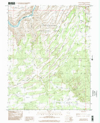
 1997 Stevens Canyon North2002 Print · USGSSouthern Utah’s high desert landscape is documented here during the late twentieth century, capturing the complex geology of the Waterpocket Fold. Researchers can trace the rugged drainages of Stevens Canyon and Halls Creek through the Capitol Reef National Park wilderness.
 - 1997 Map of Scorpion Gulch, 2002 Print
 1997 Scorpion Gulch2002 Print · USGSThe canyonlands of southern Utah are captured in the late twentieth century, showing a landscape defined by the winding Escalante River. Researchers can trace the rugged drainage of Scorpion Gulch and the expansive vistas of Baker Bench.
End of results
Showing maps 1-11 of 11
Top cities of Garfield County
- Panguitch historical maps
- Escalante historical maps
- Tropic historical maps
- Bryce Canyon City historical maps
- Henrieville historical maps
- Cannonville historical maps
See more
Frequently asked questions
- What are the different types of historical maps available for Garfield County?
- What is the oldest map of Garfield County?
- Where can I purchase historical maps of Garfield County for my home or office?
- Where can I download high-res historical maps of Garfield County?
- Are there historical topographic maps available for Garfield County?
- Is there historical aerial imagery available for Garfield County?
- Where are historical maps of Garfield County sourced from?