1980s Maps of Garfield County, Utah
Explore 69 historic maps of Garfield County from the 1980s. These maps offer a rare glimpse into what life looked like during the 1980s — showing old roads, neighborhoods, homes, and landmarks that have changed or disappeared over time.
Whether you're researching your family's past, planning a metal detecting trip, or studying how Garfield County's landscape evolved across the 1980s, these high-resolution maps are a powerful tool for exploring the history of this region.
- Focus on a specific era: All maps on this page are from the 1980s, giving you a focused view of this time period.
- See what’s changed: Compare century-old streets, trails, and buildings to today's modern landscape using overlays and satellite layers.
- Research with precision: Use these maps for genealogy, historical research, land use analysis, or educational projects.
- View, download, or print: Maps are fully viewable online in high resolution, and can be downloaded or printed for your own records.
Start exploring Garfield County's history through authentic maps from the 1980s. This is your window into the past.
Garfield County, UT maps
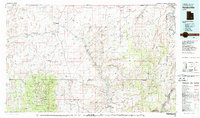
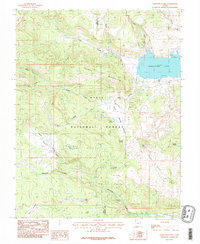
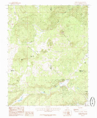
(69)- 1980 Map of Loa
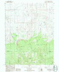
 1980 Loa1980 Print · USGSCentral Utah's high plateaus and the Fremont River corridor are captured here during the 1980s, showcasing a landscape of high-elevation reservoirs and remote ranching outposts. Genealogists can trace family names and early settlements from Loa and Teasdale to the orchards of Fruita.2 unique versions available
 - 1980 Map of Beaver, 1981 Print
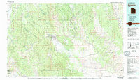
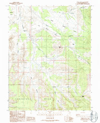
 1980 Beaver1981 Print · USGSSouthern Utah at the start of the 1980s reveals a rugged landscape of high mountain plateaus and essential desert irrigation networks. Researchers can trace the path of the Denver and Rio Grande Western through Marysvale or locate local landmarks like the Deer Trail Mine and Puffer Lake.2 unique versions available
 - 1980 Map of Panguitch, 1981 Print
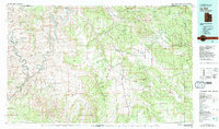
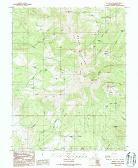
 1980 Panguitch1981 Print · USGSThe high plateau country of Southern Utah is captured here in the early eighties, centered on the Sevier River and the gateway town of Panguitch. Researchers can trace the boundaries of Bryce Canyon National Park and find local landmarks like Ruby's Inn, Panguitch Lake, and Hatch.2 unique versions available
 - 1980 Map of Hanksville, 1987 Print
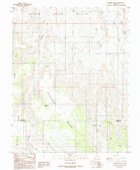
 1980 Hanksville1987 Print · USGSHanksville and the surrounding high desert are captured in the early 1980s, showcasing a landscape of dramatic topography and isolated outposts. Researchers can trace the rugged drainage of the Dirty Devil River and locate landmarks like the Factory Butte Mine and Robbers Roost Flats.2 unique versions available
 - 1980 Map of Hite Crossing, 1987 Print
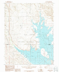
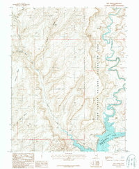
 1980 Hite Crossing1987 Print · USGSSouthern Utah's canyon country comes alive in the early eighties as the waters of Lake Powell reshape the landscape. Trace old mining operations like the Happy Jack Mine or the remote peaks of the Henry Mountains.
 - 1980 Map of Escalante, 1988 Print
 1980 Escalante1988 Print · USGSThe high desert and canyonlands of southern Utah are shown here in the 1980s, centered on the settlement of Escalante. Researchers can trace the ranching and resource history of Johns Valley or the early boundaries of Capitol Reef National Park.3 unique versions available
 - 1982 Map of La Sal, 1983 Print
 1982 La Sal1983 Print · USGSThe high desert of southeastern Utah meets the Colorado border in the early eighties, showing a landscape defined by deep canyons and mining. Trace the industrial operations at Lisbon Mine or explore the early mapping of The Needles and Island in the Sky.2 unique versions available
 - 1985 Map of Government Point
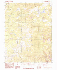
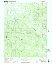
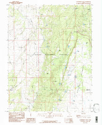 1985 Government Point1985 Print · USGSHigh-altitude plateaus and alpine basins define this mid-1980s survey of the Wayne and Garfield county line. Researchers can trace remote water sources and landmarks like Pine Creek Reservoir, Government Point, and Peterson Grove.
 - 1985 Map of Panguitch Lake
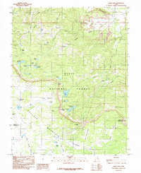
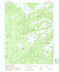
 1985 Panguitch Lake1985 Print · USGSSouthern Utah's high-elevation lake country is captured in the mid-eighties as a hub for forest recreation and ranching. Trace the development of Panguitch Lake and find remote landmarks like John L Flat, Miller Knoll, and Mammoth Spring.2 unique versions available
 - 1985 Map of Lower Bowns Reservoir
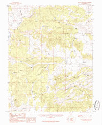
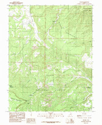
 1985 Lower Bowns Reservoir1985 Print · USGSGarfield County’s high-country plateaus are mapped here in the mid-1980s, revealing a landscape of vital water catchments and forest pastures. Researchers can trace historic landmarks like Sawmill Bench, Steep Point Lookout, and Wildcat Pasture.2 unique versions available
 - 1985 Map of Blind Lake
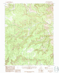
 1985 Blind Lake1985 Print · USGSHigh atop the plateaus of Wayne and Garfield counties in the mid-1980s, this area showcases a high-elevation backcountry of the Dixie National Forest. Researchers can trace the alpine water systems and grazing lands of Boulder Mountain, including Blind Lake, Hickman Pasture, and Donkey Meadows.
 - 1985 Map of Haycock Mountain
 1985 Haycock Mountain1985 Print · USGSHigh-elevation forest and ranching lands are captured here in the mid-1980s before modern developments altered the back-country. Genealogists and local historians can trace named water sources and landmarks like John Cameron Troughs, Miller Seep, and Haycock Mountain.
 - 1985 Map of Henrie Knolls
 1985 Henrie Knolls1985 Print · USGSThe high Markagunt Plateau in the mid-1980s is captured here as a landscape of timber and hidden waters. Researchers can trace the unique drainage of Duck Creek Sinks and find seasonal landmarks like Aspen Mirror Lake, Cow Lake, and Bowers Flat.2 unique versions available
 - 1985 Map of Deer Creek Lake
 1985 Deer Creek Lake1985 Print · USGSGarfield County’s high-altitude plateau is captured here in the mid-1980s, detailing the remote terrain of the Dixie National Forest. Researchers can trace the era's water storage and grazing boundaries through Kings Pasture Reservoir, Oak Creek Reservoir, and the open reaches of Baker Pasture.2 unique versions available
 - 1985 Map of Asay Bench
 1985 Asay Bench1985 Print · USGSSouthern Utah's high plateau country is captured here in the mid-eighties, showing the transition from the Markagunt Plateau to the Asay Bench. Researchers can trace historic forest access to Mammoth Cave, Castle Rock, and vital water sources like Wilson Spring.
 - 1985 Map of Grover
 1985 Grover1985 Print · USGSGrover and the surrounding Utah high country are captured in the mid-1980s, where ranching meadows meet the red rocks of the reef. Local historians can trace high-altitude landmarks like Boulder Mountain, Rock Creek Meadow, and the Wide Hollow Reservoir.2 unique versions available
 - 1986 Map of Dry Lakes Peak, 1987 Print
 1986 Dry Lakes Peak1987 Print · USGSThe high plateaus of Wayne and Garfield Counties are captured here in the mid-1980s, showcasing a landscape of remote basins and mountain passes. Trace the routes of early ranchers through Rock Corral, explore Jet Basin, or locate the waters at Sidehill Springs.
 - 1986 Map of Steele Butte, 1987 Print
 1986 Steele Butte1987 Print · USGSThe mesas and canyons of Garfield County are captured here in the mid-1980s. Local researchers can trace family-named sites like Dave Teeples Spring, locate a remote Landing Strip, and map the heights of Tarantula Mesa.
 - 1986 Map of Mount Ellen, 1987 Print
 1986 Mount Ellen1987 Print · USGSGarfield County's high ridges and mining basins are documented here in the mid-1980s, before many backcountry tracks were modernized. Genealogists and historians can trace mining era remnants around Bromide Basin, Kimble and Turner Peak, and Mc Clellan Spring.2 unique versions available
 - 1986 Map of Stevens Mesa, 1987 Print
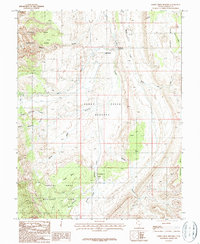
 1986 Stevens Mesa1987 Print · USGSThe high desert boundary of Wayne and Garfield counties comes into focus in the mid-1980s. Local researchers can trace vital water sources and landforms like Indianwater Seep, Maidenwater Spring, and the massive Stevens Mesa.
 - 1987 Map of Hall Mesa
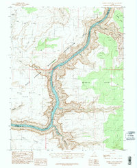
 1987 Hall Mesa1987 Print · USGSThe high desert canyons of Garfield and Kane Counties meet the rising waters of Lake Powell during the late eighties. Researchers can trace the dramatic geology of the Waterpocket Fold and the flooding of Halls Creek Bay and Bullfrog Bay.
 - 1987 Map of Bowdie Canyon West
 1987 Bowdie Canyon West1987 Print · USGSThe high desert canyons of San Juan County were meticulously documented in the late eighties as the waters of Lake Powell filled the lower reaches. Trace the remote topography of Cataract Canyon, Andy Miller Flats, and the confluence at Dark Canyon.3 unique versions available
 - 1987 Map of Sandy Creek Benches
 1987 Sandy Creek Benches1987 Print · USGSGarfield County's high-desert ranching and park lands are detailed here during the late 1980s. Researchers can trace the water sources and grazing geography of the Sandy Ranch and the canyons of Capitol Reef National Park.
 - 1987 Map of Bear Canyon
 1987 Bear Canyon1987 Print · USGSGarfield County's high desert reveals its complex canyon systems in the 1980s where national park and forest lands meet. Researchers can trace remote mining Prospects, seasonal washes like Fivemile Wash, and landmarks like Natural Arches.
 - 1987 Map of Hite North
 1987 Hite North1987 Print · USGSThe northern reaches of Glen Canyon come into focus in the late eighties as the waters of Lake Powell meet the Colorado River. Trace the remote outpost of Hite and its nearby Landing Strip at the mouth of the Dirty Devil River.
Showing maps 1-25 of 69
Top cities of Garfield County
- Panguitch historical maps
- Escalante historical maps
- Tropic historical maps
- Bryce Canyon City historical maps
- Henrieville historical maps
- Cannonville historical maps
See more
Frequently asked questions
- What are the different types of historical maps available for Garfield County?
- What is the oldest map of Garfield County?
- Where can I purchase historical maps of Garfield County for my home or office?
- Where can I download high-res historical maps of Garfield County?
- Are there historical topographic maps available for Garfield County?
- Is there historical aerial imagery available for Garfield County?
- Where are historical maps of Garfield County sourced from?