2000s (21st Century) Maps of Boulder, Utah
Explore 3 historic maps of Boulder from the 2000s (21st Century). These maps offer a rare glimpse into what life looked like during the 2000s — showing old roads, neighborhoods, homes, and landmarks that have changed or disappeared over time.
Whether you're researching your family's past, planning a metal detecting trip, or studying how Boulder's landscape evolved across the 2000s, these high-resolution maps are a powerful tool for exploring the history of this region.
- Focus on a specific era: All maps on this page are from the 2000s, giving you a focused view of this time period.
- See what’s changed: Compare century-old streets, trails, and buildings to today's modern landscape using overlays and satellite layers.
- Research with precision: Use these maps for genealogy, historical research, land use analysis, or educational projects.
- View, download, or print: Maps are fully viewable online in high resolution, and can be downloaded or printed for your own records.
Start exploring Boulder's history through authentic maps from the 2000s. This is your window into the past.
Boulder, UT maps
(3)- 2002 Map of Boulder Town, 2005 Print
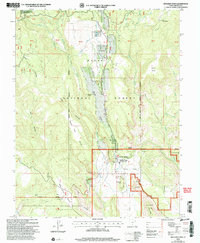 2002 Boulder Town2005 Print · USGSBoulder Town and its surrounding plateaus appear here at the turn of the millennium, framed by federal forest and monument lands. Researchers can trace local landmarks like Anasazi State Park, Balancing Rock, and the remote route of the Burr Trail.
 - 2023 Map of Calf Creek, 2023 Print
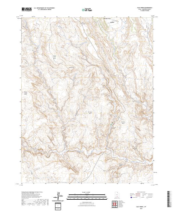 2023 Calf Creek2023 Print · USGSBoulder and the surrounding canyons are captured here in the early 2020s, showcasing the intricate drainage systems of the Escalante River. Trace geographical landmarks like the Escalante Natural Bridge, Phipps Arch, and the rugged transition across The Hogback.
 - 2023 Map of Boulder Town, 2023 Print
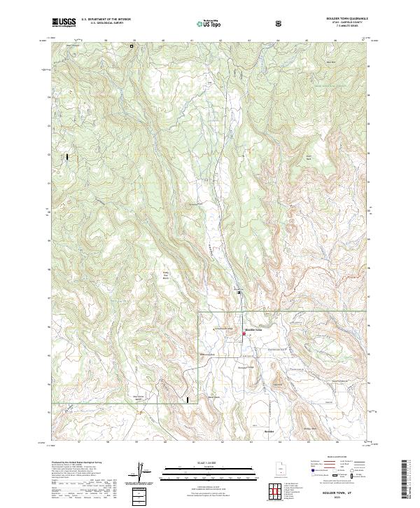 2023 Boulder Town2023 Print · USGSBoulder Town and the high-desert benches of Garfield County are mapped here in the early 2020s. Genealogists and historians can locate the Boulder Cem and local landmarks like Sugarloaf, Balancing Rock, and Durffey Mesa.
End of results
Showing maps 1-3 of 3
Top cities near Boulder
Frequently asked questions
- What are the different types of historical maps available for Boulder?
- What is the oldest map of Boulder?
- Where can I purchase historical maps of Boulder for my home or office?
- Where can I download high-res historical maps of Boulder?
- Are there historical topographic maps available for Boulder?
- Is there historical aerial imagery available for Boulder?
- Where are historical maps of Boulder sourced from?