Old Maps of Fauquier County, Virginia for Metal Detecting
Plan your next treasure hunt with 209 historic maps of Fauquier County. Find old homesites, ghost towns, trails, and gathering spots that may be lost to time — perfect for identifying promising metal detecting locations.
- Locate forgotten sites: Uncover places like long-lost settlements, abandoned rail lines, or gathering spots.
- Plan better hunts: Use map overlays combined with LiDAR or satellite views to narrow in on historically rich areas.
- Made for detectorists: Thousands of hobbyists use these maps to discover relics, coins, and hidden history.
Use these historic maps to boost your research and find new opportunities beneath the surface of Fauquier County.
Fauquier County, VA maps
(209)- 1884 Map of Harpers Ferry
 1884 Harpers Ferry1884 Print · USGSThe confluence of the Potomac and Shenandoah rivers is captured in the mid-1880s, documenting a landscape of strategic gaps and vital transit corridors. Researchers can trace the path of the Chesapeake and Ohio Canal and locate historic river crossings like Conrad Ferry and Castleman Ferry.
 - 1887 Map of Spottsylvania
 1887 Spottsylvania1887 Print · USGSCentral Virginia in the late 1880s remains a landscape of river fords and crossroads shops before modern development. Genealogists and historians can trace the locations of the Vaucluse Gold Mine, Wilderness Tavern, and the path of the Narrow Gauge Railroad.
 - 1891 Map of Harpers Ferry
 1891 Harpers Ferry1891 Print · USGSThe tri-state borderlands of the Potomac and Shenandoah valleys were a vital hub of transport and trade in the late 1800s. Researchers can trace historic river crossings like Castlemans Ferry, follow the route of the Chesapeake and Ohio Canal, or locate family-named settlements like Oatlands and Taylorstown.
 - 1892 Map of Spottsylvania
 1892 Spottsylvania1892 Print · USGSCentral Virginia’s post-war landscape is captured here in the late nineteenth century, showing a rural economy defined by gold mining and river crossings. Genealogists can trace family footprints at Todds Tavern, the Vaucluse Gold Mine, and along the Narrow Gauge Railroad.6 unique versions available
 - 1893 Map of Luray, 1898 Print
 1893 Luray1898 Print · USGSThe Shenandoah Valley in the 1890s was a land of steep mountain ridges and vital new railways. Genealogists and historians can trace old homesteads and depots along the Shenandoah Valley Railroad or find remote hamlets like Seven Fountains and Browntown.
 - 1893 Map of Harpers Ferry, 1898 Print
 1893 Harpers Ferry1898 Print · USGSThe tri-state region of the Potomac and Shenandoah valleys is captured here in the late nineteenth century, showing a landscape defined by water and rail. Trace the historic Chesapeake and Ohio Canal or locate local landmarks like Snyder Mills and Harpers Ferry.7 unique versions available
 - 1894 Map of Warrenton
 1894 Warrenton1894 Print · USGSVirginia's northern Piedmont and mountain gaps are mapped here in the late nineteenth century as the rail-and-river economy flourished. Genealogists can trace family names and small crossroads from Warrenton and Brentsville to White Sulphur Springs.9 unique versions available
 - 1894 Map of Warrenton, 1897 Print
 1894 Warrenton1897 Print · USGSFauquier County and its neighbors are documented here in the late nineteenth century, showing a landscape defined by the Bull Run Mountains and the Rappahannock. Genealogists and historians can trace old homesteads and transport hubs like Warrenton, Thorofare Gap, and Sudley Spring.
 - 1905 Map of Luray, 1910 Print
 1905 Luray1910 Print · USGSThe Blue Ridge and Shenandoah Valley are frozen in time just after the turn of the century, showing the critical rail networks and mountain gaps of the period. Genealogists can trace family names and settlements like Luray, Front Royal, and Strasburg along the Shenandoah Valley Railroad.4 unique versions available
 - 1916 Map of Berryville, 1920 Print
 1916 Berryville1920 Print · USGSThe lower Shenandoah Valley at the onset of the Great War was a landscape defined by its river ferries and growing rail lines. Genealogists and historians can trace the foundations of local life through rural landmarks like Mountain Mission, Furnace School, and the river crossing at Shannondale Ferry.2 unique versions available
 - 1927 Map of Remington
 1927 Remington1927 Print · USGSFauquier and Culpeper counties appear here in the late twenties, captured as a landscape of river-bottom farms and rail towns. Genealogists can trace family footprints at Fauquier Sulphur Springs, Westley Chapel, and the Luttrell Sch.4 unique versions available
 - 1930 Map of Warrenton
 1930 Warrenton1930 Print · USGSFauquier and Culpeper counties are captured here in the late twenties, showing a rural landscape organized around the Southern railroad and the Rappahannock River. Researchers can trace old school districts and river crossings like Hinson Ford and Litchfield Sch.2 unique versions available
 - 1933 Map of Middleburg
 1933 Middleburg1933 Print · USGSNorthern Virginia is captured here in the years following the Great War, showing a landscape defined by its ridges and historical milestones. Genealogists and historians can locate family landmarks like the Henry House, Beverly Mill, and rural centers such as Hickory Grove.
 - 1939 Map of Front Royal
 1939 Front Royal1939 Print · USGSThe Blue Ridge foothills and Front Royal are shown here during the late 1930s as the national park and military reservations were being established. Genealogists and historians can trace family locations through numerous rural institutions like Mt Paran Ch, Lottie Sch, and Miller Cem.2 unique versions available
 - 1939 Map of Berryville
 1939 Berryville1939 Print · USGSNorthern Virginia and the West Virginia borderlands appear here in the late thirties as a landscape of river fords and mountain gaps. Genealogists can trace family names at Locke Mill, Shepherd Ford, and the Mt Olive Cem.
 - 1943 Map of Catlett, 1955 Print
 1943 Catlett1955 Print · USGSMid-century Fauquier and Prince William counties center on the Southern Railway as it links rural hubs and farming estates. Genealogists can trace family footprints across dozens of local landmarks, from Vint Hill Farm to Dunkard Church and Balls Mill.2 unique versions available
 - 1943 Map of Germanna Bridge, 1957 Print
 1943 Germanna Bridge1957 Print · USGSCulpeper County and the surrounding river borders are captured here during the early 1940s as a landscape of crossroads stores and river crossings. Genealogists can trace family footprints through sites like Lignum, South Lignum School, and the historic Kellys Ford.2 unique versions available
 - 1943 Map of Thorofare Gap, 1960 Print
 1943 Thorofare Gap1960 Print · USGSNorthern Virginia at the height of the Second World War shows a landscape defined by the ridgeline of the Bull Run Mountains. Genealogists and local historians can trace the foundations of communities like Haymarket and Buckland or locate specific sites like Beverly Mills and Vint Hill Farm Military Reservation.
 - 1943 Map of Orlean, 1961 Print
 1943 Orlean1961 Print · USGSFauquier County at the height of the second World War reveals a quiet landscape of mountain peaks and crossroads communities. Genealogists and local historians can locate rural landmarks like Wilsons Store, Orlean Ch, and the Morgantown Sch among the slopes of Big Cobbler Mtn.
 - 1943 Map of Ashby Gap, 1961 Print
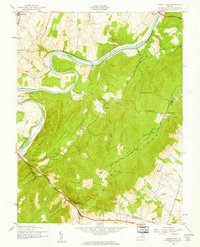 1943 Ashby Gap1961 Print · USGSThe Blue Ridge mountains and Shenandoah Valley meet in the early 1940s, showing a landscape of high ridges and winding river bends. Trace the path of the Appalachian Trail past Mt Weather or locate rural landmarks like Mt Carmel Ch and Millwood.
 - 1943 Map of Midland, 1961 Print
 1943 Midland1961 Print · USGSMid-century Fauquier County comes to life during the war years, centered on the railroad crossing at Midland. Genealogists and historians can trace the rural landscape through family-connected sites like Mt Pleasant Sch, Elkrun, and Crossroad Ch.
 - 1943 Map of Marshall, 1961 Print
 1943 Marshall1961 Print · USGSUpper Fauquier County is captured during the early 1940s, showing the agricultural heartland between the Water Mountains and Pignut Mountain. Genealogists and historians can trace the foundations of Marshall and The Plains, locating local landmarks like School No 18 and the Fairgrounds.
 - 1943 Map of Upperville, 1961 Print
 1943 Upperville1961 Print · USGSNorthern Virginia's Piedmont and Blue Ridge foothills are captured here during the early 1940s. Genealogists can trace family footprints at Upperville, Delaplane, and Markham, or locate landmarks like Pennys Hill Sch and the SOUTHERN rail line.
 - 1943 Map of Rectortown, 1961 Print
 1943 Rectortown1961 Print · USGSNorthern Virginia's Piedmont landscape is captured here during the early years of the Second World War. Researchers can trace the Southern railroad line through Rectortown or locate family history near Ivy Hill Cem and Atoka.
 - 1944 Map of Midland
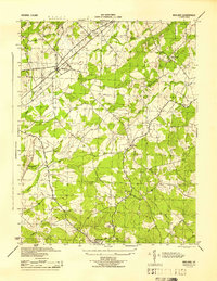 1944 Midland1944 Print · USGSMidland and the surrounding Fauquier County countryside are captured here during the mid-1940s as a landscape of rural crossroads and rail sidings. Genealogists and local historians can trace the exact locations of Mt Carmel Ch, Morrisville, and the Southern Railway line.
Showing maps 1-25 of 209
Top cities of Fauquier County
- Warrenton historical maps
- Bealeton historical maps
- Marshall historical maps
- Remington historical maps
- Opal historical maps
- Catlett historical maps
See more
Frequently asked questions
- What are the different types of historical maps available for Fauquier County?
- What is the oldest map of Fauquier County?
- Where can I purchase historical maps of Fauquier County for my home or office?
- Where can I download high-res historical maps of Fauquier County?
- Are there historical topographic maps available for Fauquier County?
- Is there historical aerial imagery available for Fauquier County?
- Where are historical maps of Fauquier County sourced from?