1940s Maps of Fauquier County, Virginia
Explore 26 historic maps of Fauquier County from the 1940s. These maps offer a rare glimpse into what life looked like during the 1940s — showing old roads, neighborhoods, homes, and landmarks that have changed or disappeared over time.
Whether you're researching your family's past, planning a metal detecting trip, or studying how Fauquier County's landscape evolved across the 1940s, these high-resolution maps are a powerful tool for exploring the history of this region.
- Focus on a specific era: All maps on this page are from the 1940s, giving you a focused view of this time period.
- See what’s changed: Compare century-old streets, trails, and buildings to today's modern landscape using overlays and satellite layers.
- Research with precision: Use these maps for genealogy, historical research, land use analysis, or educational projects.
- View, download, or print: Maps are fully viewable online in high resolution, and can be downloaded or printed for your own records.
Start exploring Fauquier County's history through authentic maps from the 1940s. This is your window into the past.
Fauquier County, VA maps
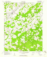
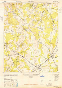
(26)- 1943 Map of Catlett, 1955 Print
 1943 Catlett1955 Print · USGSMid-century Fauquier and Prince William counties center on the Southern Railway as it links rural hubs and farming estates. Genealogists can trace family footprints across dozens of local landmarks, from Vint Hill Farm to Dunkard Church and Balls Mill.2 unique versions available
 - 1943 Map of Germanna Bridge, 1957 Print
 1943 Germanna Bridge1957 Print · USGSCulpeper County and the surrounding river borders are captured here during the early 1940s as a landscape of crossroads stores and river crossings. Genealogists can trace family footprints through sites like Lignum, South Lignum School, and the historic Kellys Ford.2 unique versions available
 - 1943 Map of Thorofare Gap, 1960 Print
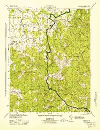
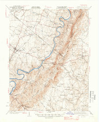
 1943 Thorofare Gap1960 Print · USGSNorthern Virginia at the height of the Second World War shows a landscape defined by the ridgeline of the Bull Run Mountains. Genealogists and local historians can trace the foundations of communities like Haymarket and Buckland or locate specific sites like Beverly Mills and Vint Hill Farm Military Reservation.
 - 1943 Map of Orlean, 1961 Print
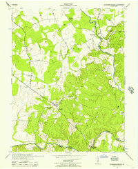
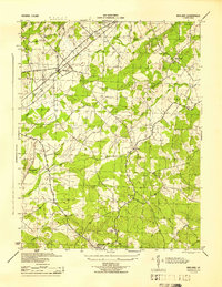
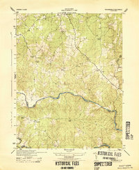
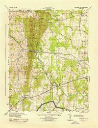
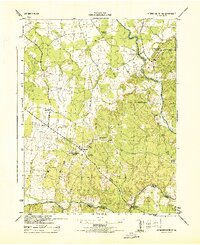
 1943 Orlean1961 Print · USGSFauquier County at the height of the second World War reveals a quiet landscape of mountain peaks and crossroads communities. Genealogists and local historians can locate rural landmarks like Wilsons Store, Orlean Ch, and the Morgantown Sch among the slopes of Big Cobbler Mtn.
 - 1943 Map of Ashby Gap, 1961 Print
 1943 Ashby Gap1961 Print · USGSThe Blue Ridge mountains and Shenandoah Valley meet in the early 1940s, showing a landscape of high ridges and winding river bends. Trace the path of the Appalachian Trail past Mt Weather or locate rural landmarks like Mt Carmel Ch and Millwood.
 - 1943 Map of Midland, 1961 Print
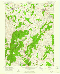
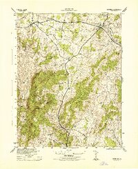
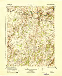
 1943 Midland1961 Print · USGSMid-century Fauquier County comes to life during the war years, centered on the railroad crossing at Midland. Genealogists and historians can trace the rural landscape through family-connected sites like Mt Pleasant Sch, Elkrun, and Crossroad Ch.
 - 1943 Map of Marshall, 1961 Print
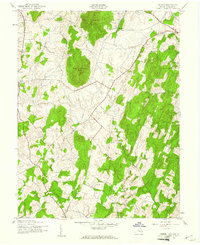
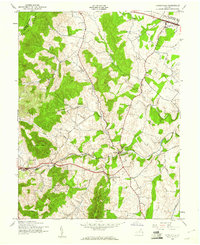
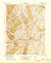
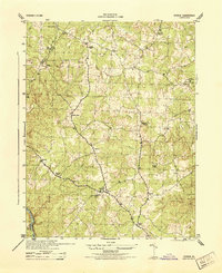
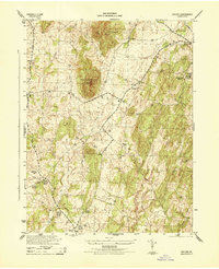
 1943 Marshall1961 Print · USGSUpper Fauquier County is captured during the early 1940s, showing the agricultural heartland between the Water Mountains and Pignut Mountain. Genealogists and historians can trace the foundations of Marshall and The Plains, locating local landmarks like School No 18 and the Fairgrounds.
 - 1943 Map of Upperville, 1961 Print
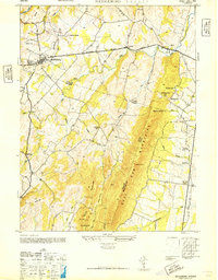
 1943 Upperville1961 Print · USGSNorthern Virginia's Piedmont and Blue Ridge foothills are captured here during the early 1940s. Genealogists can trace family footprints at Upperville, Delaplane, and Markham, or locate landmarks like Pennys Hill Sch and the SOUTHERN rail line.
 - 1943 Map of Rectortown, 1961 Print
 1943 Rectortown1961 Print · USGSNorthern Virginia's Piedmont landscape is captured here during the early years of the Second World War. Researchers can trace the Southern railroad line through Rectortown or locate family history near Ivy Hill Cem and Atoka.
 - 1944 Map of Midland
 1944 Midland1944 Print · USGSMidland and the surrounding Fauquier County countryside are captured here during the mid-1940s as a landscape of rural crossroads and rail sidings. Genealogists and local historians can trace the exact locations of Mt Carmel Ch, Morrisville, and the Southern Railway line.
 - 1944 Map of Somerville
 1944 Somerville1944 Print · USGSThe rural borders of Fauquier and Stafford Counties are captured here during the mid-forties. Researchers can locate family landmarks and early post offices at Somerville PO, Tacketts Mill, and Hearts Delight Ch Delight.
 - 1944 Map of Upperville
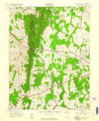
 1944 Upperville1944 Print · USGSThe Fauquier County countryside during the mid-1940s shows a landscape of prominent ridges and rural crossroads. Genealogists and local historians can trace the paths between Delaplane and Markham, locating landmarks like Fleetwood Roller Mills and the Fennys Hill School.
 - 1944 Map of Richardsville
 1944 Richardsville1944 Print · USGSRichardsville and the surrounding Virginia Piedmont are captured here in the 1940s as the river-riven borders of four counties meet. Researchers can trace the legacy of rural life through landmarks like Oakland Church, the Goldvein School, and Harding Mill.
 - 1944 Map of Berryville
 1944 Berryville1944 Print · USGSThe Virginia and West Virginia borderlands are captured here in the mid-1940s, showing the agricultural valley around Berryville meeting the steep Blue Ridge. Researchers can trace the path of the Appalachian Trail or locate vanished landmarks like Boyds Ferry and the Yellow Schoolhouse.
 - 1944 Map of Thorofare Gap
 1944 Thorofare Gap1944 Print · USGSPrince William and Fauquier counties are shown here during the Second World War as the region’s strategic gaps and rail lines remained vital to Virginia's interior. Genealogists and researchers can trace rural landmarks from Vint Hill Farm to Beverly Mills and St Pauls Ch.
 - 1944 Map of Marshall
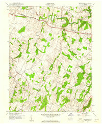
 1944 Marshall1944 Print · USGSFauquier County at the height of the Second World War remains a landscape of rail-connected villages and mountain ridges. Genealogists and local historians can trace rural school locations like Public School No 18 and Bethel School or landmarks like the Fair Grounds.
 - 1944 Map of Storck
 1944 Storck1944 Print · USGSStafford County communities and crossroads appear in detail during the mid-1940s, showing the rural structure of the Virginia Piedmont. Researchers can trace local family landmarks and community centers like Mt Olive School, Dodds Store, and Hartwood Church.
 - 1944 Map of Rectortown
 1944 Rectortown1944 Print · USGSFauquier and Loudoun counties are captured in the mid-1940s during a period of transition for northern Virginia's rural landscape. Researchers can trace the Southern rail corridor through Rectortown or locate family history at Ivy Hill Cemetery and the Milan Gristmill.
 - 1944 Map of Germanna Bridge
 1944 Germanna Bridge1944 Print · USGSCulpeper and Fauquier counties are captured here in the mid-1940s as rural river-bound communities. Genealogists and local historians can trace the road networks connecting Kellys Ford, Lignum, and the historic crossing at Germanna Bridge.
 - 1944 Map of Orlean
 1944 Orlean1944 Print · USGSMid-century Fauquier County reveals a landscape of Piedmont ridges and rural crossroads communities connected by winding country roads. Trace local heritage through landmarks like Morgantown School, the Mt Nebo Church, and numerous river fords near Orlean.
 - 1944 Map of Front Royal
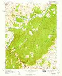
 1944 Front Royal1944 Print · USGSFront Royal and the northern Blue Ridge Mountains appear here during the mid-forties as industrial growth and federal land projects reshaped the valley. Researchers can trace family sites like Miller Cem, explore the early Skyline Drive, and locate schools such as Harmony Hollow Sch.2 unique versions available
 - 1946 Map of Middleburg
 1946 Middleburg1946 Print · USGSThe Northern Virginia hunt country in the mid-1940s reveals a landscape of Piedmont villages and ridge-top gaps. Researchers can locate family landmarks and rural institutions such as Mt Pleasant Ch, Landmark Sch, and the estates surrounding Middleburg.
 - 1946 Map of Catlett
 1946 Catlett1946 Print · USGSFauquier County's rural landscape is captured here in the years following World War II, centered on the rail stops and country crossroads that defined local life. Trace the historic Southern Railway line through Casanova and Calverton or locate sites like the Rosenwald Sch and Vint Hill Farm.
 - 1948 Map of Baltimore
 1948 Baltimore1948 Print · USGSMaryland and Pennsylvania crossroads are captured in the late 1940s, showing a landscape defined by historic rail lines and major military installations. Genealogists can trace family connections in Gettysburg, Westminster, and near the U.S. Naval Academy in Annapolis.2 unique versions available
 - 1948 Map of Washington
 1948 Washington1948 Print · USGSThe Potomac and Chesapeake regions in the late 1940s reveal a landscape of expanding military reach and deep-rooted Tidewater settlements. Trace old rail corridors like the Richmond Fredericksburg & Potomac RR or locate landmarks like the Wakefield Washington Monument and St. Marys College.2 unique versions available
Showing maps 1-25 of 26
Top cities of Fauquier County
- Warrenton historical maps
- Bealeton historical maps
- Marshall historical maps
- Remington historical maps
- Opal historical maps
- Catlett historical maps
See more
Frequently asked questions
- What are the different types of historical maps available for Fauquier County?
- What is the oldest map of Fauquier County?
- Where can I purchase historical maps of Fauquier County for my home or office?
- Where can I download high-res historical maps of Fauquier County?
- Are there historical topographic maps available for Fauquier County?
- Is there historical aerial imagery available for Fauquier County?
- Where are historical maps of Fauquier County sourced from?