1970s Maps of Asotin County, Washington
Explore 17 historic maps of Asotin County from the 1970s. These maps offer a rare glimpse into what life looked like during the 1970s — showing old roads, neighborhoods, homes, and landmarks that have changed or disappeared over time.
Whether you're researching your family's past, planning a metal detecting trip, or studying how Asotin County's landscape evolved across the 1970s, these high-resolution maps are a powerful tool for exploring the history of this region.
- Focus on a specific era: All maps on this page are from the 1970s, giving you a focused view of this time period.
- See what’s changed: Compare century-old streets, trails, and buildings to today's modern landscape using overlays and satellite layers.
- Research with precision: Use these maps for genealogy, historical research, land use analysis, or educational projects.
- View, download, or print: Maps are fully viewable online in high resolution, and can be downloaded or printed for your own records.
Start exploring Asotin County's history through authentic maps from the 1970s. This is your window into the past.
Asotin County, WA maps
(17)- 1971 Map of Anatone, 1973 Print
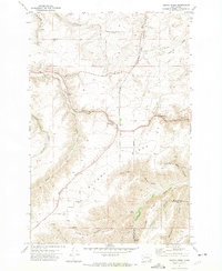
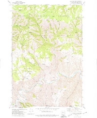
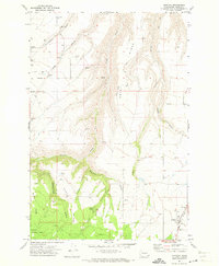 1971 Anatone1973 Print · USGSAsotin County high country in the early seventies shows a landscape of deep gulches and upland ranching centers. Trace family history at Lake School, Cloverland Cem, and the small settlement of Anatone, where the plateau meets the national forest.2 unique versions available
 - 1971 Map of Weissenfels Ridge, 1973 Print
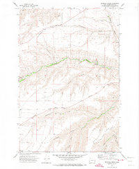
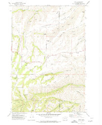
 1971 Weissenfels Ridge1973 Print · USGSSoutheastern Washington ranching and wheat farming are captured here in the early seventies. Researchers can trace the agricultural footprint of the area through the Ausman Ranch, Theon Cem, and prominent Grain Elevators.
 - 1971 Map of Asotin, 1974 Print
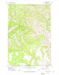
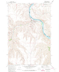 1971 Asotin1974 Print · USGSThe Snake River valley at the Washington-Idaho border shows the town of Asotin at a pivotal point of growth in the early seventies. Genealogists and local historians can trace family-named terrain like George Meyer Ridge and Maguire Gulch alongside the old settlements of Jerry and Clemens.2 unique versions available
 - 1971 Map of Silcott, 1974 Print
 1971 Silcott1974 Print · USGSThe Snake River canyonlands come into focus in the early 1970s, showing the intersection of three Washington counties. Researchers can trace historic river crossings and early settlements like Silcott and Wilma, or locate the Indian Timothy Bridge and local Cem.
 - 1971 Map of Alpowa Ridge, 1974 Print
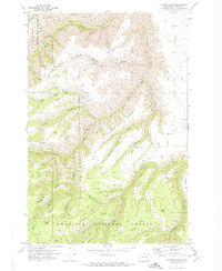
 1971 Alpowa Ridge1974 Print · USGSGarfield County in the early 1970s is shown here as a landscape of dramatic canyons and high ridges carved by Pataha Creek. Researchers can trace the legacy of the Peola community through landmarks like the Philomathian School and the Cem near Alpowa Ridge.
 - 1971 Map of Rockpile Creek, 1974 Print
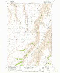
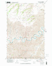
 1971 Rockpile Creek1974 Print · USGSAsotin County was characterized by its deep canyons and ridge-top settlements in the early 1970s. Local researchers can trace the rural infrastructure around Cloverland or locate specific landmarks like the Gaging Station and Headgate County Park along Asotin Creek.
 - 1971 Map of Potter Hill, 1974 Print
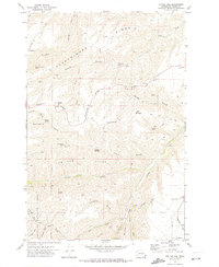 1971 Potter Hill1974 Print · USGSAsotin County high country in the early 1970s reveals a landscape of upland ranching and isolated springs. Trace family history and land use through Cloverland, Potter Hill, and remote landmarks like Rimmelspacher Spring or Tam Tam Ridge.2 unique versions available
 - 1971 Map of Pinkham Butte, 1974 Print
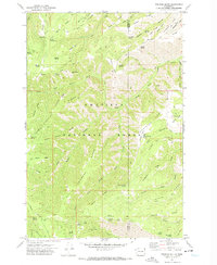 1971 Pinkham Butte1974 Print · USGSIn the early 1970s, this portion of the Blue Mountains was a wilderness of high divides and remote trails. Trace the paths used by foresters and hunters, from the Hard-To-Get-To Trail to named landmarks like Jump Off Joe Point and Wickiuo Campground.2 unique versions available
 - 1971 Map of Mountain View, 1974 Print
 1971 Mountain View1974 Print · USGSAsotin County was a landscape of high timber and river canyons in the early 1970s, where the Grande Ronde River snakes past the Oregon border. Genealogists and historians can trace family-named sites like the Autrey Cem, the settlement of Mountain View, and landmarks like Anatone Butte.2 unique versions available
 - 1971 Map of Peola, 1974 Print
 1971 Peola1974 Print · USGSThe community of Peola is shown in the early 1970s at the edge of the Blue Mountains, where high ridges meet deep canyon gulches. Researchers can trace family history at the Pioneer Cemetery, locate numerous water sources like Iron Springs, and explore the boundary of the Umatilla National Forest.2 unique versions available
 - 1971 Map of Harlow Ridge, 1974 Print
 1971 Harlow Ridge1974 Print · USGSAsotin County in the early 1970s is a landscape of high ridges and deep canyons within the Umatilla National Forest. Researchers can trace old mountain routes like the Pack Trail past Ruins and remote water sources including Warner Springs.2 unique versions available
 - 1971 Map of Saddle Butte, 1974 Print
 1971 Saddle Butte1974 Print · USGSAsotin and Garfield Counties meet at the Oregon border in the early 1970s, showcasing a landscape of high timber and remote forest service outposts. Genealogists and historians can locate family-named landmarks and camps like Wenatchee Guard Station, DeSpain Spring, and Misery Spring Campground.2 unique versions available
 - 1971 Map of Black Butte, 1974 Print
 1971 Black Butte1974 Print · USGSThe Grande Ronde River gorge straddles the Washington-Oregon border in the early seventies, showcasing a landscape of deep canyons and high ridges. Researchers can trace remote family sites like Craige Cem and landmarks such as Black Butte and The Narrows.2 unique versions available
 - 1971 Map of Clarkston, 1974 Print
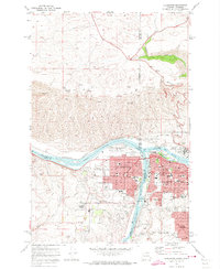 1971 Clarkston1974 Print · USGSThe growing border communities of Clarkston and Lewiston are captured in the early 1970s at the meeting of the Snake and Clearwater Rivers. Genealogists can locate family landmarks like Vineland Cemetery, Stout Ranch, and the North Idaho Childrens Home.2 unique versions available
 - 1971 Map of Stember Creek, 1974 Print
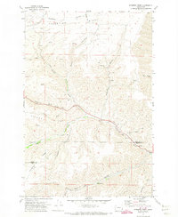 1971 Stember Creek1974 Print · USGSGarfield and Asotin counties are captured in the early seventies, showing a landscape defined by high ridges and deep water-cut gulches. Researchers can trace historic access routes like Howell Grade or locate specific points such as Warm Springs and Alpowa Creek.
 - 1971 Map of Fields Spring, 1974 Print
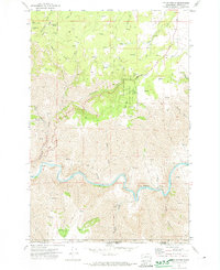 1971 Fields Spring1974 Print · USGSThe Grande Ronde River breaks through the high plateaus of the Washington-Oregon border in the early seventies, marking a landscape of deep canyons and timbered ridges. Researchers can trace the trails and remote landmarks of Fields Spring State Park, from Kuhn Landing Strip to the heights of Puffer Butte.2 unique versions available
 - 1975 Map of Clarkston, 1977 Print
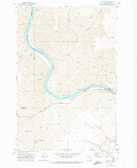
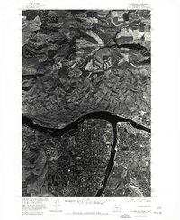 1975 Clarkston1977 Print · USGSThe border towns of Washington and Idaho come into sharp focus in the mid-seventies, showing the urban footprint of Clarkston and Lewiston. Trace the residential grids of Lewiston Orchards and the confluence of the Snake River and Clearwater River.
End of results
Showing maps 1-17 of 17
Top cities of Asotin County
Frequently asked questions
- What are the different types of historical maps available for Asotin County?
- What is the oldest map of Asotin County?
- Where can I purchase historical maps of Asotin County for my home or office?
- Where can I download high-res historical maps of Asotin County?
- Are there historical topographic maps available for Asotin County?
- Is there historical aerial imagery available for Asotin County?
- Where are historical maps of Asotin County sourced from?