1960s Maps of King County, Washington
Explore 20 historic maps of King County from the 1960s. These maps offer a rare glimpse into what life looked like during the 1960s — showing old roads, neighborhoods, homes, and landmarks that have changed or disappeared over time.
Whether you're researching your family's past, planning a metal detecting trip, or studying how King County's landscape evolved across the 1960s, these high-resolution maps are a powerful tool for exploring the history of this region.
- Focus on a specific era: All maps on this page are from the 1960s, giving you a focused view of this time period.
- See what’s changed: Compare century-old streets, trails, and buildings to today's modern landscape using overlays and satellite layers.
- Research with precision: Use these maps for genealogy, historical research, land use analysis, or educational projects.
- View, download, or print: Maps are fully viewable online in high resolution, and can be downloaded or printed for your own records.
Start exploring King County's history through authentic maps from the 1960s. This is your window into the past.
King County, WA maps
(20)- 1960 Map of Mount Si, 1962 Print
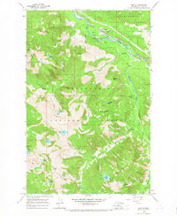
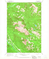
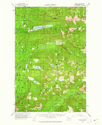 1960 Mount Si1962 Print · USGSThe King County highlands are shown here in the early sixties as a critical water and mineral resource area. Genealogists and researchers can locate Ernies Grove and trace old mining sites like the Lennox Mines or the Apex Mine.3 unique versions available
 - 1960 Map of Bandera, 1962 Print
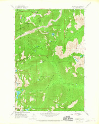
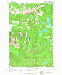
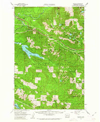 1960 Bandera1962 Print · USGSThe Snoqualmie and Green River watersheds dominate this high-country survey from the early sixties. Researchers can trace the Milwaukee Road rail line and locate mountain outposts like Camp Waskowitz and the Horseshoe Mine.3 unique versions available
 - 1961 Map of Tacoma North, 1962 Print
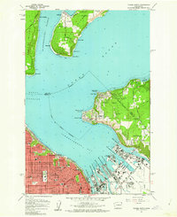 1961 Tacoma North1962 Print · USGSTacoma's industrial waterfront and the southern tip of Vashon Island are captured here during a period of significant mid-century growth. Researchers can trace the development of neighborhood schools like Lowell Sch or locate maritime landmarks such as the Dash Point Lighthouse and Browns Point.5 unique versions available
 - 1961 Map of Poverty Bay, 1962 Print
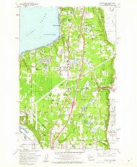 1961 Poverty Bay1962 Print · USGSThe Federal Way plateau and the King-Pierce county line are shown in the early sixties as suburban growth begins to surround historic shoreline communities. Researchers can trace the development of local schools, the Evergreen Airport, and the Auburn Cem alongside the Northern Pacific rail line.5 unique versions available
 - 1961 Map of Snoqualmie Pass, 1963 Print
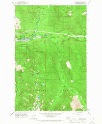
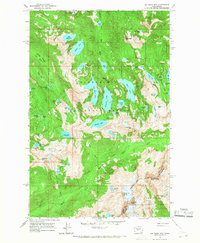
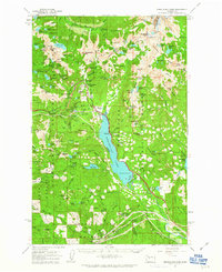 1961 Snoqualmie Pass1963 Print · USGSSnoqualmie Pass and the surrounding Cascade peaks are shown in the early sixties as the region's rail and water infrastructure matured. Researchers can trace the transcontinental routes of the Northern Pacific RR and locate early mountain outposts like Hyak and Whittier.3 unique versions available
 - 1962 Map of Seattle
 1962 Seattle1962 Print · USGSThe Puget Sound region and Olympic Peninsula are shown at a peak of mid-century growth. Genealogists and historians can trace rail lines like the Pacific Coast RR or locate landmarks such as Fort Lawton and the Bothell Power Station.
 - 1962 Map of Lester, 1964 Print
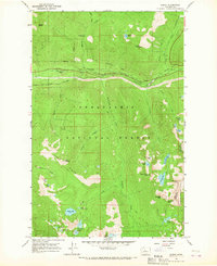
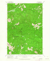 1962 Lester1964 Print · USGSThe Cascades at the start of the sixties come into focus here, showing the protected Green River Watershed and the remote Lester rail stop. Trace old mountain routes through Naches Pass or find historic camps at Government Meadow and Timothy Meadow.3 unique versions available
 - 1965 Map of Captain Point, 1967 Print
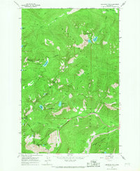
 1965 Captain Point1967 Print · USGSThe Cascades back-country at the meeting of Snohomish, Chelan, and King counties is shown here in the mid-sixties. Trace high-altitude routes like the Cascade Crest Trail and find remote waters including Grizzly Lake and Saucer Lake.2 unique versions available
 - 1965 Map of Evergreen Mtn, 1967 Print
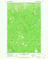
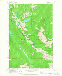
 1965 Evergreen Mtn1967 Print · USGSThe Snoqualmie National Forest wilderness in the mid-1960s was a high-country network of fire lookouts and river drainages. You can trace early backcountry access routes including the Pack Trail along Johnson Ridge and the remote Lookout on Evergreen Mtn.2 unique versions available
 - 1965 Map of Grotto, 1967 Print
 1965 Grotto1967 Print · USGSThe Cascades in the mid-1960s reveal a mix of industrial extraction and high-altitude wilderness along the Skykomish River. Trace the path of the Great Northern Railway past Grotto to find remote landmarks like the Cleopatra Mine and Lake Kanim.4 unique versions available
 - 1965 Map of Stevens Pass, 1967 Print
 1965 Stevens Pass1967 Print · USGSStevens Pass in the mid-1960s captures a critical intersection of high-mountain transit and wilderness management. Trace the path of the Great Northern railroad and locate remote landmarks like Bark Cabin and the Stevens Pass Guard Station.5 unique versions available
 - 1965 Map of Mount Daniel, 1967 Print
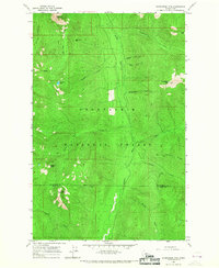
 1965 Mount Daniel1967 Print · USGSThe high Central Cascades at the boundary of King and Kittitas counties are captured here in the mid-1960s. You can trace the high-altitude Cascade Crest Trail or find remote landmarks like Cathedral Rock and Bears Breast Mtn.3 unique versions available
 - 1965 Map of Skykomish, 1967 Print
 1965 Skykomish1967 Print · USGSThe mountain town of Skykomish is shown in the mid-1960s at the junction of the Beckler and Tye Rivers. Researchers can trace the Great Northern Railroad and find high-altitude landmarks like the Maloney Ridge Lookout and Sobieski Mtn.4 unique versions available
 - 1965 Map of Baring, 1967 Print
 1965 Baring1967 Print · USGSThe mountain settlement of Baring and the surrounding Cascades are documented here in the mid-sixties. Researchers can trace the Great Northern rail corridor and find historic sites like the Sunset Mine and the local Quarry.4 unique versions available
 - 1965 Map of Snoqualmie Lake, 1967 Print
 1965 Snoqualmie Lake1967 Print · USGSThe Snoqualmie National Forest was a wilderness of high-altitude lakes and pack trails during the mid-1960s. Trace the remote drainage of the Taylor River to find Otter Falls and the vast Lake Dorothy, or follow the Dingford Creek Trail through the high peaks.4 unique versions available
 - 1965 Map of Big Snow Mtn, 1967 Print
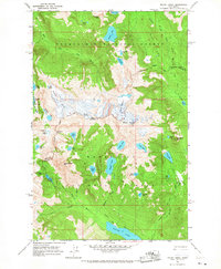
 1965 Big Snow Mtn1967 Print · USGSThe high Cascades at the King and Kittitas county line are captured here in the mid-1960s. Trace the remote ridges around Big Snow Mtn and find alpine water bodies like Angeline Lake and the string of gems in Necklace Valley.4 unique versions available
 - 1965 Map of Scenic, 1967 Print
 1965 Scenic1967 Print · USGSIn the mid-1960s, the high Cascades near the King and Chelan county line remained a rugged corridor of rail engineering and wilderness trails. Genealogists and hikers can trace the original Great Northern Railroad alignment, the Cascade Tunnel, and the historic Tonga Ridge Pack Trail.4 unique versions available
 - 1965 Map of The Cradle, 1967 Print
 1965 The Cradle1967 Print · USGSThe Wenatchee Mountains in the mid-1960s featured a complex network of alpine trails and high-country lake basins. Trace the historic route of the Cascade Crest Trail past The Cradle and through the Paddy-Go-Easy Pass.3 unique versions available
 - 1965 Map of Labyrinth Mtn, 1967 Print
 1965 Labyrinth Mtn1967 Print · USGSThe Cascades crest at Stevens Pass is captured here in the mid-1960s, showing the intersection of three counties and major mountain transit. Trace the routes of the Great Northern Tunnel, the Stevens Pass Hwy, and the Pacific Crest National Scenic Trail.5 unique versions available
 - 1968 Map of Duwamish Head, 1969 Print
 1968 Duwamish Head1969 Print · USGSThe western shores of Seattle and its surrounding islands are captured during a period of significant growth in the late sixties. Trace established neighborhoods like Fauntleroy and maritime landmarks such as Duwamish Head and the ferry to Vashon Heights.
End of results
Showing maps 1-20 of 20
Top cities of King County
- Seattle historical maps
- Bellevue historical maps
- Kent historical maps
- Renton historical maps
- Federal Way historical maps
- Kirkland historical maps
See more
Frequently asked questions
- What are the different types of historical maps available for King County?
- What is the oldest map of King County?
- Where can I purchase historical maps of King County for my home or office?
- Where can I download high-res historical maps of King County?
- Are there historical topographic maps available for King County?
- Is there historical aerial imagery available for King County?
- Where are historical maps of King County sourced from?