1980s Maps of King County, Washington
Explore 28 historic maps of King County from the 1980s. These maps offer a rare glimpse into what life looked like during the 1980s — showing old roads, neighborhoods, homes, and landmarks that have changed or disappeared over time.
Whether you're researching your family's past, planning a metal detecting trip, or studying how King County's landscape evolved across the 1980s, these high-resolution maps are a powerful tool for exploring the history of this region.
- Focus on a specific era: All maps on this page are from the 1980s, giving you a focused view of this time period.
- See what’s changed: Compare century-old streets, trails, and buildings to today's modern landscape using overlays and satellite layers.
- Research with precision: Use these maps for genealogy, historical research, land use analysis, or educational projects.
- View, download, or print: Maps are fully viewable online in high resolution, and can be downloaded or printed for your own records.
Start exploring King County's history through authentic maps from the 1980s. This is your window into the past.
King County, WA maps
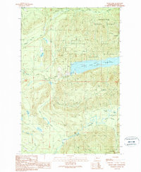
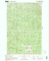
(28)- 1983 Map of Seattle South
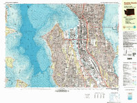 1983 Seattle South1983 Print · USGSSeattle in the early eighties shows a dense urban landscape defined by its bustling harbor and growing infrastructure. Researchers can trace the development of Rainier Valley, the industrial footprint of Harbor Island, and the sites of landmarks like the Kingdome and Seattle Center.3 unique versions available
 - 1983 Map of Bellevue South
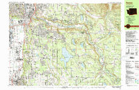
 1983 Bellevue South1983 Print · USGSThe Eastside area between Lake Washington and Lake Sammamish was rapidly developing into a major suburban hub in the early eighties. Researchers can trace neighborhood growth through Beaux Arts Village, locate family records at Sunset Hills Mem Park (Cem), or follow the old Burlington Northern line.
 - 1983 Map of Renton
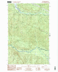
 1983 Renton1983 Print · USGSRenton and the Cedar River valley are shown here in the early eighties as suburban growth began to surround the massive Lake Youngs Watershed. Researchers can trace local landmarks like Greenwood Cem, the Burlington Northern railroad, and established neighborhoods from Bryn Mawr to Maple Valley.
 - 1983 Map of Seattle North
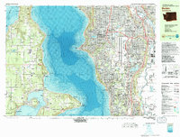
 1983 Seattle North1983 Print · USGSNorth Seattle and its surrounding waters are captured here in the early eighties, showcasing the city's dense residential expansion and maritime heritage. Genealogists and historians can trace neighborhood developments from Ballard to Wedgwood or locate local institutions like Acacia Mem Park (Cem) and the University of Washington.2 unique versions available
 - 1983 Map of Burien
 1983 Burien1983 Print · USGSPuget Sound and the expanding Sea-Tac corridor define the landscape of King County in the early eighties. Genealogists and researchers can trace local landmarks from Vashon Island Airport to the Washington Memorial Park Cemetery and Burien General Hospital.
 - 1983 Map of Auburn
 1983 Auburn1983 Print · USGSThe Green River valley and its surrounding plateaus come into focus in the early eighties as residential growth meets deep-rooted industrial corridors. Genealogists and historians can locate family landmarks like the Muckleshoot Indian Reservation, Black Diamond, and Auburn Adventist Academy.
 - 1986 Map of Nagrom
 1986 Nagrom1986 Print · USGSThe Central Cascades are captured in the mid-eighties just as modern conservation and infrastructure intersected with old mountain sites. Researchers can trace the Nagrom location, explore the Green River Watershed (City of Tacoma), and locate Bone Lake.
 - 1986 Map of Sun Top
 1986 Sun Top1986 Print · USGSPierce County high country in the mid-1980s is defined by its dramatic ridges and national forest infrastructure. Researchers can locate the Sun Top LO lookout, the Ranger Creek Landing Strip, and old riverside sites like The Dalles Campground.
 - 1986 Map of Cyclone Creek
 1986 Cyclone Creek1986 Print · USGSThe King and Pierce county line follows the high Cascades in the mid-1980s, where the White River and Clearwater River meet. Researchers can trace the protected Green River Watershed and find remote landmarks like Beaverdam Lake and Grass Mountain.
 - 1986 Map of Greenwater
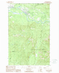
 1986 Greenwater1986 Print · USGSGreenwater and the high ridges of the Snoqualmie National Forest appear here in the mid-1980s, before modern development shifted the mountain landscape. Trace the former location of Humphrey (Site), explore Federation Forest State Park, and find the remote Mule Spring.2 unique versions available
 - 1986 Map of Lake Joy, 2003 Print
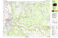
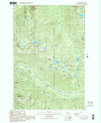
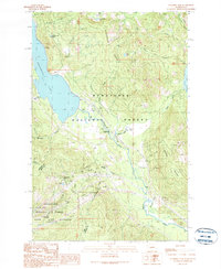
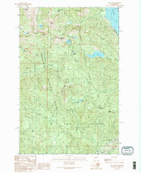
 1986 Lake Joy2003 Print · USGSKing County's rugged eastern foothills are documented here in the mid-1980s, highlighting the critical water infrastructure of the Tolt River system. Researchers can trace rural settlements at Harris and Langlois or locate landmarks like Lake Joy and the Tolt Regulating Basin.
 - 1989 Map of Bandera
 1989 Bandera1989 Print · USGSThe Snoqualmie corridor in the late eighties shows a landscape of mountain summits and transit history. Trace the Old RR Grade through the valley or locate Bandera (Site) and the waters of Mason Lake and Pratt River.2 unique versions available
 - 1989 Map of Index
 1989 Index1989 Print · USGSThe mountain town of Index is shown in the late eighties as a junction of river forks and timbered ridges. Researchers can trace historic access points and water features like Bridal Veil Falls, Sunset Falls, and high peaks such as Mt Index.3 unique versions available
 - 1989 Map of Lake Philippa
 1989 Lake Philippa1989 Print · USGSThe King County backcountry in the late eighties is a landscape of high alpine basins and deep river valleys. You can trace early wilderness resource history through scattered landmarks like the mine shaft on Quartz Creek or the remote Lake Philippa.3 unique versions available
 - 1989 Map of Devils Slide
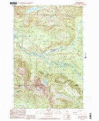
 1989 Devils Slide1989 Print · USGSThe Snoqualmie National Forest and Seattle’s protected watershed are documented here in the late eighties. Researchers can trace the engineering of the South Fork Tolt Reservoir and locate remote sites like the Cascade 3702 Lookout Tower and Wagner Bridge.
 - 1989 Map of Stampede Pass
 1989 Stampede Pass1989 Print · USGSThe Cascades crossing at Stampede Pass comes into focus in the late eighties, showing a landscape defined by critical rail and water infrastructure. Researchers can locate the Whittier (Site), the deep Stampede Tunnel, and the high-elevation Keechelus Lake.2 unique versions available
 - 1989 Map of Lester
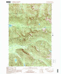
 1989 Lester1989 Print · USGSThe mountain landscape of eastern King County is shown here in the late 1980s, centered on the Green River corridor. Researchers can trace the layout of Lester, follow the Landing Strip, and locate high-altitude landmarks like Colquhoun Peak and Kelly Butte.
 - 1989 Map of Mount Phelps
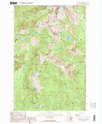
 1989 Mount Phelps1989 Print · USGSHigh in the Cascades during the late eighties, this map captures a landscape defined by Seattle's water supply and deep-woods mining. Trace the historic reach of the Damon Mine and Apex Mine, or locate the remote waters of Loch Katrine and the South Fork Tolt Reservoir.2 unique versions available
 - 1989 Map of Noble Knob
 1989 Noble Knob1989 Print · USGSThe high Cascades of Washington's Pierce County are documented here in the late eighties, showing the path of the Pacific Crest National Scenic Trail through the timber. Trace the locations of Camp Urich, the high-altitude Corral Pass Campground, and remote landmarks like Noble Knob.2 unique versions available
 - 1989 Map of Chikamin Peak
 1989 Chikamin Peak1989 Print · USGSThe high Cascades of Kittitas County come into focus during the late eighties, documenting the intersection of two National Forests. You can trace the Pacific Crest National Scenic Trail past high-altitude landmarks like Chikamin Peak and Spectacle Lake.2 unique versions available
 - 1989 Map of Blowout Mountain
 1989 Blowout Mountain1989 Print · USGSHigh in the Cascades during the late 1980s, the county line between King and Kittitas counties divides a landscape of protected watersheds and forests. Hikers and historians can trace the Pacific Crest National Scenic Trail across Tacoma Pass to the slopes of Blowout Mountain.
 - 1989 Map of Gold Bar
 1989 Gold Bar1989 Print · USGSThe Skykomish River valley in the late eighties shows the timber and transport routes that shaped Snohomish County. Trace the paths of an OLD RR GRADE and find local landmarks like the FISH HATCHERY or the high waters of Duffey Lakes.2 unique versions available
 - 1989 Map of Mount Si
 1989 Mount Si1989 Print · USGSThe foothills of the Cascades near King County are documented here in the late eighties as timber and recreation interests shaped the land. Researchers can trace forest access via 4WD tracks to high-country landmarks like Lake Hancock, Mount Si, and Ernies Grove.
 - 1989 Map of Chester Morse Lake
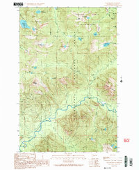
 1989 Chester Morse Lake1989 Print · USGSThe Snoqualmie River valley in the late eighties serves as a busy corridor of industry and infrastructure just before reaching the deep Cascades. Researchers can trace the development of Tanner and Boxley or locate historical sites like Camp Waskowitz and the Horseshoe Mine.
 - 1989 Map of Lost Lake
 1989 Lost Lake1989 Print · USGSThe high Cascades at the King and Kittitas border are captured here in the late eighties, documenting critical municipal watersheds and alpine passes. Trace historical transit through Yakima Pass, the Old Railroad Grade, and the Fort Tilton Historical Marker.2 unique versions available
Showing maps 1-25 of 28
Top cities of King County
- Seattle historical maps
- Bellevue historical maps
- Kent historical maps
- Renton historical maps
- Federal Way historical maps
- Kirkland historical maps
See more
Frequently asked questions
- What are the different types of historical maps available for King County?
- What is the oldest map of King County?
- Where can I purchase historical maps of King County for my home or office?
- Where can I download high-res historical maps of King County?
- Are there historical topographic maps available for King County?
- Is there historical aerial imagery available for King County?
- Where are historical maps of King County sourced from?