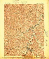
1900-1909 Maps of West Virginia
Explore 90 historic maps of West Virginia from 1900-1909. These maps offer a rare glimpse into what life looked like during the 1900s — showing old roads, neighborhoods, homes, and landmarks that have changed or disappeared over time.
Whether you're researching your family's past, planning a metal detecting trip, or studying how West Virginia's landscape evolved across the 1900s, these high-resolution maps are a powerful tool for exploring the history of this region.
- Focus on a specific era: All maps on this page are from the 1900s, giving you a focused view of this time period.
- See what’s changed: Compare century-old streets, trails, and buildings to today's modern landscape using overlays and satellite layers.
- Research with precision: Use these maps for genealogy, historical research, land use analysis, or educational projects.
- View, download, or print: Maps are fully viewable online in high resolution, and can be downloaded or printed for your own records.
Start exploring West Virginia's history through authentic maps from the 1900s. This is your window into the past.
West Virginia maps
(90)- 1900 Map of Accident
 1900 Accident1900 Print · USGSGarrett County highlands at the turn of the century reveal a landscape of mountain settlements and river-valley industry. Genealogists can trace family roots through the Blooming Rose Settlement, early milling sites like Speelman Mills, and the Baltimore and Ohio RR corridor.6 unique versions available
 - 1900 Map of Pawpaw
 1900 Pawpaw1900 Print · USGSThe Potomac River's intricate meanders define this borderland at the close of the nineteenth century. Researchers can trace the parallel routes of the Chesapeake and Ohio Canal and the Baltimore and Ohio Railroad past Magnolia, Dam No. 6, and Fisher Ford.8 unique versions available
 - 1900 Map of Kanawha Falls
 1900 Kanawha Falls1900 Print · USGSThe Kanawha and Elk rivers converge here at the turn of the century as the coal and rail industries were rapidly transforming the West Virginia landscape. Genealogists and historians can trace riverside settlements like Montgomery and Coalburg or follow the paths of the Chesapeake and Ohio RR and early river navigation at Lock 2.
 - 1900 Map of Oakland
 1900 Oakland1900 Print · USGSGarrett County and the West Virginia borderlands appear at the turn of the century as a landscape of mountain resorts and rail towns. Genealogists can trace family names at Gnegy Church, locate old stations like Altamont, and explore early settlements from Crellin to Bayard.5 unique versions available
 - 1900 Map of Flintstone
 1900 Flintstone1900 Print · USGSThe Maryland and West Virginia border at the close of the nineteenth century centers on the vital Potomac River transportation corridor. Researchers can trace the Chesapeake and Ohio Canal, the B. & O. R. R., and early settlements like Oldtown, Flintstone, and Wolf Mill.6 unique versions available
 - 1901 Map of Hancock
 1901 Hancock1901 Print · USGSMaryland and West Virginia met at the turn of the century along a busy corridor of river transport and rail expansion. Genealogists can trace family roots through old landmarks like Yeakle Mill, Fairview Church, and early hamlets such as Stotlers Crossroads.8 unique versions available
 - 1901 Map of Nicholas
 1901 Nicholas1901 Print · USGSCentral West Virginia's river valleys and high ridges are shown here at the turn of the century as the timber industry expanded. Genealogists can trace family landmarks and river crossings like Camden on Gauley, Wainville P.O., and Bays Ferry Ford.3 unique versions available
 - 1901 Map of Frostburg
 1901 Frostburg1901 Print · USGSMaryland's coal country and the critical mountain pass at Cumberland are shown in detail at the turn of the century. Genealogists and industrial historians can locate old mining works at Eckhart Mines, the path of the C. & O. Canal, and the early layout of Frostburg.2 unique versions available
 - 1901 Map of Kanawha Falls
 1901 Kanawha Falls1901 Print · USGSWest Virginia's coal and rail heartland is captured here at the end of the nineteenth century, as river navigation and railroads transformed the Kanawha Valley. Genealogists and historians can trace the early footprints of Montgomery, find family sites near Kanawha Falls, and locate landmarks like Hawks Nest or Powellton.3 unique versions available
 - 1901 Map of Monterey, 1905 Print
 1901 Monterey1905 Print · USGSThe high Allegheny ridges of Highland and Bath Counties are shown at the turn of the century when isolated valley settlements were linked by winding mountain gaps. Genealogists can trace early homesteads and commerce centers like Cleeks Mills, Mountaingrove, and New Hampden.8 unique versions available
 - 1901 Map of Guyandot, 1953 Print
 1901 Guyandot1953 Print · USGSThe Ohio River valley at the start of the twentieth century shows a bustling corridor of industry and river commerce. Genealogists and historians can trace the early footprints of Huntington and Ceredo alongside early rail routes like the Baltimore and Ohio RR.
 - 1901 Map of Ceredo, 1953 Print
 1901 Ceredo1953 Print · USGSThe tri-state convergence of West Virginia, Ohio, and Kentucky comes alive in this early 20th-century survey of the Ohio River valley. Genealogists and rail historians can trace the vital transport networks of Kenova and Ceredo, alongside family-named landmarks like Walker Br and Rice Run.2 unique versions available
 - 1902 Map of Parkersburg
 1902 Parkersburg1902 Print · USGSThe river-and-rail corridor between Ohio and West Virginia comes alive at the dawn of the twentieth century. Researchers can trace the early footprints of Parkersburg and Vienna, the sprawling Blennerhassett Island, and the old rail lines at Belpre.
 - 1902 Map of Wheeling
 1902 Wheeling1902 Print · USGSThe Ohio River valley at the start of the 1900s was a powerhouse of rail and river industry across West Virginia, Ohio, and Pennsylvania. Genealogists can trace family roots in early industrial hubs like Martins Ferry, locate historic landmarks like the S Bridge, or find riverfront settlements such as Beach Bottom and Yorkville.7 unique versions available
 - 1902 Map of Guyandot
 1902 Guyandot1902 Print · USGSThe industrial hub of Huntington and the river town of Guyandot sit at the center of this early century border survey. Genealogists can trace family names and small settlements along Twelvepole Creek and Russell Creek, including Lavalette, Shoals, and Dickson.4 unique versions available
 - 1902 Map of Clarksburg
 1902 Clarksburg1902 Print · USGSNorth-central West Virginia at the opening of the twentieth century was a bustling network of river-towns and turnpikes. Genealogists can trace family roots through coal-and-rail hubs like Shinnston and Lumberport or rural landmarks such as Sturms Mill and Pinnickinnick Mt.3 unique versions available
 - 1902 Map of Raleigh
 1902 Raleigh1902 Print · USGSRaleigh County and the New River Gorge were entering their industrial peak when this survey was conducted in the late nineteenth century. Researchers can trace the early rail network of the CHESAPEAKE AND OHIO RR through booming towns like Thurmond, Beury, and East Sewell.3 unique versions available
 - 1902 Map of Milton
 1902 Milton1902 Print · USGSTeays Valley and the western Virginia hill country are shown here at the turn of the century, as the railroad era transformed the region's commerce. Genealogists can trace early homesteads and landmarks like Howell Mill, Salt Rock, and the Ben Johnson Ford.3 unique versions available
 - 1902 Map of Fairmont
 1902 Fairmont1902 Print · USGSMarion and Taylor Counties were hubs of coal and transit at the opening of the twentieth century, as the rail lines followed the winding rivers. Genealogists can trace early family settlements and work sites from the Tyrconnell Mines to rural Nebo Church and Boothsville.4 unique versions available
 - 1902 Map of Morgantown
 1902 Morgantown1902 Print · USGSMorgantown and the Monongahela River corridor appear here at the dawn of the twentieth century, captured during a period of industrial growth. Genealogists and historians can trace old iron industry sites like Clinton Furnace, river crossings at Ice's Ferry, and early rail routes.5 unique versions available
 - 1902 Map of Midkiff, 1925 Print
 1902 Midkiff1925 Print · USGSLincoln and Cabell Counties at the turn of the century show a region transitioning through the arrival of the railroad and the growth of river-valley commerce. Family historians can trace early property sites and communities like Milton, Hamlin, and the historic Blue Sulphur Springs along the Mud River corridor.
 - 1903 Map of Kenova
 1903 Kenova1903 Print · USGSThe tri-state river junction at Ashland and Kenova was a bustling industrial hub after the turn of the century. Trace early rail lines and mining settlements like Coalton and Boghead, or locate family landmarks along the Little Sandy River and Means Tunnel.5 unique versions available
 - 1903 Map of Littleton
 1903 Littleton1903 Print · USGSThe West Virginia and Pennsylvania borderlands appear here at the turn of the century, marked by deep ridges and creek-side settlements. Trace the path of the B. and O. R. R. as it connects Littleton to outlying hamlets like Wileyville and Burchfield.
 - 1904 Map of Parkersburg
 1904 Parkersburg1904 Print · USGSThe riverfront economies of Wood County and Washington County meet at the turn of the century where the Muskingum and Ohio rivers converge. Researchers can trace the early rail networks of the Baltimore and Ohio R.R. and locate family-named settlements like Gravelbank, Center Belpre, and Vincent.5 unique versions available
 - 1904 Map of Kenova
 1904 Kenova1904 Print · USGSThe tri-state confluence of the Ohio River and Big Sandy River hums with early industrial activity at the start of the century. Genealogists can trace rail-side settlements and remote homesteads along Blaine Creek and near Mt Savage or Webbville.
Showing maps 1-25 of 90
Top cities of West Virginia
- Charleston historical maps
- Huntington historical maps
- Parkersburg historical maps
- Morgantown historical maps
- Wheeling historical maps
- Weirton historical maps
See more
Top counties of West Virginia
- Kanawha County historical maps
- Berkeley County historical maps
- Monongalia County historical maps
- Cabell County historical maps
- Wood County historical maps
- Raleigh County historical maps
See more
Frequently asked questions
- What are the different types of historical maps available for West Virginia?
- What is the oldest map of West Virginia?
- Where can I purchase historical maps of West Virginia for my home or office?
- Where can I download high-res historical maps of West Virginia?
- Are there historical topographic maps available for West Virginia?
- Is there historical aerial imagery available for West Virginia?
- Where are historical maps of West Virginia sourced from?