1910s Maps of West Virginia
Explore 82 historic maps of West Virginia from the 1910s. These maps offer a rare glimpse into what life looked like during the 1910s — showing old roads, neighborhoods, homes, and landmarks that have changed or disappeared over time.
Whether you're researching your family's past, planning a metal detecting trip, or studying how West Virginia's landscape evolved across the 1910s, these high-resolution maps are a powerful tool for exploring the history of this region.
- Focus on a specific era: All maps on this page are from the 1910s, giving you a focused view of this time period.
- See what’s changed: Compare century-old streets, trails, and buildings to today's modern landscape using overlays and satellite layers.
- Research with precision: Use these maps for genealogy, historical research, land use analysis, or educational projects.
- View, download, or print: Maps are fully viewable online in high resolution, and can be downloaded or printed for your own records.
Start exploring West Virginia's history through authentic maps from the 1910s. This is your window into the past.
West Virginia maps
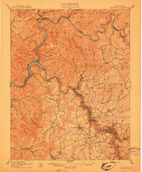
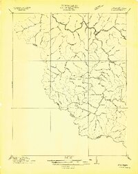
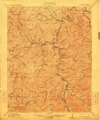
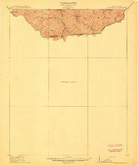
(82)- 1910 Map of Clay
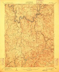 1910 Clay1910 Print · USGSWest Virginia's coal and timber country comes alive in this survey of the Elk River valley just after the turn of the century. Genealogists and historians can trace the early rail networks of the Coke and Coke RR and locate vanished rural hubs like Yankee Dam PO and Triplett School.3 unique versions available
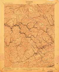
 - 1910 Map of Pineville
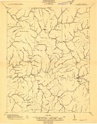 1910 Pineville1910 Print · USGSWyoming County at the dawn of the twentieth century was a landscape of deep hollows and high ridges connected by the Guyandot River. Genealogists can trace family footprints in early settlements like Baileysville, Oceana, and near the old McDonald Mill.2 unique versions available
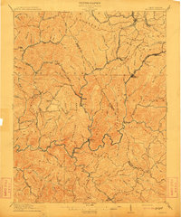
 - 1910 Map of Bald Knob
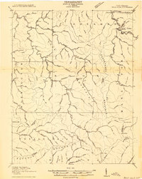 1910 Bald Knob1910 Print · USGSSouthern West Virginia in the early twentieth century was a landscape of remote mountain gaps and emerging rail corridors. Genealogists and historians can trace early settlements like Jarrolds Valley and Van, or locate historic crossing points like Walnut Gap and Indian Gap.2 unique versions available
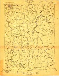
 - 1910 Map of Holden
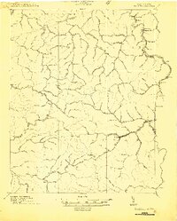 1910 Holden1910 Print · USGSLogan County’s rugged coalfield landscape is captured here in the early 1900s as development followed the winding Guyandot River. Researchers can trace old family-named settlements like Mc Cloud, Whirlwind, and Halcyon tucked into the hollows.
 - 1910 Map of Fayetteville
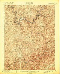
 1910 Fayetteville1910 Print · USGSThe West Virginia coalfields were in full operation when this survey was conducted, showing the dense rail networks along the Gauley River. Local historians can trace family-named sites and industrial hamlets like Nuttallburg, Gauley Bridge, and Kaymoor.4 unique versions available
 - 1910 Map of Sutton Special
 1910 Sutton Special1910 Print · USGSCentral West Virginia at the end of the first decade of the 1900s shows a landscape transformed by river-valley railroads. Genealogists can trace family roots through hillside settlements like Flatwoods and Centralia or locate early post offices at Gillespie Hyer PO and Bakers Run Levi PO.3 unique versions available
 - 1910 Map of Montgomery
 1910 Montgomery1910 Print · USGSThe industrial corridor of the Kanawha Valley is seen here in the early 1900s, defined by the river and the competing rail lines of the era. Genealogists and historians can trace the foundations of coal-field communities at Paint Creek Junction, Coalburg, and Pratt PO.3 unique versions available
 - 1910 Map of Gassaway
 1910 Gassaway1910 Print · USGSBraxton County at the peak of its rail-and-river era is captured here, centered on the growing industrial hub of Gassaway. Genealogists and historians can trace early post offices and settlements like Villa Nova Duck PO, Strange Creek, and the Coal and Coke Ry corridor.3 unique versions available
 - 1910 Map of Naugatuck
 1910 Naugatuck1910 Print · USGSMingo and Wayne Counties come into focus in the early twentieth century as the coal and timber industry transformed these hollows. Genealogists and researchers can trace the Norfolk and Western rail line through early settlements like Kermit, Breeden, and Naugatuck.
 - 1910 Map of Antietam
 1910 Antietam1910 Print · USGSMaryland's borderlands and the Potomac River valley are captured here in the early twentieth century. Genealogists can locate family landmarks like Garretts Mill, trace the Chesapeake and Ohio Canal, or find historic sites including Dunkard Church.6 unique versions available
 - 1910 Map of Iaeger
 1910 Iaeger1910 Print · USGSMcDowell County's steep coal country is documented here in the early twentieth century as the railroad transformed the mountain landscape. Genealogists can trace family names and early homesteads near Iaeger, Avondale PO, and Paynesville along the Norfolk and Western RR.
 - 1910 Map of Clarksburg, 1920 Print
 1910 Clarksburg1920 Print · USGSClay County at the dawn of the twentieth century was a landscape of river-bend railroads and high mountain hollows. Genealogists can trace family footprints through rural post offices like Angeline PO, valley schools such as Triplett School, and rail stops at Dundon and Clay Courthouse Station.
 - 1910 Map of Paw Paw, 1959 Print
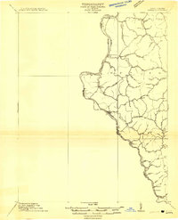
 1910 Paw Paw1959 Print · USGSMaryland and West Virginia meet along the serpentine Potomac River in the early twentieth century as railroads and canals compete for the valley. Trace the industrial landscape from the Ohio and Chesapeake Canal to the river towns of Paw Paw and Little Orleans.
 - 1911 Map of Louisa
 1911 Louisa1911 Print · USGSThe West Virginia borderlands along the Big Sandy River come to life in this early twentieth-century study of Wayne County. Trace family roots and vanished rail stops like Fort Gay, Glenhayes, and Saltpeter along the Norfolk and Western Railway line.
 - 1911 Map of Marshes
 1911 Marshes1911 Print · USGSRaleigh County and the surrounding highlands are shown just after the turn of the century, when mountain life centered on isolated creek hollows. Genealogists can trace family footprints through dozens of rural landmarks like Meadow Inn School, Matville P O, and Peachtree School.
 - 1911 Map of Peytona
 1911 Peytona1911 Print · USGSSouthern West Virginia’s coal and rail landscape is captured here in the decade before the Great War, centered on the winding Coal River. Researchers can trace the early rail hubs and hollows including Winifrede, Peytona, and the vanished Lewiston PO.3 unique versions available
 - 1911 Map of Flattop
 1911 Flattop1911 Print · USGSSouthern West Virginia’s coal and timber country comes into focus just as the railroads transformed these ridges and hollows. Genealogists can trace dozens of rural schoolhouses and family-named landmarks like Huff Knob, Egeria, and the VIRGINIAN RY corridor.
 - 1911 Map of Madison
 1911 Madison1911 Print · USGSBoone and Lincoln counties appear here in the early twentieth century as the rail network began to reshape the coal-bearing valleys. Researchers can trace early infrastructure through the Chesapeake and Ohio line and settlements like Madison, Uneeda, and Danville.2 unique versions available
 - 1911 Map of Beckley
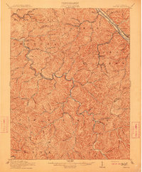
 1911 Beckley1911 Print · USGSThe coal and rail landscape of Raleigh and Fayette counties comes to life in the years before the Great War. Genealogists can trace family roots through numerous remote settlements and rural landmarks like Mount Hope, Silver Cliff School, and the winding New River.
 - 1911 Map of Pocahontas Special
 1911 Pocahontas Special1911 Print · USGSThe West Virginia coalfields are in full industrial bloom in this early century survey, showing the rail-dependent towns along the Norfolk & Western RR. Genealogists can trace family locations in mining hubs like Keystone, Goodwill, and Bearwallow Worth PO.
 - 1912 Map of Mullens
 1912 Mullens1912 Print · USGSThe Raleigh and Wyoming county lines meet in this 1910 study of the West Virginia coalfields during a period of rapid industrial growth. Genealogists and historians can trace the early path of the Virginian RR and locate vanished company towns like Stotesbury, Glen White, and Hotchkiss.2 unique versions available
 - 1912 Map of Sago
 1912 Sago1912 Print · USGSThe Buckhannon River valley was a bustling corridor for the Baltimore and Ohio Railroad in the early twentieth century. Genealogists can trace family names and remote post offices at Beans Mill Indian Camp PO, Sago, and Kingsville PO.4 unique versions available
 - 1912 Map of Naugatuck
 1912 Naugatuck1912 Print · USGSMingo and Wayne County borderlands are shown here in the early twentieth century, as the river-and-rail economy transformed these Appalachian hollows. Genealogists and historians can trace family-named sites along the Tug Fork and Norfolk and Western Ry, including Kermit, Naugatuck, and Breeden.
 - 1912 Map of Pounding Mill
 1912 Pounding Mill1912 Print · USGSThe McDowell and Tazewell borderlands appear here in the decade before the First World War, showing the early infrastructure of this mountainous region. Researchers can trace the path of Squire Jim Road and locate the settlement of Horsepen among the headwaters of Big Creek.
 - 1912 Map of Bald Knob
 1912 Bald Knob1912 Print · USGSBoone County and the surrounding coalfields are captured in the early twentieth century as rail lines began to penetrate the deep Appalachian hollows. Genealogists and historians can trace early settlements at Whitesville, Jarrolds Valley, and Gordon alongside the growing C. and O. R. R. line.3 unique versions available
Showing maps 1-25 of 82
Top cities of West Virginia
- Charleston historical maps
- Huntington historical maps
- Parkersburg historical maps
- Morgantown historical maps
- Wheeling historical maps
- Weirton historical maps
See more
Top counties of West Virginia
- Kanawha County historical maps
- Berkeley County historical maps
- Monongalia County historical maps
- Cabell County historical maps
- Wood County historical maps
- Raleigh County historical maps
See more
Frequently asked questions
- What are the different types of historical maps available for West Virginia?
- What is the oldest map of West Virginia?
- Where can I purchase historical maps of West Virginia for my home or office?
- Where can I download high-res historical maps of West Virginia?
- Are there historical topographic maps available for West Virginia?
- Is there historical aerial imagery available for West Virginia?
- Where are historical maps of West Virginia sourced from?