1920s Maps of West Virginia
Explore 145 historic maps of West Virginia from the 1920s. These maps offer a rare glimpse into what life looked like during the 1920s — showing old roads, neighborhoods, homes, and landmarks that have changed or disappeared over time.
Whether you're researching your family's past, planning a metal detecting trip, or studying how West Virginia's landscape evolved across the 1920s, these high-resolution maps are a powerful tool for exploring the history of this region.
- Focus on a specific era: All maps on this page are from the 1920s, giving you a focused view of this time period.
- See what’s changed: Compare century-old streets, trails, and buildings to today's modern landscape using overlays and satellite layers.
- Research with precision: Use these maps for genealogy, historical research, land use analysis, or educational projects.
- View, download, or print: Maps are fully viewable online in high resolution, and can be downloaded or printed for your own records.
Start exploring West Virginia's history through authentic maps from the 1920s. This is your window into the past.
West Virginia maps
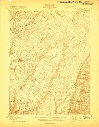
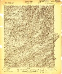
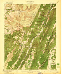
(145)- 1920 Map of Elk Garden
 1920 Elk Garden1920 Print · USGSThe West Virginia highlands and the Potomac River border are captured here just after the Great War, during the peak of the rail-and-coal era. Genealogists can locate numerous rural landmarks including Elk Garden, Rehoboth Church, and the Nethken School.
 - 1920 Map of Davis
 1920 Davis1920 Print · USGSWest Virginia's high mountain plateaus and the Maryland border are captured here just after the Great War. Genealogists can trace family footprints near the Fairfax Stone or locate rural landmarks like Rohrbaugh School and the Stony River Dam.
 - 1920 Map of Petersburg
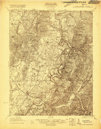
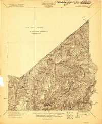
 1920 Petersburg1920 Print · USGSThe West Virginia and Virginia borderlands were a network of tight-knit mountain communities just after the Great War. Genealogists can locate family-named sites like Schmuckers School and Sites Chapel or trace the early Smoke Hole Settlement.3 unique versions available
 - 1920 Map of Moorefield, 1958 Print
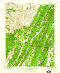
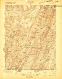
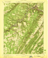
 1920 Moorefield1958 Print · USGSHardy and Hampshire Counties come alive in the 1920s as the Baltimore and Ohio RR winds through the Trough. Genealogists can locate family homesteads near dozens of rural landmarks like Old Pine Church, Sector PO, and the Hines School.2 unique versions available
 - 1920 Map of Onego, 1959 Print
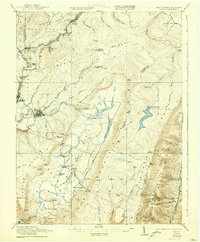
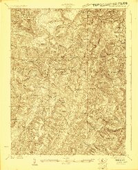
 1920 Onego1959 Print · USGSPendleton and Grant counties in the early twentieth century are shown here as a landscape of isolated mountain communities and riverside hamlets. Researchers can trace family-named landmarks and long-standing institutions like the Germany Settlement, Mouth of Seneca, and the Evergreen Church.2 unique versions available
 - 1920 Map of Keyser, 1964 Print
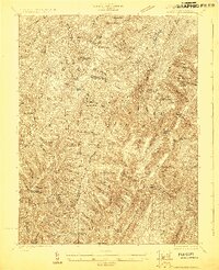
 1920 Keyser1964 Print · USGSMineral and Hampshire counties in the 1920s reveal a landscape of deep river valleys and prominent ridges tied together by the Baltimore and Ohio RR. Researchers can locate dozens of country schools and churches, from Trinity Church to the Pancake School and Reeses Mill.
 - 1921 Map of Callaghan
 1921 Callaghan1921 Print · USGSThe West Virginia and Virginia borderlands come alive in this early 1920s survey of the mountain gaps and valley drafts. Researchers can trace rural life through numerous country schools like Bound School and landmarks such as Columbia Sulphur Springs and Wileys Crossing.
 - 1921 Map of Orkney Springs
 1921 Orkney Springs1921 Print · USGSHardy County life in the early 1920s was centered in the valley between the high ridges of Shenandoah and South Fork mountains. Genealogists can trace family footprints through a dense network of rural schools and churches, including Jenkins Chapel, Mathias, and the Lumber RR.2 unique versions available
 - 1921 Map of Keyser
 1921 Keyser1921 Print · USGSThe Potomac River valley and the ridges of Mineral and Hampshire counties are captured here in the early twenties. Researchers can locate vanished landmarks like the Russellville PO, industrial sites at Ochre, and dozens of rural schoolhouses from Red Star School to Knobly School.2 unique versions available
 - 1921 Map of Petersburg
 1921 Petersburg1921 Print · USGSEastern West Virginia at the start of the twenties shows a landscape of mountain hollows tied together by the Baltimore and Ohio at Petersburg. Genealogists can trace family names through landmarks like Hedrick Church, Crites School, and Ketterman.
 - 1921 Map of Alderson
 1921 Alderson1921 Print · USGSThe Greenbrier River valley and the West Virginia highlands come alive in the early 1920s, showing the region's rail-dependent economy and rural school networks. Researchers can trace family roots at Nickels Mill, Spider Den School, and the settlement of Sinks Grove.3 unique versions available
 - 1921 Map of White Sulphur Springs
 1921 White Sulphur Springs1921 Print · USGSThe Greenbrier Valley in the early twenties reveals a landscape of dense rural settlements and early mountain thoroughfares. Genealogists can trace family footprints across dozens of local sites like Germany School, Balm of Gilead Church, and White Sulphur Springs.2 unique versions available
 - 1921 Map of Hanging Rock
 1921 Hanging Rock1921 Print · USGSHampshire County in the early twentieth century is captured here as a landscape of isolated mountain hollows and river settlements. Genealogists can locate dozens of neighborhood landmarks like Milesons Mill, Tearcoat Church, and schools such as Shady Grove School.3 unique versions available
 - 1921 Map of Clintonville
 1921 Clintonville1921 Print · USGSGreenbrier County is captured in the early twentieth century as a landscape of mountain ridges and valley settlements connected by the historic James River and Kanawha Turnpike. Researchers can locate dozens of family-named landmarks, including Baker Mill, Maude Chapel, and the famous mineral waters at Blue Sulphur Springs.
 - 1921 Map of Ronceverte
 1921 Ronceverte1921 Print · USGSThe West Virginia and Virginia borderlands come alive in this early 1920s record of the Greenbrier Valley and Allegheny ridges. Genealogists can trace family roots through numerous local landmarks like Organ Cave, Red Mill, and the Highland Green School.2 unique versions available
 - 1921 Map of Richwood
 1921 Richwood1921 Print · USGSThe West Virginia mountain country of Greenbrier and Nicholas counties is captured here just after the Great War. Researchers can trace rural life through old schoolhouses like Fallbrook School and Big Stone School, or locate settlements at Jettsville and Quinnwood.2 unique versions available
 - 1921 Map of Onego
 1921 Onego1921 Print · USGSThe West Virginia highlands in the early 1920s reveal a network of isolated mountain schools and valley settlements. Genealogists can trace family roots through landmarks like Onego, High Rock Church, and the Boggs School near Seneca Rock.2 unique versions available
 - 1921 Map of Greenland Gap
 1921 Greenland Gap1921 Print · USGSWest Virginia's Grant County highlands are documented here during the early twenties, showing a landscape of isolated mountain hollows and ridge-top schools. Genealogists can locate family landmarks like Locust Grove Church, Maysville, and over a dozen rural schoolhouses including Mountain Top School.3 unique versions available
 - 1921 Map of Moorefield
 1921 Moorefield1921 Print · USGSHardy and Hampshire counties come to life in the early 1920s as mountain settlements like Needmore and Oldfields cluster along the river gaps. Researchers can locate dozens of vanished rural schoolhouses and churches, from Thrasher Spring School to Old Pine Church.2 unique versions available
 - 1921 Map of Davis, 1938 Print
 1921 Davis1938 Print · USGSThe West Virginia highlands and the Maryland border come alive in this early twentieth-century survey of the Allegheny Front. Researchers can trace the legacy of timber and coal through the Lumber RR and find local landmarks like the Fairfax Stone and Cortland School.2 unique versions available
 - 1922 Map of Onego
 1922 Onego1922 Print · USGSPendleton County's high ridges and river valleys are captured here in the early 1920s as the Monongahela National Forest was being established. Genealogists and hikers can locate old mountain homesteads, numerous remote schools like Keel Spring School, and the iconic Seneca Rock.2 unique versions available
 - 1922 Map of Fort Seybert
 1922 Fort Seybert1922 Print · USGSPendleton County's South Fork Valley is captured in the early 1920s, showing a landscape of remote mountain homesteads and small valley hamlets. Genealogists can locate family landmarks like Locust Grove School, New Bethel Church, and the high peaks of Shenandoah Mountain.2 unique versions available
 - 1922 Map of Elk Garden
 1922 Elk Garden1922 Print · USGSThe Potomac River highlands come to life in the early 1920s as rail and river industry define the border between Maryland and West Virginia. Genealogists and local historians can trace family roots through numerous small schools and churches like Sunnyside School, Mt Pisgah Church, and Hartmansville.2 unique versions available
 - 1922 Map of Horton
 1922 Horton1922 Print · USGSThe West Virginia highlands in the early twenties were a landscape of mountain timber towns and isolated valley schools. Genealogists can trace family names at Little Italy or Evenwood, and locate rural landmarks like Bethel Church and Mylius School.2 unique versions available
 - 1922 Map of Spruce Knob
 1922 Spruce Knob1922 Print · USGSThe Potomac Highlands are seen here in the early 1920s, a period defined by small mountain gaps and high-altitude settlements. Researchers can trace rural life through dozens of sites like Osceola Po, Winterburn Station, and the isolated Ridge Church.3 unique versions available
Showing maps 1-25 of 145
Top cities of West Virginia
- Charleston historical maps
- Huntington historical maps
- Parkersburg historical maps
- Morgantown historical maps
- Wheeling historical maps
- Weirton historical maps
See more
Top counties of West Virginia
- Kanawha County historical maps
- Berkeley County historical maps
- Monongalia County historical maps
- Cabell County historical maps
- Wood County historical maps
- Raleigh County historical maps
See more
Frequently asked questions
- What are the different types of historical maps available for West Virginia?
- What is the oldest map of West Virginia?
- Where can I purchase historical maps of West Virginia for my home or office?
- Where can I download high-res historical maps of West Virginia?
- Are there historical topographic maps available for West Virginia?
- Is there historical aerial imagery available for West Virginia?
- Where are historical maps of West Virginia sourced from?