
Historical Maps of St. Croix County, Wisconsin
Journey back in time with 87 historical maps of St. Croix County, dating from 1946 to present day. Explore and discover the history of St. Croix County through detailed topographic maps, featuring cities, landmarks, and geographical changes. Dive deeper into each map with our interactive high-resolution viewer and extensive library data. Every map in our collection is also available for purchase as a framed or unframed museum-quality print for those interested interested in bringing a part of history into their home. Begin your historical adventure now!
St. Croix County, WI maps
(87)- 1946 Map of Hudson, 1954 Print
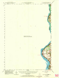
 1946 Hudson1954 Print · USGSCovers portions of St. Croix County, including Hudson, Minnesota, and others.
 - 1946 Map of Knapp, 1967 Print
 1946 Knapp1967 Print · USGSCovers portions of St. Croix County, including Knapp, Pierce County, and others.
 - 1946 Map of River Falls, 1968 Print
 1946 River Falls1968 Print · USGSCovers portions of St. Croix County, including River Falls, and others.
 - 1948 Map of Downing, 1970 Print
 1948 Downing1970 Print · USGSCovers portions of St. Croix County, including Downing, Barron County, and others.
 - 1948 Map of New Richmond, 1957 Print
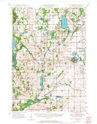
 1948 New Richmond1957 Print · USGSCovers portions of St. Croix County, including New Richmond, Minnesota, and others.
 - 1948 Map of New Richmond, 1966 Print
 1948 New Richmond1966 Print · USGSCovers portions of St. Croix County, including New Richmond, Minnesota, and others.
 - 1948 Map of New Richmond, 1976 Print
 1948 New Richmond1976 Print · USGSCovers portions of St. Croix County, including New Richmond, Minnesota, and others.
 - 1948 Map of Stillwater, 1962 Print
 1948 Stillwater1962 Print · USGSCovers portions of St. Croix County, including Stillwater, Washington County, and others.
 - 1948 Map of Stillwater, 1969 Print
 1948 Stillwater1969 Print · USGSCovers portions of St. Croix County, including Stillwater, Washington County, and others.
 - 1949 Map of Baldwin
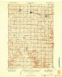 1949 Baldwin1949 Print · USGSCovers portions of St. Croix County, including Baldwin, Pierce County, and others.
Showing maps 1-10 of 87
Top cities related to St. Croix County
See more
Top counties related to St. Croix County
- Milwaukee County, WI
- Dane County, WI
- Waukesha County, WI
- Brown County, WI
- Racine County, WI
- Outagamie County, WI
See more
Frequently asked questions
- Can I purchase a physical print of a historical map of St. Croix County?
- Why are historical maps of St. Croix County important for research and professional purposes?
- What types of historical maps are available for St. Croix County?
- What advanced features do you offer for professional use?
- How can I find a specific historical map of St. Croix County?
- How can I contribute a historical map of St. Croix County that's not in your collection?
- What is the oldest map of St. Croix County in your collection?
- How can I download a map of St. Croix County?