2000s (21st Century) Maps of Calamus, Wisconsin
Explore 4 historic maps of Calamus from the 2000s (21st Century). These maps offer a rare glimpse into what life looked like during the 2000s — showing old roads, neighborhoods, homes, and landmarks that have changed or disappeared over time.
Whether you're researching your family's past, planning a metal detecting trip, or studying how Calamus's landscape evolved across the 2000s, these high-resolution maps are a powerful tool for exploring the history of this region.
- Focus on a specific era: All maps on this page are from the 2000s, giving you a focused view of this time period.
- See what’s changed: Compare century-old streets, trails, and buildings to today's modern landscape using overlays and satellite layers.
- Research with precision: Use these maps for genealogy, historical research, land use analysis, or educational projects.
- View, download, or print: Maps are fully viewable online in high resolution, and can be downloaded or printed for your own records.
Start exploring Calamus's history through authentic maps from the 2000s. This is your window into the past.
Calamus, WI maps
(4)- 2022 Map of Astico, 2022 Print
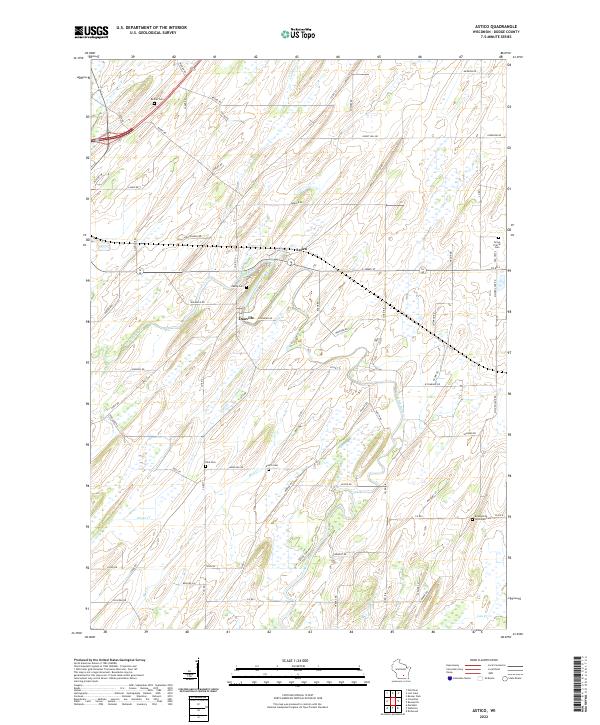 2022 Astico2022 Print · USGSDodge County's agricultural heartland is documented here in the early twenty-first century, centered on the Crawfish River valley. Researchers can trace ancestral ties at sites like Okeeg Cem, Elba Cem, and the Evangelical Reformed Cem near the settlement of Danville.
 - 2022 Map of Lost Lake, 2022 Print
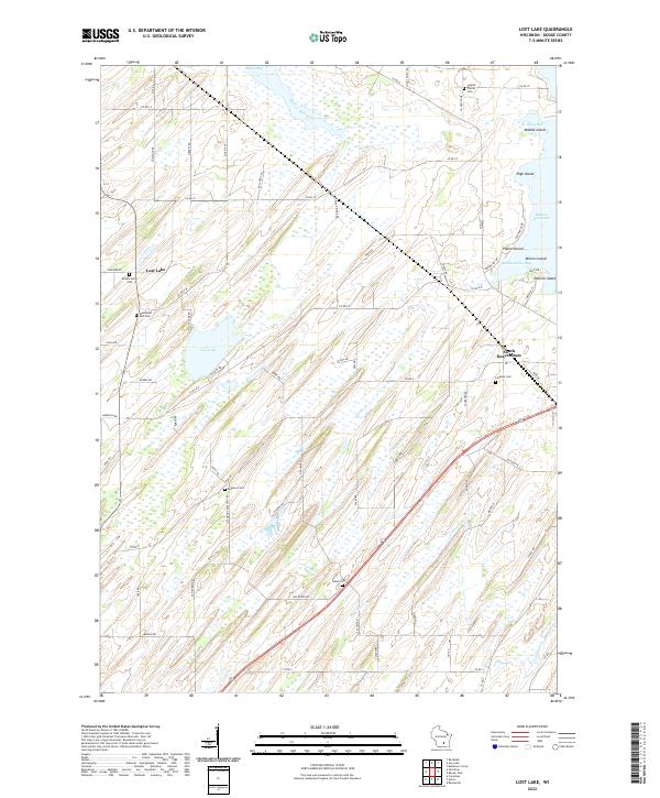 2022 Lost Lake2022 Print · USGSDodge County, Wisconsin, is shown here in the early 2020s, characterized by the intricate wetlands and shorelines of Lost Lake and Beaver Dam Lake. Researchers can trace old family burial grounds like English Prairie Cem and Wanderers Rest Cem or explore the named islands of the lake, including Poplar Island and Millers Island.
 - 2022 Map of Fall River, 2022 Print
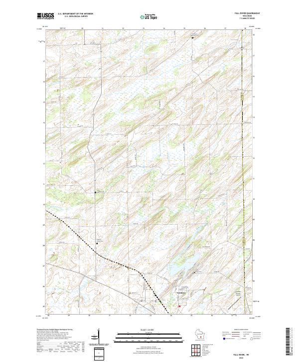 2022 Fall River2022 Print · USGSFall River and the surrounding Columbia County farmland are captured in the early 2020s as the community revolves around the Crawfish River. Researchers can locate several historical burial sites like Saint Stephen Cem and Courtland Methodist Cem, or trace the shoreline of Lazy Lake.
 - 2022 Map of Columbus, 2022 Print
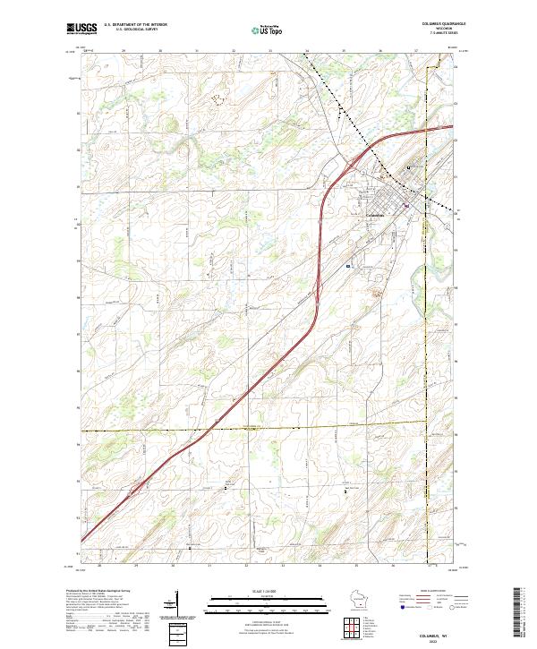 2022 Columbus2022 Print · USGSColumbus and its surrounding farm country are captured here at the start of the 2020s. Researchers can locate burial sites like Hillside Cem and Oak Lawn Cem or trace the winding path of the Crawfish River.
End of results
Showing maps 1-4 of 4
Top cities near Calamus
- Beaver Dam historical maps
- Watertown historical maps
- Columbus historical maps
- Waupun historical maps
- Waterloo historical maps
- Juneau historical maps
See more
Top neighborhoods of Calamus
Frequently asked questions
- What are the different types of historical maps available for Calamus?
- What is the oldest map of Calamus?
- Where can I purchase historical maps of Calamus for my home or office?
- Where can I download high-res historical maps of Calamus?
- Are there historical topographic maps available for Calamus?
- Is there historical aerial imagery available for Calamus?
- Where are historical maps of Calamus sourced from?