1970s Maps of Outagamie County, Wisconsin
Explore 10 historic maps of Outagamie County from the 1970s. These maps offer a rare glimpse into what life looked like during the 1970s — showing old roads, neighborhoods, homes, and landmarks that have changed or disappeared over time.
Whether you're researching your family's past, planning a metal detecting trip, or studying how Outagamie County's landscape evolved across the 1970s, these high-resolution maps are a powerful tool for exploring the history of this region.
- Focus on a specific era: All maps on this page are from the 1970s, giving you a focused view of this time period.
- See what’s changed: Compare century-old streets, trails, and buildings to today's modern landscape using overlays and satellite layers.
- Research with precision: Use these maps for genealogy, historical research, land use analysis, or educational projects.
- View, download, or print: Maps are fully viewable online in high resolution, and can be downloaded or printed for your own records.
Start exploring Outagamie County's history through authentic maps from the 1970s. This is your window into the past.
Outagamie County, WI maps
(10)- 1974 Map of Hilbert, 1977 Print
 1974 Hilbert1977 Print · USGSCalumet County was a thriving rail intersection in the 1970s, where three major lines converged at the village of Hilbert. Genealogists and local historians can trace the community's heritage through landmarks like St Peters Cem, Forest Junction, and the Forest Assembly Ground.
 - 1974 Map of Seymour, 1977 Print
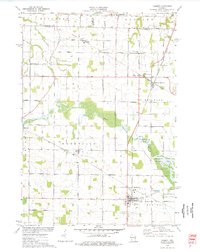
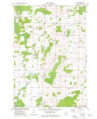
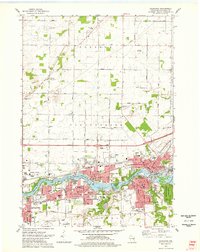
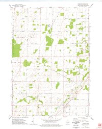
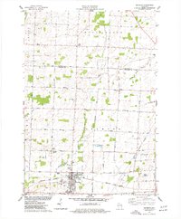 1974 Seymour1977 Print · USGSMid-seventies Outagamie County centers on the rail and road crossroads of Seymour as it appeared during a period of steady growth. Researchers can trace family sites through numerous rural cemeteries and small settlements like Rose Lawn, Isaak, and St Sebastian Cem.
 - 1974 Map of Nichols, 1977 Print
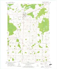
 1974 Nichols1977 Print · USGSThe rural landscapes of Outagamie and Shawano Counties are captured here in the mid-seventies, centered on the rail-linked village of Nichols. Researchers can trace old family sites near Briarton and local cemeteries like North Cicero Cem along the Shioc River corridor.
 - 1974 Map of Kaukauna, 1978 Print
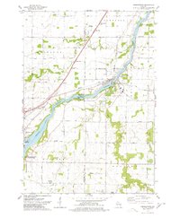
 1974 Kaukauna1978 Print · USGSKaukauna and the surrounding Fox River valley are captured in the mid-seventies, showing the dense industrial and parish-linked neighborhoods of the era. Researchers can trace family roots through numerous sites like Holy Name Cem, St John Cem, and schools like Electa Quinney Sch.2 unique versions available
 - 1974 Map of Oneida South, 1978 Print
 1974 Oneida South1978 Print · USGSThe Oneida Indian Reservation and the banks of the Fox River are captured here during the mid-seventies. Researchers can trace ancestral locations and local landmarks from Little Rapids to the Immaculate Conception Sch and Lost Dauphin State Park.
 - 1974 Map of Freedom, 1978 Print
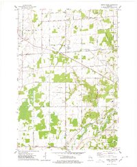
 1974 Freedom1978 Print · USGSOutagamie County in the mid-1970s shows a landscape defined by the Oneida Indian Reservation Boundary and traditional dairy-country settlements. Genealogists and local historians can locate several rural burial sites like St John the Baptist Cem and trace the small crossroads communities of Chicago Corners and Five Corners.
 - 1974 Map of Black Creek, 1978 Print
 1974 Black Creek1978 Print · USGSOutagamie County's agricultural and transit corridors are frozen in time here during the mid-seventies, centered on the railroad village of Black Creek. Genealogists and local historians can trace family roots through numerous sites like Binghamton Cem, Twelve Corners, and Emmanuel Ch.
 - 1974 Map of Wrightstown, 1978 Print
 1974 Wrightstown1978 Print · USGSWrightstown and the Fox River valley are captured in the mid-1970s, showing a landscape defined by water power and rural crossroads. Genealogists can locate numerous local burial sites like St Johns Cem and South Lawrence Cem, or trace the old Chicago and Northwestern rail corridor.
 - 1974 Map of Oneida North, 1978 Print
 1974 Oneida North1978 Print · USGSBrown and Outagamie counties in the mid-seventies reveal a network of rural hamlets and farming townships. Genealogists can trace family footprints through sites like Owego Cem, Lannoye Sch, and the historical community at Oneida.
 - 1974 Map of Sherwood, 1978 Print
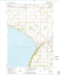 1974 Sherwood1978 Print · USGSThe Lake Winnebago shoreline in the mid-1970s shows a landscape balancing industry and recreation at the Calumet and Outagamie county line. Researchers can find old family cemeteries like Sacred Heart Cem, explore the Limekiln Ruins, or trace the Soo Line through Sherwood.2 unique versions available
End of results
Showing maps 1-10 of 10
Top cities of Outagamie County
- Appleton historical maps
- Grand Chute historical maps
- Kaukauna historical maps
- Little Chute historical maps
- Greenville historical maps
- Kimberly historical maps
See more
Frequently asked questions
- What are the different types of historical maps available for Outagamie County?
- What is the oldest map of Outagamie County?
- Where can I purchase historical maps of Outagamie County for my home or office?
- Where can I download high-res historical maps of Outagamie County?
- Are there historical topographic maps available for Outagamie County?
- Is there historical aerial imagery available for Outagamie County?
- Where are historical maps of Outagamie County sourced from?