Old Maps of Outagamie County, Wisconsin for Genealogy
Trace your family roots with 150 historic maps of Outagamie County. These high-res maps reveal old neighborhoods, homesites, landmarks, and streets — helping you uncover where your ancestors lived and how the area evolved over time.
- Explore historic neighborhoods: Identify where your relatives may have lived in the 1800s or 1900s.
- Compare maps over time: Trace the changes in streets, buildings, and landmarks for multi-generational research.
- Perfect for genealogy & ancestry research: Used by family historians and researchers to map out lineage and migration.
These maps are an incredible resource for exploring your personal connection to Outagamie County's past.
Outagamie County, WI maps
(150)- 1911 Map of Neenah, 1949 Print
 1911 Neenah1949 Print · USGSThe Fox River Valley was a thriving industrial and social corridor at the dawn of the twentieth century. Genealogists and historians can trace the early layouts of Neenah and Menasha or locate vanished landmarks like High Cliff PO and the Limeworks.
 - 1954 Map of De Pere, 1956 Print
 1954 De Pere1956 Print · USGSThe Fox River valley in the mid-1950s was a hub of industrial navigation and growing aviation between De Pere and Green Bay. Genealogists can trace family names through dozens of rural sites like St Patrick Cem, Gopher Hill, and the Michaelson Sch (Abandoned).2 unique versions available
 - 1954 Map of Chilton, 1956 Print
 1954 Chilton1956 Print · USGSMid-century Calumet County is captured here during a period of transition for its rural school districts and thriving rail corridors. Genealogists can locate family landmarks such as St Lukes Church, Brillion Cem, and several schoolhouses like the Howe Sch.3 unique versions available
 - 1954 Map of Green Bay, 1980 Print
 1954 Green Bay1980 Print · USGSGreen Bay and Brown County are shown during a period of steady mid-century growth and agricultural prominence. Researchers can trace family roots through numerous country schools like White Pine Sch and established cemeteries such as Chase Cem and Peace Cem.
 - 1955 Map of Neenah, 1957 Print
 1955 Neenah1957 Print · USGSMid-century Wisconsin comes to life along the Fox River and Lake Winnebago as industrial towns like Neenah and Menasha expand. Genealogists and historians can trace old property lines near St Marys Cem or locate defunct landmarks like the Drive-in Theater and Clay Sch.3 unique versions available
 - 1955 Map of Embarrass, 1957 Print
 1955 Embarrass1957 Print · USGSIn the mid-1950s, this pocket of Wisconsin was a landscape of dairy townships and evolving rural education. Genealogists can trace family roots through numerous sites like St John Ch, the Danish Cem, and many schoolhouses marked abandoned including Riverbank Sch.2 unique versions available
 - 1955 Map of Appleton, 1957 Print
 1955 Appleton1957 Print · USGSMid-century Appleton thrives as a river-based industrial and academic center during the mid-1950s. Genealogists and historians can trace the footprint of Lawrence College, numerous parochial schools like St Teresa Sch, and outlying hamlets such as Mackville.3 unique versions available
 - 1955 Map of Appleton, 1957 Print
 1955 Appleton1957 Print · USGSOutagamie County's river-driven industrial valley and sprawling northern farmsteads are captured here in the mid-1950s. Genealogists and historians can trace the foundations of Appleton and Kaukauna or locate rural landmarks like Mackville Station and the Herman Sch (Abandoned).2 unique versions available
 - 1955 Map of Neenah, 1957 Print
 1955 Neenah1957 Print · USGSMid-century Neenah and Menasha show a bustling river-and-rail corridor at the mouth of Lake Winnebago. Genealogists and historians can trace neighborhood growth near Doty Island, locate family sites at Oak Hill Cem, or find recreation spots like Waverly Beach.3 unique versions available
 - 1955 Map of Seymour, 1957 Print
 1955 Seymour1957 Print · USGSWisconsin's dairy heartland comes alive in this mid-century survey of the borderlands between Shawano and Outagamie counties. Genealogists can trace family roots through numerous rural schools and churches, from St Johns Ch to the Elm Grove Cem near Laney.3 unique versions available
 - 1955 Map of Green Bay, 1968 Print
 1955 Green Bay1968 Print · USGSCentral and Eastern Wisconsin are captured here in the mid-fifties, showing the industrial growth of the Fox Valley and Wisconsin River corridors. Genealogists and historians can trace rail lines like the Green Bay and Western through settlements like Weyauwega, Clintonville, and Pulaski.2 unique versions available
 - 1956 Map of New London, 1958 Print
 1956 New London1958 Print · USGSWisconsin's Fox Valley region in the mid-fifties shows a landscape of river-town commerce and deep rural roots. Genealogists can trace family sites at Wanderers Rest Cem or locate the many country schools like Golden Hill Sch and Hickory Grove Sch.
 - 1961 Map of Oshkosh, 1963 Print
 1961 Oshkosh1963 Print · USGSThe Fox River Valley in the early sixties showcases the expansion of Oshkosh and its lakefront settlements. Genealogists and historians can trace family roots through local sites like Calvary Cem, St Peters Cem, and the Winnebago State Hospital grounds.2 unique versions available
 - 1961 Map of Oshkosh NE, 1966 Print
 1961 Oshkosh NE1966 Print · USGSWinnebago County farm country and rail junctions are captured here in the early sixties. Researchers can trace the tracks of the Soo Line through Medina Junction and find local landmarks like Immanuel Ch, Clayton Cem, and Gillingham Sch.3 unique versions available
 - 1961 Map of Oshkosh NW, 1966 Print
 1961 Oshkosh NW1966 Print · USGSWinnebago County in the early sixties shows a landscape of river marshes and small farming hamlets centered around Winchester and Larsen. Genealogists and local historians can locate early family burials at Royer Cem and Bell Cem or trace the rural school districts at Mathison Sch.2 unique versions available
 - 1969 Map of New London, 1971 Print
 1969 New London1971 Print · USGSNew London and the surrounding river valleys are captured here in the late sixties, showcasing a landscape defined by the convergence of rail and water. Researchers can locate family landmarks such as Wayside Cem, Emanuel Ch, and the old Washington Jr High Sch.
 - 1969 Map of Hortonville, 1971 Print
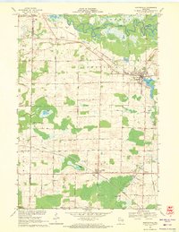 1969 Hortonville1971 Print · USGSOutagamie County during the late sixties shows a landscape of steady agricultural life and vital rail connections. Researchers can locate family landmarks like SS Peter and Paul Cem and trace the paths of the Soo Line through Medina.2 unique versions available
 - 1969 Map of Leeman, 1971 Print
 1969 Leeman1971 Print · USGSOutagamie and Shawano counties are captured here in the late sixties, where the winding Wolf River meets vast conservation lands. Researchers can locate family landmarks along Eskman Road, the St Lawrence Cem, and the old Navarino Sch.
 - 1969 Map of Bear Creek, 1971 Print
 1969 Bear Creek1971 Print · USGSWaupaca and Outagamie Counties in the late sixties were defined by the winding Embarrass River and the rural rail corridor. Genealogists and local historians can trace the town centers of Clintonville and Bear Creek, find rural burial sites like Danish Cem, and locate the Chicago and North Western tracks.
 - 1969 Map of Greenville, 1972 Print
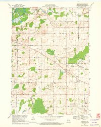 1969 Greenville1972 Print · USGSOutagamie County is documented here in the late sixties as the local infrastructure of Greenville and Hortonville expanded. Researchers can trace historic family burial sites at Wanderers Rest Cem, find the Wide Awake Sch, and follow the CHICAGO AND NORTH WESTERN rail line.2 unique versions available
 - 1969 Map of Shiocton, 1972 Print
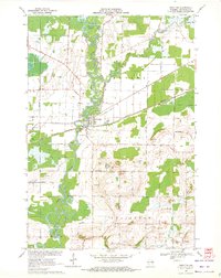 1969 Shiocton1972 Print · USGSWisconsin's Fox Valley region in the late sixties reveals a landscape shaped by the winding Wolf River and the Green Bay and Western railroad. Genealogists and local historians can trace family connections at Bovina Cem or locate old homesteads along Mayflower Drive and Kirschner Road.2 unique versions available
 - 1974 Map of Hilbert, 1977 Print
 1974 Hilbert1977 Print · USGSCalumet County was a thriving rail intersection in the 1970s, where three major lines converged at the village of Hilbert. Genealogists and local historians can trace the community's heritage through landmarks like St Peters Cem, Forest Junction, and the Forest Assembly Ground.
 - 1974 Map of Seymour, 1977 Print
 1974 Seymour1977 Print · USGSMid-seventies Outagamie County centers on the rail and road crossroads of Seymour as it appeared during a period of steady growth. Researchers can trace family sites through numerous rural cemeteries and small settlements like Rose Lawn, Isaak, and St Sebastian Cem.
 - 1974 Map of Nichols, 1977 Print
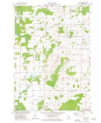 1974 Nichols1977 Print · USGSThe rural landscapes of Outagamie and Shawano Counties are captured here in the mid-seventies, centered on the rail-linked village of Nichols. Researchers can trace old family sites near Briarton and local cemeteries like North Cicero Cem along the Shioc River corridor.
 - 1974 Map of Kaukauna, 1978 Print
 1974 Kaukauna1978 Print · USGSKaukauna and the surrounding Fox River valley are captured in the mid-seventies, showing the dense industrial and parish-linked neighborhoods of the era. Researchers can trace family roots through numerous sites like Holy Name Cem, St John Cem, and schools like Electa Quinney Sch.2 unique versions available
Showing maps 1-25 of 150
Top cities of Outagamie County
- Appleton historical maps
- Grand Chute historical maps
- Kaukauna historical maps
- Little Chute historical maps
- Greenville historical maps
- Kimberly historical maps
See more
Frequently asked questions
- What are the different types of historical maps available for Outagamie County?
- What is the oldest map of Outagamie County?
- Where can I purchase historical maps of Outagamie County for my home or office?
- Where can I download high-res historical maps of Outagamie County?
- Are there historical topographic maps available for Outagamie County?
- Is there historical aerial imagery available for Outagamie County?
- Where are historical maps of Outagamie County sourced from?