1980s Maps of Carbon County, Wyoming
Explore 29 historic maps of Carbon County from the 1980s. These maps offer a rare glimpse into what life looked like during the 1980s — showing old roads, neighborhoods, homes, and landmarks that have changed or disappeared over time.
Whether you're researching your family's past, planning a metal detecting trip, or studying how Carbon County's landscape evolved across the 1980s, these high-resolution maps are a powerful tool for exploring the history of this region.
- Focus on a specific era: All maps on this page are from the 1980s, giving you a focused view of this time period.
- See what’s changed: Compare century-old streets, trails, and buildings to today's modern landscape using overlays and satellite layers.
- Research with precision: Use these maps for genealogy, historical research, land use analysis, or educational projects.
- View, download, or print: Maps are fully viewable online in high resolution, and can be downloaded or printed for your own records.
Start exploring Carbon County's history through authentic maps from the 1980s. This is your window into the past.
Carbon County, WY maps
(29)- 1980 Map of Medicine Bow
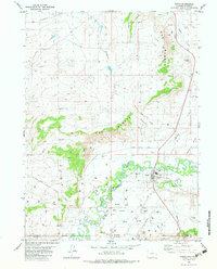
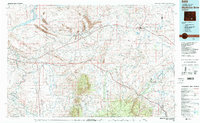 1980 Medicine Bow1980 Print · USGSCarbon County’s high plains and industrial corridors are captured here in the late twentieth century, centered on the coal-rich territory around Hanna. Genealogists and historians can trace the paths of the historic Overland Trail and the Union Pacific Railroad past settlements like Elmo and Fort Steele.
 - 1981 Map of Shirley Basin
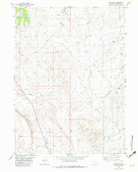
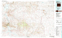 1981 Shirley Basin1981 Print · USGSThe high Wyoming desert comes alive in this early 1980s survey of Carbon County, where massive reservoirs meet rugged mountain ranges. Researchers can trace the industrial activity at Shirley Basin and Mine Dumps or explore early shoreline footprints at Seminoe State Park.
 - 1981 Map of Walden, 1982 Print
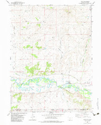
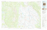 1981 Walden1982 Print · USGSThe North Park basin in the early eighties was a high-country crossroads of ranching and industry. Researchers can trace the Union Pacific rail corridor and locate historical mining operations like the Sudduth Mine or the remote settlement of Coalmont.
 - 1982 Map of Saratoga
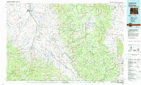 1982 Saratoga1982 Print · USGSHigh country ranching and mining define this southern Wyoming region during the early 1980s. Researchers can trace the Union Pacific Railroad corridor through Foxpark or locate the historic Ferris-Haggarty Mine near the North Platte River.
 - 1982 Map of Doty Mountain, 1983 Print
 1982 Doty Mountain1983 Print · USGSCarbon County’s high desert landscape was a crossroads for 19th-century travelers and 20th-century energy explorers. Trace the historic Overland Trail past the Waskie Stage Station or locate the Baur Ranch and early energy markers like Olson Well.
 - 1982 Map of Sulphur Springs, 1983 Print
 1982 Sulphur Springs1983 Print · USGSCarbon County in the early eighties shows a transition from historic pioneer routes to modern ranching and exploration. Researchers can trace the Overland Trail, locate the Sulphur Springs Ranch, and find isolated markers like a Grave near Horse Gulch.
 - 1982 Map of Smiley Draw, 1983 Print
 1982 Smiley Draw1983 Print · USGSRanching and energy exploration define this Wyoming landscape in the early eighties. Genealogists and historians can trace the Morgan Ranch and remote landmarks like Wild Horse Butte and Deep Creek Butte.
 - 1982 Map of Garden Gulch, 1983 Print
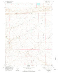
 1982 Garden Gulch1983 Print · USGSCarbon County ranching and energy exploration meet in the early 1980s along the drainages of Cow Creek and Wild Cow Creek. Researchers can locate family landmarks like the J O Ranch or trace the development of the landscape via Gas Wells and the PIPELINE.
 - 1982 Map of Peach Orchard Flat, 1983 Print
 1982 Peach Orchard Flat1983 Print · USGSIn the early 1980s, the high-desert landscape of Carbon County was defined by its drainage basins and growing energy infrastructure. Researchers can trace the path of the Pipeline through Peach Orchard Flat and locate remote landmarks like Pines Trail and Muddy Creek.
 - 1982 Map of Baggs, 1983 Print
 1982 Baggs1983 Print · USGSThe riverfront town of Baggs and its borderlands are shown in the early eighties as energy development transformed the valley. Researchers can trace local landmarks like Ledford, the Little Snake River, and the industrial sites at Gravel Pits.
 - 1982 Map of Blue Gap, 1983 Print
 1982 Blue Gap1983 Print · USGSCarbon County, Wyoming, is shown here during a period of active energy development in the early eighties. Genealogists and historians can trace the network of utility corridors and water sources like Soldiers Well, Blue Gap, and Mexican Flats.
 - 1982 Map of Dixon, 1983 Print
 1982 Dixon1983 Print · USGSThe Little Snake River valley at the Wyoming-Colorado border is captured here in the early eighties. Researchers can trace the Eversole Cem, identify the Dixon Airport, and follow irrigation routes like the First Mesa Ditch.
 - 1983 Map of Coal Mine Ridge
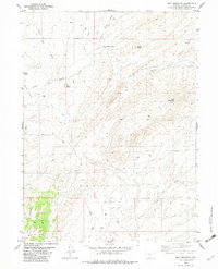
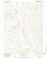
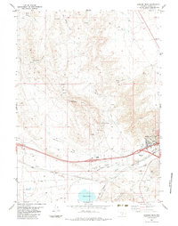
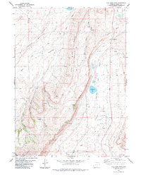 1983 Coal Mine Ridge1983 Print · USGSCarbon County’s high ridges and desert basins are captured here during the late twentieth century. Researchers can trace the water and resource history of the region through landmarks like Coal Mine Ridge, Chicken Pete Spring, and the Aqueduct.
 - 1983 Map of Separation Peak
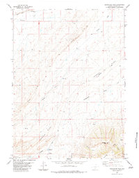 1983 Separation Peak1983 Print · USGSCarbon County's high-desert terrain is captured here in the early 1980s, showing a land of stark ridges and vital water sources. Trace the path of the Pacific Pipeline or locate landmarks like Separation Peak and Sixteenmile Reservoir in this ranching and energy corridor.
 - 1983 Map of Shamrock Hills
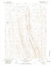 1983 Shamrock Hills1983 Print · USGSThe high desert of Carbon County comes into focus in the early eighties, centered on the prominent ridgelines of the Shamrock Hills. Local history researchers can trace the footprint of Mahoney Ranch and the early energy exploration marked by a Gas Well and various drill holes.
 - 1983 Map of Baggs
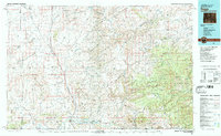 1983 Baggs1983 Print · USGSSettlement along the Wyoming-Colorado border in the early eighties follows the path of the Little Snake River through Carbon and Moffat counties. Researchers can trace the path of the Overland Trail or locate historical mining sites like the Ferris-Haggarty Mine and Standard Mine.
 - 1983 Map of La Marsh Creek West
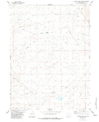
 1983 La Marsh Creek West1983 Print · USGSThe high sagebrush plains and peaks of Carbon County appear here in the early 1980s, centered on the Continental Divide. Historians can trace the Overland Trail and locate the Pine Grove Stage Station (Site) among the slopes of Miller Hill.
 - 1983 Map of Kindt Reservoir
 1983 Kindt Reservoir1983 Print · USGSCarbon County ranching and transit history are preserved here in the late twentieth century, showing the intersection of pioneer trails and modern industry. Researchers can trace the path of the Overland Trail near Bolten Ranch and locate the historic Coal Mine in the northern draws.
 - 1983 Map of Rendle Hill
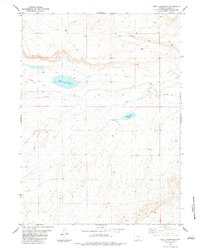
 1983 Rendle Hill1983 Print · USGSCarbon County's high plains are captured here in the early eighties, showing a landscape defined by its vital water sources and energy corridors. Trace the locations of family-named landmarks like Rendle Point and isolated outposts such as Bell Springs or Ninemile Hill.
 - 1983 Map of Smith Draw West
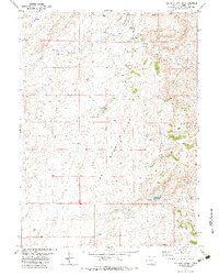
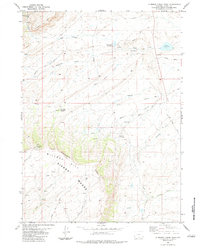
 1983 Smith Draw West1983 Print · USGSCarbon County's high-desert terrain is captured in the early eighties during a peak period of geological exploration and land management. Researchers can trace resource activity through numerous Drill Holes and Quarries near Chokecherry Knob.
 - 1983 Map of Smith Draw East
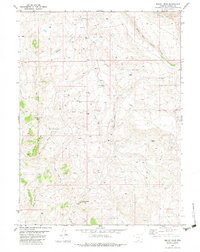
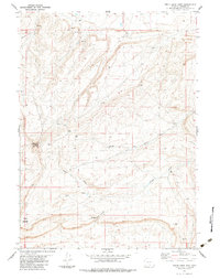
 1983 Smith Draw East1983 Print · USGSCarbon County ranching and energy corridors are captured here in the early eighties, showcasing a landscape of high-plateau drainages. Researchers can trace the layout of Pipelines and find landmarks like the Corral and the prominent Hogback.
 - 1983 Map of La Marsh Creek East
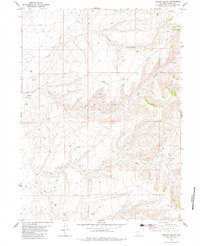
 1983 La Marsh Creek East1983 Print · USGSCarbon County’s high plains are captured here in the early 1980s, showcasing a landscape defined by historic transportation routes. You can trace the path of the Overland Trail and locate the Sage Creek Stage Station (Site) alongside Deadman Springs.
 - 1983 Map of Rawlins Peak SW
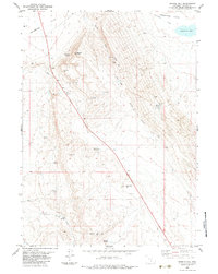
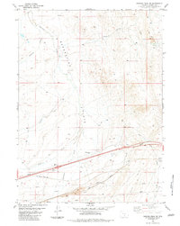 1983 Rawlins Peak SW1983 Print · USGSCarbon County in the early eighties shows a high-desert landscape shaped by energy and rail. Trace the Union Pacific line near Hadsell and explore topographical landmarks like Red Rim and Indian Spring.
 - 1983 Map of Bridger Pass
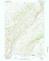 1983 Bridger Pass1983 Print · USGSCarbon County in the early eighties retains the deep physical imprints of the westward migration routes. Researchers can trace the Bridger Pass Emigrant Road and locate the Bridger Stage Station (Site) along the historic Overland Trail.2 unique versions available
 - 1983 Map of Rawlins Peak
 1983 Rawlins Peak1983 Print · USGSThe high Wyoming basin at the foot of the mountains comes into focus during the early eighties, centered on the railroad hub of Rawlins. Researchers can trace the path of the Union Pacific, locate the Radio Tower (KRAL), and explore the rugged drainage of Sixteenmile Draw.
Showing maps 1-25 of 29
Top cities of Carbon County
- Rawlins historical maps
- Saratoga historical maps
- Hanna historical maps
- Encampment historical maps
- Sinclair historical maps
- Baggs historical maps
See more
Frequently asked questions
- What are the different types of historical maps available for Carbon County?
- What is the oldest map of Carbon County?
- Where can I purchase historical maps of Carbon County for my home or office?
- Where can I download high-res historical maps of Carbon County?
- Are there historical topographic maps available for Carbon County?
- Is there historical aerial imagery available for Carbon County?
- Where are historical maps of Carbon County sourced from?