1900s (20th Century) Maps of Carbon County, Wyoming
Explore 236 historic maps of Carbon County from the 1900s (20th Century). These maps offer a rare glimpse into what life looked like during the 1900s — showing old roads, neighborhoods, homes, and landmarks that have changed or disappeared over time.
Whether you're researching your family's past, planning a metal detecting trip, or studying how Carbon County's landscape evolved across the 1900s, these high-resolution maps are a powerful tool for exploring the history of this region.
- Focus on a specific era: All maps on this page are from the 1900s, giving you a focused view of this time period.
- See what’s changed: Compare century-old streets, trails, and buildings to today's modern landscape using overlays and satellite layers.
- Research with precision: Use these maps for genealogy, historical research, land use analysis, or educational projects.
- View, download, or print: Maps are fully viewable online in high resolution, and can be downloaded or printed for your own records.
Start exploring Carbon County's history through authentic maps from the 1900s. This is your window into the past.
Carbon County, WY maps
(236)- 1906 Map of Medicine Bow, 1955 Print
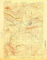
 1906 Medicine Bow1955 Print · USGSThe Medicine Bow Range at the dawn of the twentieth century shows a high-country economy driven by mining, timber, and ranching. Researchers can trace early infrastructure like the Laramie Hahns Peak and Pacific RR or locate family sites such as the Beckwith Ranch and Lenhardys Cabin.
 - 1908 Map of Medicine Bow
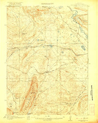
 1908 Medicine Bow1908 Print · USGSThe Medicine Bow Range at the dawn of the twentieth century shows a landscape of mountain ranches and early mining. Trace family-named landmarks like Logan-Grisley Ranch and industrial sites like Webbers Sawmill or the White Swan Mine.3 unique versions available
 - 1914 Map of Hanna
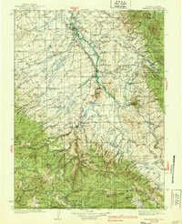
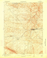 1914 Hanna1914 Print · USGSCarbon County ranching and railroad life come into focus in the years before the Great War. You can trace the early irrigation networks and family outposts like Brooks Ranch and Kinney's Ranch or locate the original layouts of Hanna and Threetown.3 unique versions available
 - 1914 Map of Walcott
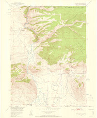
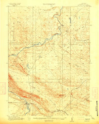 1914 Walcott1914 Print · USGSCarbon County ranching and rail operations are in full swing in the years before the Great War. You can trace the Union Pacific line through Fort Steele and Walcott, or locate legacy homesteads like Ferris Ranch and Corson Ranch.2 unique versions available
 - 1914 Map of Saddleback Hills, 1958 Print
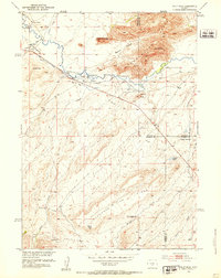
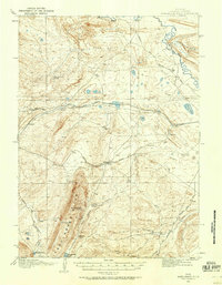 1914 Saddleback Hills1958 Print · USGSCarbon County’s rail and ranching landscape is captured here before the First World War, centered on the historic high-plains corridor of the Union Pacific. Local historians can trace the early road network and vital water stops like Missouri John Spring, Como Lake, and the settlement at Carbon.
 - 1915 Map of Como Ridge
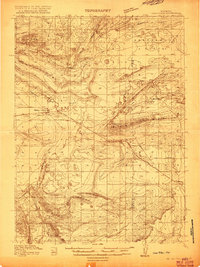 1915 Como Ridge1915 Print · USGSThe high plains of Carbon County come alive in the early twentieth century as the legendary Lincoln Highway pushes westward alongside the Union Pacific. Genealogists and historians can trace the early development of Medicine Bow and locate rural landmarks like the Ambler School and Robbers Roost.2 unique versions available
 - 1918 Map of Como Ridge
 1918 Como Ridge1918 Print · USGSMedicine Bow and the surrounding Carbon County high plains are captured here just before the close of the Great War. Researchers can trace the early path of the Union Pacific railroad and find rural landmarks like the Ambler School and Robbers Roost.2 unique versions available
 - 1921 Map of Saddleback Hills
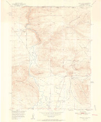
 1921 Saddleback Hills1921 Print · USGSCarbon County at the start of the 1920s shows a landscape shaped by the Union Pacific Railroad and early transit routes. You can trace the historic footprint of Carbon or locate remote watering holes like Missouri John Spring and Fiddlers Green.2 unique versions available
 - 1932 Map of Savery
 1932 Savery1932 Print · USGSSouthern Wyoming ranching and mining country meet at the edge of the Rockies in the early thirties. Genealogists and historians can locate rural schools like Ketchum Sch, the operations of Pioneer Coal Co, and the remote Tullis settlement.3 unique versions available
 - 1939 Map of Saratoga
 1939 Saratoga1939 Print · USGSThe North Platte valley comes alive in the late 1930s as a vital corridor for ranching and transport. Researchers can trace the Saratoga and Encampment Railroad or locate early rural schools like Benton Creek Sch and the Big Cr Mine.3 unique versions available
 - 1940 Map of Savery
 1940 Savery1940 Print · USGSThe high country of the Wyoming-Colorado border is captured here as the ranching and forest service outposts of the early twentieth century were becoming established. Researchers can trace the remote Snake River drainage and find historic sites like Tullis, Savery, and the Rambler Ranger Sta.2 unique versions available
 - 1950 Map of Northgate, 1957 Print
 1950 Northgate1957 Print · USGSJackson County ranching and mining operations are captured in detail at the turn of the 1950s. Genealogists and historians can trace family-named sites like the Quaintance Ranch alongside industrial landmarks including the Fluorspar Mine and Gero Tunnel.6 unique versions available
 - 1951 Map of Savage Peak, 1952 Print
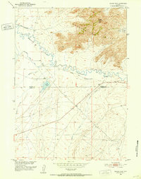 1951 Savage Peak1952 Print · USGSThe high-desert terrain along the Natrona and Carbon county line is captured here in the early fifties. You can trace the historic route of the Oregon Trail and locate landmarks like the Historical Marker and Savage Peak.3 unique versions available
 - 1951 Map of Bucklin Reservoirs, 1952 Print
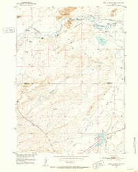 1951 Bucklin Reservoirs1952 Print · USGSCentral Wyoming's high desert reveals its ranching and migration history in the early fifties, before modern developments altered the trail corridors. Genealogists and historians can trace the Oregon California Trail past the Turkey Track Ranch and Bucklin Reservoirs.3 unique versions available
 - 1951 Map of Bear Mountain, 1953 Print
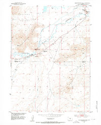
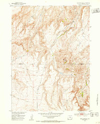 1951 Bear Mountain1953 Print · USGSThe high plains of the Natrona and Carbon County line are captured here in the early fifties, showcasing a landscape of high summits and deep creek beds. Researchers can trace the drainages of Stinking Creek, Bear Creek, and the slopes of Bear Mountain.3 unique versions available
 - 1951 Map of Pathfinder Reservoir NW, 1953 Print
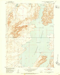 1951 Pathfinder Reservoir NW1953 Print · USGSThe high-elevation desert of Central Wyoming meets the water in the early 1950s at the Natrona and Carbon County line. Researchers can trace the original shoreline and refuge boundaries near Granite Ridge and Pathfinder Mountain.3 unique versions available
 - 1951 Map of Independence Rock, 1953 Print
 1951 Independence Rock1953 Print · USGSThe Sweetwater River valley is captured here in the early 1950s, preserving the trail-worn landscape of central Wyoming. Researchers can trace the Oregon Trail past Independence Rock and find sites like the Pony Express Sta and Martins Cove.2 unique versions available
 - 1951 Map of Bear Spring, 1953 Print
 1951 Bear Spring1953 Print · USGSCentral Wyoming ranching and water rights take center stage in the early fifties as the Missouri River Basin project advanced. Researchers can locate the Demorst Ranch and trace the vital flow of Bear Spring Creek through the Natrona and Carbon county line.3 unique versions available
 - 1951 Map of Pathfinder Dam, 1953 Print
 1951 Pathfinder Dam1953 Print · USGSThe North Platte River canyon and the engineering of the Pathfinder Dam are captured here in the early 1950s. Geologists and local historians can trace the high-desert landscape from the Pedro Mountains to water sources like Poison Spring and Swede Spring.3 unique versions available
 - 1951 Map of Fort Ridge, 1953 Print
 1951 Fort Ridge1953 Print · USGSCrossing the high plains in the early fifties, this survey captures the intersection of pioneer migration and the modern oil industry. Researchers can trace the Oregon Trail past the Sweetwater Pony Express Sta (Ruins) and the landmarks of Sentinel Rocks.3 unique versions available
 - 1951 Map of Split Rock, 1953 Print
 1951 Split Rock1953 Print · USGSCentral Wyoming ranching and river life are frozen in time here during the early fifties, where the Sweetwater River meets the high desert. Researchers can trace family-named landmarks and infrastructure like Split Rock School, Speyers Homestead, and the irrigation network of Mc Intosh Ditch.4 unique versions available
 - 1952 Map of Northgate
 1952 Northgate1952 Print · USGSHigh-altitude ranching and mining operations meet along the North Platte River in northern Colorado during the early fifties. Genealogists and historians can trace industrial sites like the Fluorspar Mine, local landmarks like Quaintance Ranch, and the Union Pacific rail corridor.2 unique versions available
 - 1953 Map of Leo, 1955 Print
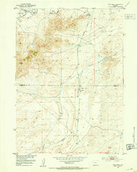
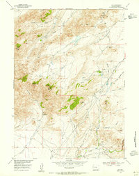 1953 Leo1955 Print · USGSIn the early fifties, the Pedro Mountains of Carbon County remained a land of isolated family ranches and high-country landmarks. Trace the locations of Peters Ranch, the small settlement of Leo, and the high point at Pyramid Peak.3 unique versions available
 - 1953 Map of Bradley Peak, 1955 Print
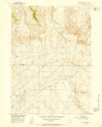
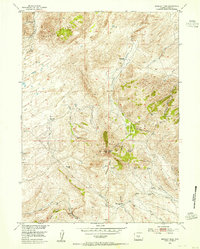 1953 Bradley Peak1955 Print · USGSCarbon County ranching and mining history come alive in this mid-century survey of the rugged Wyoming interior. Trace early western infrastructure through the Elkhorn Stage Station and remote outposts like Boot Ranch or the Sunday Morning Mine.4 unique versions available
 - 1953 Map of Seminoe Dam NE, 1955 Print
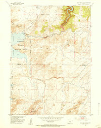
 1953 Seminoe Dam NE1955 Print · USGSMid-century Wyoming ranching and river development are captured here during a period of significant regional water projects. Researchers can locate remote outposts like Kortes Dam Camp, the Lost Creek School, and the Vivian Ranch.3 unique versions available
Showing maps 1-25 of 236
Top cities of Carbon County
- Rawlins historical maps
- Saratoga historical maps
- Hanna historical maps
- Encampment historical maps
- Sinclair historical maps
- Baggs historical maps
See more
Frequently asked questions
- What are the different types of historical maps available for Carbon County?
- What is the oldest map of Carbon County?
- Where can I purchase historical maps of Carbon County for my home or office?
- Where can I download high-res historical maps of Carbon County?
- Are there historical topographic maps available for Carbon County?
- Is there historical aerial imagery available for Carbon County?
- Where are historical maps of Carbon County sourced from?