
1951 Map of Bucklin Reservoirs
USGS Topo · Published 1952About this map
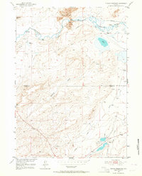
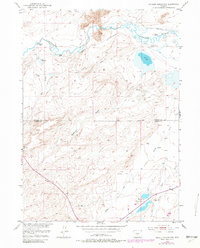
The Oregon California Trail and the Emigrant Road cut a historic diagonal across this high desert landscape, tracing the ancestral path of westward migration through central Wyoming. In the early 1950s, this area north of the Natrona and Carbon County line remained dominated by a ranching economy, with family-named operations like the Cross L Ranch, Crane Ranch, and Turkey Track Ranch scattered along the Sweetwater River. The river's winding course is supported by a system of irrigation, though traces of earlier efforts like the Y Z Ditch (Abandoned) appear alongside more modern features like the Bucklin Reservoirs. The presence of several Windmills and a Gravel Pit indicate the essential infrastructure required to sustain life and travel between the distinctive Sweetwater Rocks and Soda Lake.
Find a feature on this map
25 named features on this map. Tap any name to fly to it.
Don’t see what you’re looking for? This feature index may not catch every label — zoom into the map to look around manually.
Map Details
Editions of this 1951 Bucklin Reservoirs Map
3 editions found
Other maps of this area

1951 · Savage Peak
USGS Topo · 1:24,000

1951 · Lone Mountain
USGS Topo · 1:24,000

1951 · Split Rock
USGS Topo · 1:24,000

1951 · Lankin Dome
USGS Topo · 1:24,000

1955 · Casper
USGS Topo · 1:250,000

1958 · Casper
USGS Topo · 1:250,000

1959 · Miller Spring
USGS Topo · 1:24,000

1962 · Casper
USGS Topo · 1:250,000

1962 · Whiskey Peak
USGS Topo · 1:24,000
1962 · Youngs Pass
USGS Topo · 1:24,000