1910s Maps of Carbon County, Wyoming
Explore 5 historic maps of Carbon County from the 1910s. These maps offer a rare glimpse into what life looked like during the 1910s — showing old roads, neighborhoods, homes, and landmarks that have changed or disappeared over time.
Whether you're researching your family's past, planning a metal detecting trip, or studying how Carbon County's landscape evolved across the 1910s, these high-resolution maps are a powerful tool for exploring the history of this region.
- Focus on a specific era: All maps on this page are from the 1910s, giving you a focused view of this time period.
- See what’s changed: Compare century-old streets, trails, and buildings to today's modern landscape using overlays and satellite layers.
- Research with precision: Use these maps for genealogy, historical research, land use analysis, or educational projects.
- View, download, or print: Maps are fully viewable online in high resolution, and can be downloaded or printed for your own records.
Start exploring Carbon County's history through authentic maps from the 1910s. This is your window into the past.
Carbon County, WY maps
(5)- 1914 Map of Hanna
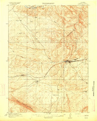 1914 Hanna1914 Print · USGSCarbon County ranching and railroad life come into focus in the years before the Great War. You can trace the early irrigation networks and family outposts like Brooks Ranch and Kinney's Ranch or locate the original layouts of Hanna and Threetown.3 unique versions available
 - 1914 Map of Walcott
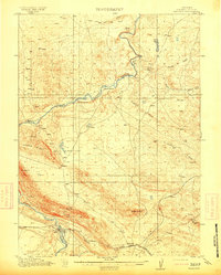 1914 Walcott1914 Print · USGSCarbon County ranching and rail operations are in full swing in the years before the Great War. You can trace the Union Pacific line through Fort Steele and Walcott, or locate legacy homesteads like Ferris Ranch and Corson Ranch.2 unique versions available
 - 1914 Map of Saddleback Hills, 1958 Print
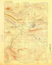
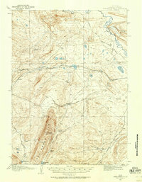 1914 Saddleback Hills1958 Print · USGSCarbon County’s rail and ranching landscape is captured here before the First World War, centered on the historic high-plains corridor of the Union Pacific. Local historians can trace the early road network and vital water stops like Missouri John Spring, Como Lake, and the settlement at Carbon.
 - 1915 Map of Como Ridge
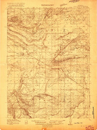 1915 Como Ridge1915 Print · USGSThe high plains of Carbon County come alive in the early twentieth century as the legendary Lincoln Highway pushes westward alongside the Union Pacific. Genealogists and historians can trace the early development of Medicine Bow and locate rural landmarks like the Ambler School and Robbers Roost.2 unique versions available
 - 1918 Map of Como Ridge
 1918 Como Ridge1918 Print · USGSMedicine Bow and the surrounding Carbon County high plains are captured here just before the close of the Great War. Researchers can trace the early path of the Union Pacific railroad and find rural landmarks like the Ambler School and Robbers Roost.2 unique versions available
End of results
Showing maps 1-5 of 5
Top cities of Carbon County
- Rawlins historical maps
- Saratoga historical maps
- Hanna historical maps
- Encampment historical maps
- Sinclair historical maps
- Baggs historical maps
See more
Frequently asked questions
- What are the different types of historical maps available for Carbon County?
- What is the oldest map of Carbon County?
- Where can I purchase historical maps of Carbon County for my home or office?
- Where can I download high-res historical maps of Carbon County?
- Are there historical topographic maps available for Carbon County?
- Is there historical aerial imagery available for Carbon County?
- Where are historical maps of Carbon County sourced from?