1990s Maps of Carbon County, Wyoming
Explore 18 historic maps of Carbon County from the 1990s. These maps offer a rare glimpse into what life looked like during the 1990s — showing old roads, neighborhoods, homes, and landmarks that have changed or disappeared over time.
Whether you're researching your family's past, planning a metal detecting trip, or studying how Carbon County's landscape evolved across the 1990s, these high-resolution maps are a powerful tool for exploring the history of this region.
- Focus on a specific era: All maps on this page are from the 1990s, giving you a focused view of this time period.
- See what’s changed: Compare century-old streets, trails, and buildings to today's modern landscape using overlays and satellite layers.
- Research with precision: Use these maps for genealogy, historical research, land use analysis, or educational projects.
- View, download, or print: Maps are fully viewable online in high resolution, and can be downloaded or printed for your own records.
Start exploring Carbon County's history through authentic maps from the 1990s. This is your window into the past.
Carbon County, WY maps
(18)- 1992 Map of Turpin Reservoir, 1996 Print
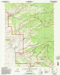
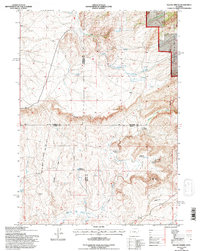
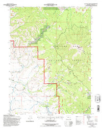
 1992 Turpin Reservoir1996 Print · USGSCarbon County high country is documented here in the early nineties, showing the managed lands of the Medicine Bow National Forest. Trace mountain routes through Cedar Pass or locate the Golden Gate Prospect and Turpin Reservoir.
 - 1992 Map of Coad Mountain, 1996 Print
 1992 Coad Mountain1996 Print · USGSThe high country of Carbon County comes alive in this early 1990s record of mountain summits and ranching outposts. Researchers can trace remote locales like Johnson Ranch and Ivans Grove or navigate the natural gaps of Oberg Pass and Rattlesnake Pass.
 - 1992 Map of Elk Mountain SW, 1996 Print
 1992 Elk Mountain SW1996 Print · USGSHigh-plains ranching and forest management define this Carbon County area during the early nineties. Genealogists and researchers can trace family-named homesteads like Ollikalla Ranch and Johnson Ranch or locate the remote Cem and Bow River Work Center.
 - 1992 Map of Barcus Peak, 1996 Print
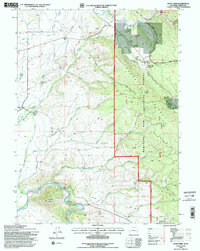
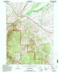
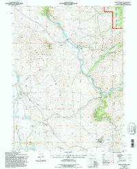 1992 Barcus Peak1996 Print · USGSThe North Platte River valley is shown in the 1990s as a high-altitude ranching hub on the edge of the Medicine Bow National Forest. Researchers can trace the legacy of family operations at Platt Ranch and locate the Beaver Creek School.
 - 1992 Map of Strouss Hill, 1996 Print
 1992 Strouss Hill1996 Print · USGSHigh plains ranching and historic migration routes define this Wyoming landscape during the 1990s. Genealogists and historians can trace the path of the Overland Trail near Strouss Hill and locate long-established properties like Manthos Ranch.
 - 1992 Map of Overlook Hill, 1996 Print
 1992 Overlook Hill1996 Print · USGSThe high ranch lands of Carbon County are captured here in the 1990s as the North Platte River winds through the Medicine Bow National Forest. Researchers can trace old irrigation systems like the Finfrock Ditch and remote outposts like the A Bar A Ranch.
 - 1992 Map of Oberg Ranch, 1996 Print
 1992 Oberg Ranch1996 Print · USGSCarbon County ranching and irrigation are captured here in the early nineties, showing a landscape defined by water rights and family holdings. Researchers can trace historic homesteads like Oberg Ranch and the Standard Pass Creek Sch, or locate the site of the Old Pennock Place.
 - 1992 Map of Phantom Lake, 1996 Print
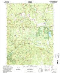
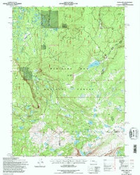
 1992 Phantom Lake1996 Print · USGSThe high timberlands of the Carbon County mountains are captured here in the early nineties, centered on the Medicine Bow National Forest. Local historians can trace the high-country landscape around Ryan Park and locate landmarks like the Slash Ridge Lookout and alpine waters of Phantom Lake.
 - 1992 Map of Finley Reservoir, 1996 Print
 1992 Finley Reservoir1996 Print · USGSCarbon County ranching and water rights take center stage in the 1990s as the high country irrigation systems support isolated homesteads. Genealogists and local historians can trace family land at Finley Ranch, Taylor Ranch, and the Lazy River Ranch along the North Platte River.
 - 1992 Map of Squaw Spring, 1996 Print
 1992 Squaw Spring1996 Print · USGSRemote ranching life and early homesteads characterize this Wyoming landscape during the late twentieth century. Genealogists and historians can locate the Higginson Homestead, the Little Medicine Sch, and the winding Little Medicine Bow River.
 - 1992 Map of Medicine Bow Peak, 1996 Print
 1992 Medicine Bow Peak1996 Print · USGSThe high alpine country of the Wyoming Rockies is captured here in the early nineties, centered on the crest of the Snowy Range. Researchers can trace forest access routes and high-altitude landmarks like the Libby Flats Observation Shed, Snowy Range Pass, and Headquarters Park.
 - 1992 Map of Sand Lake, 1996 Print
 1992 Sand Lake1996 Print · USGSThe high alpine wilderness of the Snowy Range is mapped here during the early nineties as it transitions between Carbon and Albany counties. Researchers can trace the network of high-country paths like the Deep Creek Trail and Sheep Lake Trail connecting remote waters such as Sand Lake and Deep Lake.
 - 1992 Map of Keystone, 1996 Print
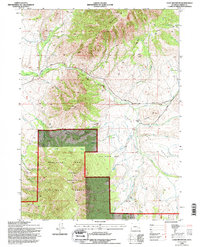
 1992 Keystone1996 Print · USGSThe Medicine Bow National Forest in the early nineties is a landscape of high-country mining and timber heritage. Researchers can trace historic extraction sites like Rambler Mine and Golden Key Mine or explore old settlements at Keystone and Holmes.2 unique versions available
 - 1992 Map of Ryan Park, 1996 Print
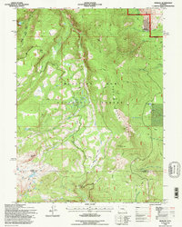
 1992 Ryan Park1996 Print · USGSThe Medicine Bow Mountains in the early nineties reveal a landscape of high-country ranching and forest management. Researchers can trace historic water rights and rural infrastructure through features like the Brush Creek Sch, Dewey Mine, and the Wiant and Highline Ditch.2 unique versions available
 - 1992 Map of Morgan, 1996 Print
 1992 Morgan1996 Print · USGSHigh in the Snowy Range during the early nineties, this area showcases the dense hydrological and trail networks of the Medicine Bow National Forest. Researchers can trace old routes near the settlement of Morgan or locate mountain landmarks like Crater Lake and Rock Creek Point.2 unique versions available
 - 1992 Map of Kennaday Peak, 1996 Print
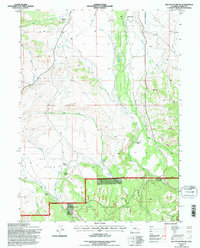
 1992 Kennaday Peak1996 Print · USGSCarbon County ranching and timber lands are captured here during the 1990s as the Forest Service updated its interior boundaries. Genealogists and historians can trace family landholdings like Kennaday Ranch and locate the irrigation works of Wiant Ditch and Lime Kiln Park.
 - 1992 Map of Arlington, 1996 Print
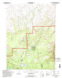
 1992 Arlington1996 Print · USGSArlington and the surrounding Wyoming high country are captured here in the early nineties, showing where the historic Overland Trail meets the forest edge. Researchers can locate established homesteads like Bengough Ranch and White Ranch along the banks of Rock Creek.
 - 1992 Map of White Rock Canyon, 1996 Print
 1992 White Rock Canyon1996 Print · USGSCarbon County’s high country is captured here during the 1990s, where the national forest meets working ranch lands. Trace historical use through sites like Wick Brothers Ranch and Sawmill Park, or follow the Stud Creek Trail through White Rock Canyon.
End of results
Showing maps 1-18 of 18
Top cities of Carbon County
- Rawlins historical maps
- Saratoga historical maps
- Hanna historical maps
- Encampment historical maps
- Sinclair historical maps
- Baggs historical maps
See more
Frequently asked questions
- What are the different types of historical maps available for Carbon County?
- What is the oldest map of Carbon County?
- Where can I purchase historical maps of Carbon County for my home or office?
- Where can I download high-res historical maps of Carbon County?
- Are there historical topographic maps available for Carbon County?
- Is there historical aerial imagery available for Carbon County?
- Where are historical maps of Carbon County sourced from?