1950s Maps of Carbon County, Wyoming
Explore 66 historic maps of Carbon County from the 1950s. These maps offer a rare glimpse into what life looked like during the 1950s — showing old roads, neighborhoods, homes, and landmarks that have changed or disappeared over time.
Whether you're researching your family's past, planning a metal detecting trip, or studying how Carbon County's landscape evolved across the 1950s, these high-resolution maps are a powerful tool for exploring the history of this region.
- Focus on a specific era: All maps on this page are from the 1950s, giving you a focused view of this time period.
- See what’s changed: Compare century-old streets, trails, and buildings to today's modern landscape using overlays and satellite layers.
- Research with precision: Use these maps for genealogy, historical research, land use analysis, or educational projects.
- View, download, or print: Maps are fully viewable online in high resolution, and can be downloaded or printed for your own records.
Start exploring Carbon County's history through authentic maps from the 1950s. This is your window into the past.
Carbon County, WY maps
(66)- 1950 Map of Northgate, 1957 Print
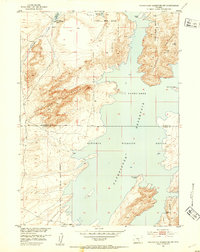
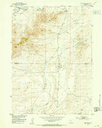
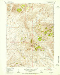
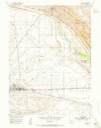
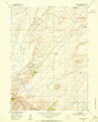
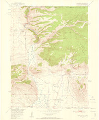 1950 Northgate1957 Print · USGSJackson County ranching and mining operations are captured in detail at the turn of the 1950s. Genealogists and historians can trace family-named sites like the Quaintance Ranch alongside industrial landmarks including the Fluorspar Mine and Gero Tunnel.6 unique versions available
 - 1951 Map of Savage Peak, 1952 Print
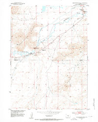
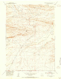
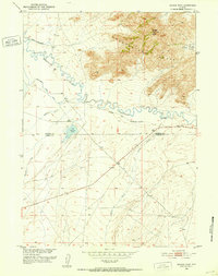 1951 Savage Peak1952 Print · USGSThe high-desert terrain along the Natrona and Carbon county line is captured here in the early fifties. You can trace the historic route of the Oregon Trail and locate landmarks like the Historical Marker and Savage Peak.3 unique versions available
 - 1951 Map of Bucklin Reservoirs, 1952 Print
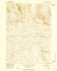
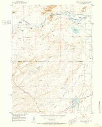 1951 Bucklin Reservoirs1952 Print · USGSCentral Wyoming's high desert reveals its ranching and migration history in the early fifties, before modern developments altered the trail corridors. Genealogists and historians can trace the Oregon California Trail past the Turkey Track Ranch and Bucklin Reservoirs.3 unique versions available
 - 1951 Map of Bear Mountain, 1953 Print
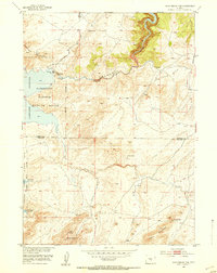
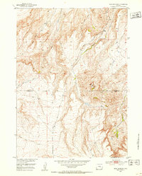 1951 Bear Mountain1953 Print · USGSThe high plains of the Natrona and Carbon County line are captured here in the early fifties, showcasing a landscape of high summits and deep creek beds. Researchers can trace the drainages of Stinking Creek, Bear Creek, and the slopes of Bear Mountain.3 unique versions available
 - 1951 Map of Pathfinder Reservoir NW, 1953 Print
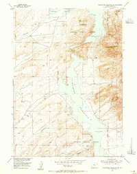
 1951 Pathfinder Reservoir NW1953 Print · USGSThe high-elevation desert of Central Wyoming meets the water in the early 1950s at the Natrona and Carbon County line. Researchers can trace the original shoreline and refuge boundaries near Granite Ridge and Pathfinder Mountain.3 unique versions available
 - 1951 Map of Independence Rock, 1953 Print
 1951 Independence Rock1953 Print · USGSThe Sweetwater River valley is captured here in the early 1950s, preserving the trail-worn landscape of central Wyoming. Researchers can trace the Oregon Trail past Independence Rock and find sites like the Pony Express Sta and Martins Cove.2 unique versions available
 - 1951 Map of Bear Spring, 1953 Print
 1951 Bear Spring1953 Print · USGSCentral Wyoming ranching and water rights take center stage in the early fifties as the Missouri River Basin project advanced. Researchers can locate the Demorst Ranch and trace the vital flow of Bear Spring Creek through the Natrona and Carbon county line.3 unique versions available
 - 1951 Map of Pathfinder Dam, 1953 Print
 1951 Pathfinder Dam1953 Print · USGSThe North Platte River canyon and the engineering of the Pathfinder Dam are captured here in the early 1950s. Geologists and local historians can trace the high-desert landscape from the Pedro Mountains to water sources like Poison Spring and Swede Spring.3 unique versions available
 - 1951 Map of Fort Ridge, 1953 Print
 1951 Fort Ridge1953 Print · USGSCrossing the high plains in the early fifties, this survey captures the intersection of pioneer migration and the modern oil industry. Researchers can trace the Oregon Trail past the Sweetwater Pony Express Sta (Ruins) and the landmarks of Sentinel Rocks.3 unique versions available
 - 1951 Map of Split Rock, 1953 Print
 1951 Split Rock1953 Print · USGSCentral Wyoming ranching and river life are frozen in time here during the early fifties, where the Sweetwater River meets the high desert. Researchers can trace family-named landmarks and infrastructure like Split Rock School, Speyers Homestead, and the irrigation network of Mc Intosh Ditch.4 unique versions available
 - 1952 Map of Northgate
 1952 Northgate1952 Print · USGSHigh-altitude ranching and mining operations meet along the North Platte River in northern Colorado during the early fifties. Genealogists and historians can trace industrial sites like the Fluorspar Mine, local landmarks like Quaintance Ranch, and the Union Pacific rail corridor.2 unique versions available
 - 1953 Map of Leo, 1955 Print
 1953 Leo1955 Print · USGSIn the early fifties, the Pedro Mountains of Carbon County remained a land of isolated family ranches and high-country landmarks. Trace the locations of Peters Ranch, the small settlement of Leo, and the high point at Pyramid Peak.3 unique versions available
 - 1953 Map of Bradley Peak, 1955 Print
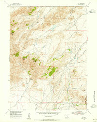
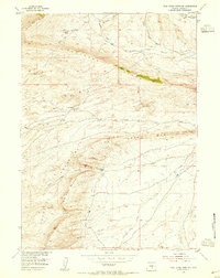
 1953 Bradley Peak1955 Print · USGSCarbon County ranching and mining history come alive in this mid-century survey of the rugged Wyoming interior. Trace early western infrastructure through the Elkhorn Stage Station and remote outposts like Boot Ranch or the Sunday Morning Mine.4 unique versions available
 - 1953 Map of Seminoe Dam NE, 1955 Print
 1953 Seminoe Dam NE1955 Print · USGSMid-century Wyoming ranching and river development are captured here during a period of significant regional water projects. Researchers can locate remote outposts like Kortes Dam Camp, the Lost Creek School, and the Vivian Ranch.3 unique versions available
 - 1953 Map of Seminoe Dam, 1955 Print
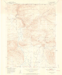
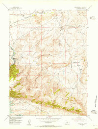
 1953 Seminoe Dam1955 Print · USGSThe North Platte River corridor is seen here in the early 1950s during a pivotal era of dam construction and water reclamation. Genealogists and historians can locate early homestead sites like Mihel Place and Anderson Ranch alongside Seminoe Dam and Kortes Dam.4 unique versions available
 - 1953 Map of Wild Horse Mountain, 1955 Print
 1953 Wild Horse Mountain1955 Print · USGSCarbon County ranching and high-desert terrain come into focus in the early fifties, showing a landscape of deep canyons and prominent ridges. Researchers can trace land use at Tapers Ranch or locate landmarks like Cheyenne Spring and the VABM Haystack 7482 peak.3 unique versions available
 - 1953 Map of Sinclair, 1955 Print
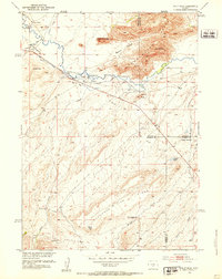
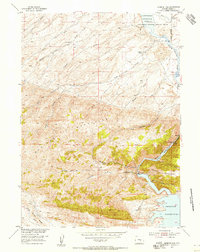
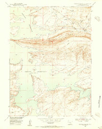
 1953 Sinclair1955 Print · USGSSinclair was an industrial powerhouse in the 1950s, defined by its massive oil infrastructure and vital transport links. Researchers can trace the layout of the large Refinery, the historic Lincoln Highway, and family landmarks like Duncan Ranch.3 unique versions available
 - 1953 Map of Seminoe Dam SW, 1955 Print
 1953 Seminoe Dam SW1955 Print · USGSIn the early fifties, the high plains of Carbon County were defined by ranching life and the waters of Seminoe Reservoir. Trace local history through family-named landmarks like I D Ranch, the Airstrip, and O'Brien Spring.3 unique versions available
 - 1953 Map of Ferris, 1955 Print
 1953 Ferris1955 Print · USGSThe Ferris Mountains and high-desert basins of Carbon County define this ranching and oil-drilling landscape in the early fifties. Genealogists and historians can trace family homesteads like Larsen Place and the abandoned Marvin Place near the General Petroleum Oil Field.4 unique versions available
 - 1953 Map of Pathfinder Reservoir SW, 1955 Print
 1953 Pathfinder Reservoir SW1955 Print · USGSThe high desert of Carbon County is shown here in the early 1950s, centered on the protected waters of the North Platte River. Trace the remote landscape of the Pedro Mountains and find local landmarks like Park Ranch and the winding Sunday Morning Creek.4 unique versions available
 - 1953 Map of Buzzard Ranch, 1955 Print
 1953 Buzzard Ranch1955 Print · USGSCarbon County ranching life is captured here in the early fifties, centered on the sheep and cattle operations of the high plains. Researchers can trace the legacy of local families at Buzzard Ranch, Burtch Ranch, and the site of Roberts Ranch (Aband).3 unique versions available
 - 1953 Map of Seminoe Dam SE, 1955 Print
 1953 Seminoe Dam SE1955 Print · USGSCarbon County ranching and water management are frozen in time during the early fifties along the western edge of the Seminoe Mountains. Researchers can locate family landmarks like McNees Ranch and Tennant Ranch tucked among the drainages of Horseshoe Ridge.3 unique versions available
 - 1953 Map of Fourmile Point, 1955 Print
 1953 Fourmile Point1955 Print · USGSCarbon County ranchlands and high-altitude basins are documented in the early 1950s before significant modern expansion. Researchers can trace the layout of the Meer Ranch and locate remote landmarks like Burgess Springs and Fourmile Point.3 unique versions available
 - 1953 Map of Fourmile Ridge, 1955 Print
 1953 Fourmile Ridge1955 Print · USGSCarbon County ranching and water management are frozen in time during the early fifties as the post-war era transformed the high plains. Researchers can trace historic property locations like Irene Ranch and follow old transit routes such as Kortes Road and Shirley Basin Road.3 unique versions available
 - 1953 Map of Spanish Mine, 1955 Print
 1953 Spanish Mine1955 Print · USGSCarbon County ranching and mining country is captured here in the early fifties, showing the transition from high plains to mountain peaks. Trace old routes near Jimmys Place, the inactive Spanish Mine, and water sources along Rush Creek.3 unique versions available
Showing maps 1-25 of 66
Top cities of Carbon County
- Rawlins historical maps
- Saratoga historical maps
- Hanna historical maps
- Encampment historical maps
- Sinclair historical maps
- Baggs historical maps
See more
Frequently asked questions
- What are the different types of historical maps available for Carbon County?
- What is the oldest map of Carbon County?
- Where can I purchase historical maps of Carbon County for my home or office?
- Where can I download high-res historical maps of Carbon County?
- Are there historical topographic maps available for Carbon County?
- Is there historical aerial imagery available for Carbon County?
- Where are historical maps of Carbon County sourced from?