
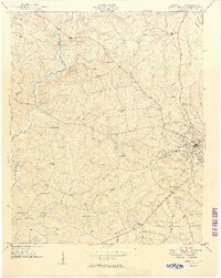
1949 Map of Abbeville
USGS Topo · Published 1949About this map
The town of Abbeville serves as the hub of this mid-century survey, its streets and structures concentrated at the junction of the Seaboard Air Line railway. Beyond the town limits, the landscape is defined by a dense network of rural institutions, including the County Farm and numerous schools like Edgewood Sch and Pine Grove Sch. The community's social and religious centers are well-documented, with family-history landmarks such as Upper Long Cane Ch and its neighboring Upper Long Cane Cem, as well as Cypress Chapel and Warrenton Ch.
Find a feature on this map
39 named features on this map. Tap any name to fly to it.
Don’t see what you’re looking for? This feature index may not catch every label — zoom into the map to look around manually.
Map Details
Editions of this 1949 Abbeville Map
2 editions found
Other maps of this area

1892 · Abbeville
USGS Topo · 1:125,000

1893 · Elberton
USGS Topo · 1:125,000

1948 · Abbeville East
USGS Topo · 1:24,000

1948 · Verdery
USGS Topo · 1:24,000

1948 · Abbeville West
USGS Topo · 1:24,000

1949 · Calhoun Creek
USGS Topo · 1:24,000

1950 · Verdery
USGS Topo · 1:24,000

1950 · Abbeville East
USGS Topo · 1:24,000

1954 · Greenville
USGS Topo · 1:250,000

1958 · Greenville
USGS Topo · 1:250,000