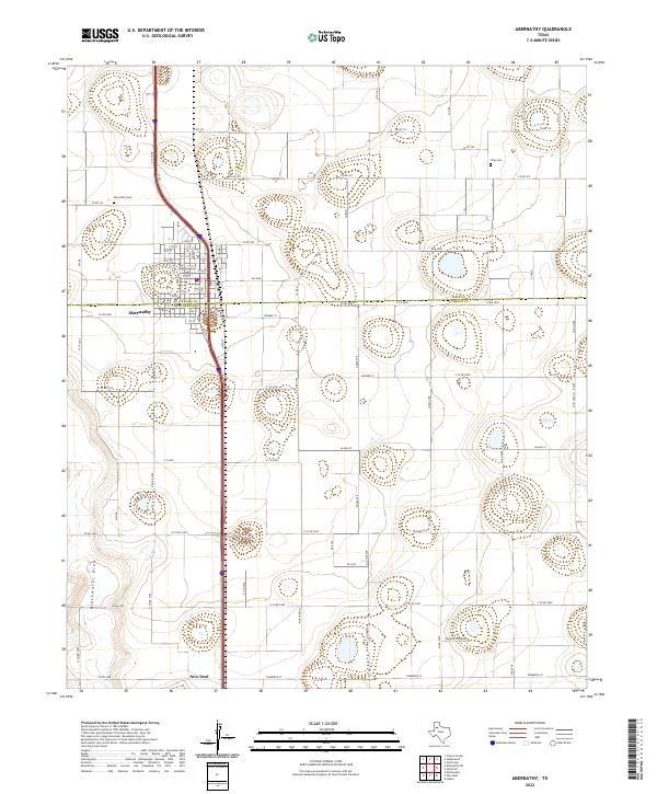
2022 Map of Abernathy
USGS Topo · Published 2022About this map
The boundary between Hale Co and Lubbock Co bisects the agricultural landscape of the Texas High Plains, creating a distinct administrative divide through the town of Abernathy. This modern survey reveals a geometric grid of county roads and farm-to-market routes like FM 2060 and FM 597 that define the region's land use. While the terrain is largely dominated by organized rural sections, the natural hydrology of the Blackwater Draw cuts across the western portion of the map, providing a glimpse into the underlying topography of the Llano Estacado.
Find a feature on this map
29 named features on this map. Tap any name to fly to it.
Don’t see what you’re looking for? This feature index may not catch every label — zoom into the map to look around manually.
Map Details
Editions of this 2022 Abernathy Map
This is the sole edition of this map. No revisions or reprints were ever made.
Other maps of this area

1954 · Lubbock
USGS Topo · 1:250,000

1956 · Shallowater
USGS Topo · 1:24,000

1956 · New Deal
USGS Topo · 1:24,000

1957 · Lubbock
USGS Topo · 1:62,500

1957 · Abernathy
USGS Topo · 1:62,500

1965 · Idalou
USGS Topo · 1:24,000

1965 · Heckville
USGS Topo · 1:24,000

1968 · Julia Lake
USGS Topo · 1:24,000
1976 · Abernathy SE
USGS Topo · 1:24,000
1976 · Abernathy NW
USGS Topo · 1:24,000