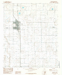
1985 Map of Abernathy
USGS Topo · Published 1985About this map
The high plains landscape of the Texas Panhandle is defined by a dense network of water wells and storage tanks surrounding the town of Abernathy. This 1980s-era survey captures the agricultural and industrial infrastructure of the region, where the grid-based settlement pattern is intersected by the winding path of Blackwater Draw to the west. Straddling the boundary between Hale Co and Lubbock Co, the area displays a transition from town lots to expansive rural sections dotted with numerous wells vital for irrigation and oil production.
Find a feature on this map
8 named features on this map. Tap any name to fly to it.
Don’t see what you’re looking for? This feature index may not catch every label — zoom into the map to look around manually.
Map Details
Editions of this 1985 Abernathy Map
This is the sole edition of this map. No revisions or reprints were ever made.
Other maps of this area

1954 · Lubbock
USGS Topo · 1:250,000

1956 · Shallowater
USGS Topo · 1:24,000

1956 · New Deal
USGS Topo · 1:24,000

1957 · Lubbock
USGS Topo · 1:62,500

1957 · Abernathy
USGS Topo · 1:62,500

1965 · Idalou
USGS Topo · 1:24,000

1965 · Heckville
USGS Topo · 1:24,000

1968 · Julia Lake
USGS Topo · 1:24,000
1976 · Abernathy SE
USGS Topo · 1:24,000
1976 · Abernathy NW
USGS Topo · 1:24,000