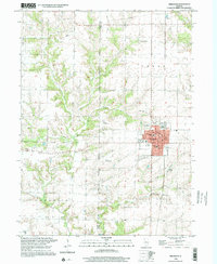
1998 Map of Abingdon
USGS Topo · Published 2001About this map
Abingdon serves as the primary hub on this Knox County landscape, where the town grid is defined by streets like Jefferson St and Main St near City Hall. The area's agricultural and rural character is shaped by several family and local burial sites, including Boydstun-Dawdy Cem, Humiston Cem, and Meridian Cem, which provide significant points for genealogical research. The physical geography is marked by the winding courses of Cedar Fork and Indian Creek, while industrial and transit history is reflected in the Old RR Grade and scattered aviation points like Malone Landing Strip. Small educational landmarks such as Hedding Sch and the local High Sch anchor the community, surrounded by the townships of Floyd, Berwick, and Indian Point.
Find a feature on this map
38 named features on this map. Tap any name to fly to it.
Don’t see what you’re looking for? This feature index may not catch every label — zoom into the map to look around manually.
Map Details
Editions of this 1998 Abingdon Map
This is the sole edition of this map. No revisions or reprints were ever made.
Other maps of this area

1915 · Avon
USGS Topo · 1:62,500

1916 · Good Hope
USGS Topo · 1:62,500

1918 · Good Hope
USGS Topo · 1:62,500

1921 · Monmouth
USGS Topo · 1:62,500

1923 · Monmouth
USGS Topo · 1:62,500

1925 · Galesburg
USGS Topo · 1:62,500

1927 · Galesburg
USGS Topo · 1:62,500

1944 · Avon
USGS Topo · 1:62,500

1958 · Burlington
USGS Topo · 1:250,000

1961 · Burlington
USGS Topo · 1:250,000