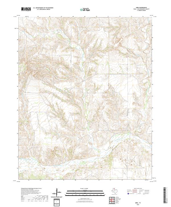
2022 Map of Abra
USGS Topo · Published 2022About this map
The Salt Fork Red River carves a significant course across the southern portion of this Collingsworth County landscape, defining the local drainage patterns and topography. Numerous tributaries, including Richardson Creek and Wills Cr, feed into the river system, creating a dissected terrain of draws and ridges. The map reveals a rural network of county roads, such as Co RD 49 and Co RD 80, which provide access through the open country. This area represents the quintessential ranching and agricultural landscape of the Texas Panhandle, where the land is primarily organized by the section lines of the original land surveys. The persistence of watercourses like Big Sandy Creek and Gup Cr shaped the early settlement patterns and the placement of modern infrastructure like FM 1547.
Find a feature on this map
21 named features on this map. Tap any name to fly to it.
Don’t see what you’re looking for? This feature index may not catch every label — zoom into the map to look around manually.
Map Details
Editions of this 2022 Abra Map
This is the sole edition of this map. No revisions or reprints were ever made.
Other maps of this area

1954 · Amarillo
USGS Topo · 1:250,000

1954 · Plainview
USGS Topo · 1:250,000

1958 · Amarillo
USGS Topo · 1:250,000

1958 · Plainview
USGS Topo · 1:250,000

1959 · Spencer Lake
USGS Topo · 1:24,000

1959 · McKnight
USGS Topo · 1:24,000

1963 · Ramsdell
USGS Topo · 1:24,000

1963 · Shamrock West
USGS Topo · 1:24,000

1963 · McLean
USGS Topo · 1:24,000

1964 · Rolla NE
USGS Topo · 1:24,000