1900 Map of Accident
USGS Topo · Published 1933About this map
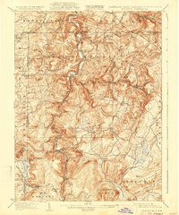
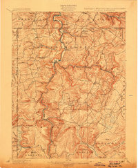
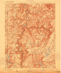
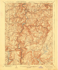
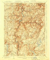
Accident and Friendsville anchor this 1898 survey of the tri-state highlands, where the National Turnpike cuts across the northern ridges near Addison. The landscape is defined by the sharp vertical relief of Negro Mountain and Meadow Mountain, with the Baltimore and Ohio R. R. winding along the steep banks of the Youghiogheny River. This era reflects a transition from isolated mountain communities like the Blooming Rose Settlement to an industrializing frontier, evidenced by the Lumber R. R. and the Mose Mill Tram Road penetrating the timbered valleys. Genealogists can locate family landmarks such as Browning Mill, the Chestnut Avenue Church, and scattered rural schools including Cane Valley School and Pine Swamp School, all established before the later development of the surrounding river basins.
Find a feature on this map
85 named features on this map. Tap any name to fly to it.
Don’t see what you’re looking for? This feature index may not catch every label — zoom into the map to look around manually.
Map Details
Editions of this 1900 Accident Map
6 editions found
Other maps of this area

1886 · St. George
USGS Topo · 1:125,000

1891 · St. George
USGS Topo · 1:125,000

1895 · Piedmont
USGS Topo · 1:125,000

1899 · Grantsville
USGS Topo · 1:62,500

1899 · Oakland
USGS Topo · 1:62,500

1900 · Accident
USGS Topo · 1:62,500

1900 · Oakland
USGS Topo · 1:62,500

1900 · Uniontown
USGS Topo · 1:62,500

1904 · Bruceton
USGS Topo · 1:62,500

1904 · Grantsville
USGS Topo · 1:62,500