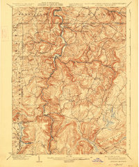
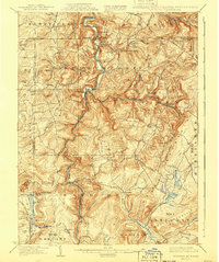
1900 Map of Accident
USGS Topo · Published 1927About this map
The Youghiogheny River carves a deep path through the heart of Garrett County, Maryland, and parts of Pennsylvania and West Virginia in this turn-of-the-century survey. The landscape is defined by its early industrial and agricultural foundations, where numerous mills such as Speelman Mills, Kaese Mill, and Browning Mill were established along the steep mountain drainages. The settlement pattern shows a rural society transitioning from isolated farmsteads to organized post offices like Guard P.O. and the unique Blooming Rose Settlement. Transportation was essential to this rugged area, highlighted by the Baltimore and Ohio railroad following the river valley and a network of early routes like the Pipe Line and Turnpike. Local genealogy is anchored by landmarks such as the Chestnut Avenue Church and Pine Swamp School, providing a detailed look at the social fabric before the creation of the nearby dam systems.
Find a feature on this map
84 named features on this map. Tap any name to fly to it.
Don’t see what you’re looking for? This feature index may not catch every label — zoom into the map to look around manually.
Map Details
Editions of this 1900 Accident Map
6 editions found
Other maps of this area

1886 · St. George
USGS Topo · 1:125,000

1891 · St. George
USGS Topo · 1:125,000

1895 · Piedmont
USGS Topo · 1:125,000

1899 · Grantsville
USGS Topo · 1:62,500

1899 · Oakland
USGS Topo · 1:62,500

1900 · Accident
USGS Topo · 1:62,500

1900 · Oakland
USGS Topo · 1:62,500

1900 · Uniontown
USGS Topo · 1:62,500

1904 · Bruceton
USGS Topo · 1:62,500

1904 · Grantsville
USGS Topo · 1:62,500