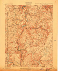
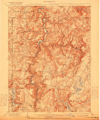
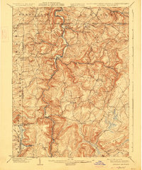
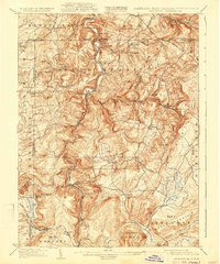
1900 Map of Accident
USGS Topo · Published 1907About this map
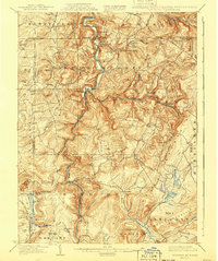
Blooming Rose Settlement and other small agricultural communities populate this rugged upland landscape at the intersection of Maryland, Pennsylvania, and West Virginia. The Youghiogheny River carves a deep central corridor through the terrain, serving as a primary artery for movement and industry at the turn of the century. The transportation network is defined by a mix of established routes like the Baltimore and Ohio Railroad and rugged industrial corridors such as the Lumber R.R. and several segments of Tram Road.
Find a feature on this map
95 named features on this map. Tap any name to fly to it.
Don’t see what you’re looking for? This feature index may not catch every label — zoom into the map to look around manually.
Map Details
Editions of this 1900 Accident Map
6 editions found
Other maps of this area

1886 · St. George
USGS Topo · 1:125,000

1891 · St. George
USGS Topo · 1:125,000

1895 · Piedmont
USGS Topo · 1:125,000

1899 · Grantsville
USGS Topo · 1:62,500

1899 · Oakland
USGS Topo · 1:62,500

1900 · Accident
USGS Topo · 1:62,500

1900 · Oakland
USGS Topo · 1:62,500

1900 · Uniontown
USGS Topo · 1:62,500

1904 · Bruceton
USGS Topo · 1:62,500

1904 · Grantsville
USGS Topo · 1:62,500