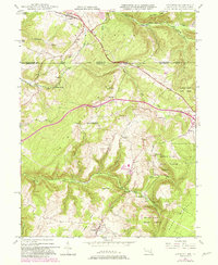
1947 Map of Accident
USGS Topo · Published 1982About this map
Accident sits at the heart of this landscape, positioned along the historic corridor of the National Road as it crosses from Maryland into Pennsylvania. The map illustrates a region where local industry and natural resources are intertwined, featuring sites like the Sausman Mine and the water-powered operations of Kaese Mill and Engle Mill along the drainage of Bear Creek. The terrain is defined by prominent ridges such as Negro Mountain and Winding Ridge, which shaped the early transportation routes through the Appalachian highlands.
Find a feature on this map
38 named features on this map. Tap any name to fly to it.
Don’t see what you’re looking for? This feature index may not catch every label — zoom into the map to look around manually.
Map Details
Editions of this 1947 Accident Map
2 editions found
Other maps of this area

1899 · Grantsville
USGS Topo · 1:62,500

1900 · Accident
USGS Topo · 1:62,500

1904 · Grantsville
USGS Topo · 1:62,500

1921 · Meyersdale
USGS Topo · 1:62,500

1922 · Confluence
USGS Topo · 1:62,500

1931 · Confluence
USGS Topo · 1:62,500

1933 · Confluence
USGS Topo · 1:62,500

1939 · Meyersdale
USGS Topo · 1:62,500

1944 · Meyersdale
USGS Topo · 1:62,500

1946 · Grantsville
USGS Topo · 1:24,000