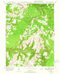
1948 Map of Accident
USGS Topo · Published 1966About this map
The settlement of Accident and the surrounding Maryland highlands appear here just after the war, showing a landscape defined by industrial forestry and family-scale farming. The Savage River State Forest covers large sections of the eastern terrain, while the historic National Pike cuts across the northern reaches, connecting Addison and Strawn. This 1948 survey documents the local economy of the era, from the extractive history of the Swanton Mine to the water-powered legacy of Engle Mill and Kaese Mill along Bear Creek. Genealogists will find distinct family landmarks like Turney Cem and local educational hubs such as Rich Sch preserved at their mid-century locations. The map also records early infrastructure including an Underground Pipe Line and a state Fish Hatchery, illustrating the intersection of natural resources and public works in Garrett County.
Find a feature on this map
38 named features on this map. Tap any name to fly to it.
Don’t see what you’re looking for? This feature index may not catch every label — zoom into the map to look around manually.
Map Details
Editions of this 1948 Accident Map
2 editions found
Other maps of this area

1899 · Grantsville
USGS Topo · 1:62,500

1900 · Accident
USGS Topo · 1:62,500

1904 · Grantsville
USGS Topo · 1:62,500

1921 · Meyersdale
USGS Topo · 1:62,500

1922 · Confluence
USGS Topo · 1:62,500

1931 · Confluence
USGS Topo · 1:62,500

1933 · Confluence
USGS Topo · 1:62,500

1939 · Meyersdale
USGS Topo · 1:62,500

1944 · Meyersdale
USGS Topo · 1:62,500

1946 · Grantsville
USGS Topo · 1:24,000