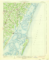
1931 Map of Accomac
USGS Topo · Published 1957About this map
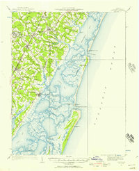
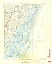
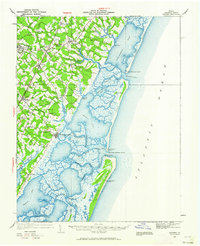
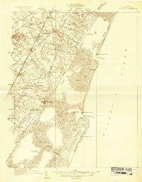
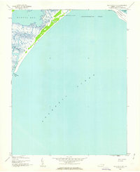
Accomac and the surrounding coastal necks of Virginia’s Eastern Shore are defined by a complex geography of marshes and barrier islands in this 1931 survey. The inland corridor, home to settlements like Onley and Tasley, is anchored by the Pennsylvania RR, which runs parallel to the early automotive route of State Highway No 13. The landscape transitions from fertile farm acreage near Melfa to the intricate tidal networks of Burtons Bay and Bradford Bay. A distinct maritime economy is visible along the coast, where the Wachapreague Club and several Coast Guard stations, including Parramore Beach C G Sta, monitor the shifting sands of Metomkin Island and Parramore Island. Local genealogists will find several rural landmarks, such as Becker Ch and Oak Grove Chapel, which served the dispersed agricultural communities of the early twentieth century.
Find a feature on this map
77 named features on this map. Tap any name to fly to it.
Don’t see what you’re looking for? This feature index may not catch every label — zoom into the map to look around manually.
Map Details
Editions of this 1931 Accomac Map
4 editions found
Other maps of this area

1903 · Crisfield
USGS Topo · 1:62,500

1920 · Crisfield
USGS Topo · 1:62,500
1931 · Accomac
USGS Topo · 1:48,000
1935 · Accomac
USGS Topo · 1:62,500

1941 · Broadwater
USGS Topo · 1:62,500
1942 · Chesconessex
USGS Topo · 1:31,680
1942 · Mappsville
USGS Topo · 1:24,000

1942 · Little Machipongo Inlet
USGS Topo · 1:24,000
1942 · Nassawadox
USGS Topo · 1:24,000
1942 · Wallops Island
USGS Topo · 1:24,000