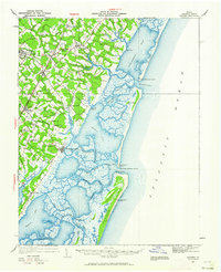
1931 Map of Accomac
USGS Topo · Published 1962About this map
The salt marshes and coastal inlets of Virginia's Eastern Shore define this landscape, where the Pennsylvania Railroad corridor links inland agricultural hubs with the Atlantic maritime economy. Accomac serves as a central focal point, surrounded by a network of smaller rural communities like Tasley, Onley, and Melfa. The shoreline is heavily articulated by features such as Metomkin Bay and Burton's Bay, protected from the open ocean by a chain of barrier islands including Cedar Island and Paramore Island. These coastal areas reveal the era's reliance on water navigation and maritime safety, evidenced by multiple Coast Guard installations like the Metomkin Inlet C G Sta and the Wachapreague C G Sta. Social life is marked by the presence of the Keller Fairgrounds and several recreational lodges, such as the Wachapreague Club and Holly Island Club.
Find a feature on this map
68 named features on this map. Tap any name to fly to it.
Don’t see what you’re looking for? This feature index may not catch every label — zoom into the map to look around manually.
Map Details
Editions of this 1931 Accomac Map
4 editions found
Other maps of this area

1903 · Crisfield
USGS Topo · 1:62,500

1920 · Crisfield
USGS Topo · 1:62,500

1931 · Accomac
USGS Topo · 1:48,000

1935 · Accomac
USGS Topo · 1:62,500

1941 · Broadwater
USGS Topo · 1:62,500

1942 · Chesconessex
USGS Topo · 1:31,680

1942 · Mappsville
USGS Topo · 1:24,000

1942 · Little Machipongo Inlet
USGS Topo · 1:24,000

1942 · Nassawadox
USGS Topo · 1:24,000

1942 · Wallops Island
USGS Topo · 1:24,000