
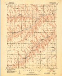
1951 Map of Achilles
USGS Topo · Published 1952About this map
Achilles sits at the center of a high plains landscape defined by the branching tributaries of the Sappa and Prairie Dog Creeks. This 1951 survey, part of the Missouri River Basin development program, shows a network of rural school districts and parish churches that sustained this farming community during the mid-century era. Education was clearly localized, with sites like Pleasant Ridge Sch, Valley View Sch, and the Fairview Sch (Abandoned) spaced across the townships of Arbor and Jefferson. The spiritual and social life of the area is anchored by St Patrick Ch and the Cumberland Ch, which sits adjacent to its namesake Cumberland Cem. The terrain is deeply inscribed by drainage patterns like Long Draw and the North Fork Sappa Creek, illustrating how the agricultural layout was dictated by the natural draws and forks of the Kansas plains.
Find a feature on this map
29 named features on this map. Tap any name to fly to it.
Don’t see what you’re looking for? This feature index may not catch every label — zoom into the map to look around manually.
Map Details
Editions of this 1951 Achilles Map
2 editions found
Other maps of this area

1943 · Colby
USGS Topo · 1:62,500

1951 · Selden
USGS Topo · 1:62,500

1951 · Herndon
USGS Topo · 1:62,500

1951 · Atwood
USGS Topo · 1:62,500

1951 · Oberlin
USGS Topo · 1:62,500

1951 · Chardon
USGS Topo · 1:62,500

1954 · Goodland
USGS Topo · 1:250,000

1956 · Goodland
USGS Topo · 1:250,000

1957 · Goodland
USGS Topo · 1:250,000

1965 · Oberlin SW
USGS Topo · 1:24,000