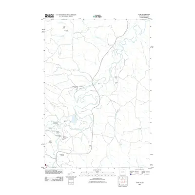
2011 Map of Acme
USGS Topo · Published 2011About this map
Acme and the surrounding river valleys in Sheridan County appear as a landscape defined by extensive surface mining and coal extraction in the early 21st century. The Tongue River meanders through the center of the sheet, joined by Goose Creek and Ash Creek, providing the primary drainage for a region heavily marked by industrial activity. The map reveals a dense concentration of named mining sites, such as the Youngs Creek Mine in the north and the Dietz Number Five and Eight Mine in the south, reflecting the historical and modern importance of the Powder River Basin's energy resources. While much of the land is dedicated to industrial footprints like the Zowada Pit and Plachet Pit Mine, the presence of the Gladewater Ditch and various rural routes, including Beatty Gulch Rd and Monarch-Ash Creek Rd, indicates a persistent rural infrastructure connecting these workings to the settlement at Acme.
Find a feature on this map
38 named features on this map. Tap any name to fly to it.
Don’t see what you’re looking for? This feature index may not catch every label — zoom into the map to look around manually.
Map Details
Editions of this 2011 Acme Map
This is the sole edition of this map. No revisions or reprints were ever made.
Other maps of this area

1894 · Rosebud
USGS Topo · 1:125,000

1895 · Dayton
USGS Topo · 1:125,000

1901 · Rosebud
USGS Topo · 1:125,000

1901 · Dayton
USGS Topo · 1:125,000

1909 · Sheridan
USGS Topo · 1:125,000

1911 · Sheridan
USGS Topo · 1:125,000

1954 · Hardin
USGS Topo · 1:250,000

1955 · Sheridan
USGS Topo · 1:250,000

1957 · Hardin
USGS Topo · 1:250,000

1958 · Hardin
USGS Topo · 1:250,000