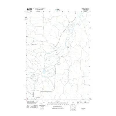
2012 Map of Acme
USGS Topo · Published 2012About this map
Acme sits at the confluence of the Tongue River and Goose Cr, marking a landscape defined by its vital water systems and rural infrastructure along the Wyoming-Montana border. This early 21st-century survey documents a complex network of agricultural and industrial water management, most notably the Gladewater Ditch, which cuts across the terrain to support local land use. The river's winding path is flanked by significant tributaries such as Ash Cr and Youngs Cr, creating a riparian corridor through the northern Sheridan County countryside. Transportation throughout the region is primarily facilitated by local routes including Acme Rd and Youngs Creek Rd, while the inclusion of family-named landmarks like Beatty Gulch provides essential geographic context for those researching the local heritage and land development of this river valley.
Find a feature on this map
20 named features on this map. Tap any name to fly to it.
Don’t see what you’re looking for? This feature index may not catch every label — zoom into the map to look around manually.
Map Details
Editions of this 2012 Acme Map
This is the sole edition of this map. No revisions or reprints were ever made.
Other maps of this area

1894 · Rosebud
USGS Topo · 1:125,000

1895 · Dayton
USGS Topo · 1:125,000

1901 · Rosebud
USGS Topo · 1:125,000

1901 · Dayton
USGS Topo · 1:125,000

1909 · Sheridan
USGS Topo · 1:125,000

1911 · Sheridan
USGS Topo · 1:125,000

1954 · Hardin
USGS Topo · 1:250,000

1955 · Sheridan
USGS Topo · 1:250,000

1957 · Hardin
USGS Topo · 1:250,000

1958 · Hardin
USGS Topo · 1:250,000