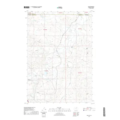
2017 Map of Acme
USGS Topo · Published 2017About this map
Tongue River and Goose Creek converge in this northern Wyoming landscape, where the settlements of Acme and Kleenburn anchor a complex of local roads and water management features. The area's agricultural and industrial reliance on water is evident in the presence of the Gladewater Ditch, which cuts across the terrain north of the river. The topography is defined by numerous draws and gulches, including Wheat Draw, Sheep Draw, and Beatty Gulch, illustrating the drainage patterns that feed into the larger river system.
Find a feature on this map
40 named features on this map. Tap any name to fly to it.
Don’t see what you’re looking for? This feature index may not catch every label — zoom into the map to look around manually.
Map Details
Editions of this 2017 Acme Map
This is the sole edition of this map. No revisions or reprints were ever made.
Other maps of this area

1894 · Rosebud
USGS Topo · 1:125,000

1895 · Dayton
USGS Topo · 1:125,000

1901 · Rosebud
USGS Topo · 1:125,000

1901 · Dayton
USGS Topo · 1:125,000

1909 · Sheridan
USGS Topo · 1:125,000

1911 · Sheridan
USGS Topo · 1:125,000

1954 · Hardin
USGS Topo · 1:250,000

1955 · Sheridan
USGS Topo · 1:250,000

1957 · Hardin
USGS Topo · 1:250,000

1958 · Hardin
USGS Topo · 1:250,000