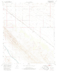
1953 Map of Acolita
USGS Topo · Published 1986About this map
The Southern Pacific railroad cuts a sharp diagonal through the Imperial Valley desert in this mid-century survey, passing the remote siding of Acolita. This landscape is defined by its stark military and industrial imprints, as the northern portion of the map is occupied by an Aerial Gunnery Range and a Naval Reservation Bdy within the Chocolate Mountains.
Find a feature on this map
11 named features on this map. Tap any name to fly to it.
Don’t see what you’re looking for? This feature index may not catch every label — zoom into the map to look around manually.
Map Details
Editions of this 1953 Acolita Map
5 editions found
Other maps of this area

1907 · Holtville
USGS Topo · 1:125,000

1940 · Iris
USGS Topo · 1:62,500

1940 · Alamorio
USGS Topo · 1:62,500

1942 · El Centro
USGS Topo · 1:250,000

1945 · Alamorio
USGS Topo · 1:62,500

1945 · Iris
USGS Topo · 1:62,500

1953 · Acolita
USGS Topo · 1:24,000

1953 · Acolita
USGS Topo · 1:62,500

1954 · El Centro
USGS Topo · 1:250,000

1954 · Salton Sea
USGS Topo · 1:250,000